Country:
Region:
City:
Latitude and Longitude:
Time Zone:
Postal Code:
IP information under different IP Channel
ip-api
Country
Region
City
ASN
Time Zone
ISP
Blacklist
Proxy
Latitude
Longitude
Postal
Route
Luminati
Country
Region
eng
City
ilford
ASN
Time Zone
Europe/London
ISP
Daisy Corporate Services Trading Ltd
Latitude
Longitude
Postal
IPinfo
Country
Region
City
ASN
Time Zone
ISP
Blacklist
Proxy
Latitude
Longitude
Postal
Route
db-ip
Country
Region
City
ASN
Time Zone
ISP
Blacklist
Proxy
Latitude
Longitude
Postal
Route
ipdata
Country
Region
City
ASN
Time Zone
ISP
Blacklist
Proxy
Latitude
Longitude
Postal
Route
Popular places and events near this IP address

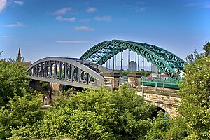
Sunderland
City in Tyne and Wear, England
Distance: Approx. 164 meters
Latitude and longitude: 54.906,-1.381
Sunderland ( ) is a port city in Tyne and Wear, England. It is a port at the mouth of the River Wear on the North Sea, approximately 10 miles (16 km) south-east of Newcastle upon Tyne. The built-up area had a population of 168,277 at the 2021 census, making it the second largest settlement in North East England after Newcastle.

Wearside
Built-up area in England
Distance: Approx. 115 meters
Latitude and longitude: 54.90388889,-1.38111111
Wearside () is a built-up area in County Durham and Tyne and Wear, England. It is named after the River Wear which flows through it and traditionally all in the County of Durham. In the 2011 census, its official name was the Sunderland Built-up area since Sunderland is its largest part, the urban area extends to the surrounding City of Sunderland district, small parts of County Durham district and a small part of the Metropolitan Borough of Gateshead.

Sunderland Museum and Winter Gardens
Museum in Sunderland, England
Distance: Approx. 154 meters
Latitude and longitude: 54.90416667,-1.38
Sunderland Museum and Winter Gardens is a municipal museum in Sunderland, England. It contains the only known British example of a gliding reptile, the oldest known vertebrate capable of gliding flight. The exhibit was discovered in Eppleton quarry.

Park Lane Interchange
Tyne and Wear Metro station in Sunderland
Distance: Approx. 308 meters
Latitude and longitude: 54.902301,-1.3846154
Park Lane is a Tyne and Wear Metro station, serving the port city of Sunderland in Tyne and Wear, England. It joined the network on 28 April 2002, following the opening of the extension from Pelaw to South Hylton.

Sunderland station
Railway and metro station in Tyne and Wear, England
Distance: Approx. 156 meters
Latitude and longitude: 54.9061,-1.3824
Sunderland is a railway and metro station in Sunderland, Tyne and Wear, England. It is on the Durham Coast Line, which runs between Middlesbrough and Newcastle, via Hartlepool. It is owned by Network Rail and managed by Northern Trains.

Sunderland Central (UK Parliament constituency)
Parliamentary constituency in the United Kingdom, 2010 onwards
Distance: Approx. 110 meters
Latitude and longitude: 54.904,-1.381
Sunderland Central is a constituency in the House of Commons of the UK Parliament. It is represented by the Labour Party MP Lewis Atkinson, who has held the seat since 2024.

Sunderland Art Gallery
Distance: Approx. 163 meters
Latitude and longitude: 54.90389,-1.3801
The Sunderland Art Gallery is an art gallery based within the Sunderland Museum and Winter Gardens centre, in Sunderland City Centre. The collection of paintings includes works by the British artist, L.S. Lowry, many with local significance. For example, River Wear at Sunderland (1961) and Girl in a Red Hat on a Promenade (1972) – an enigmatic piece composed at Seaburn.

Sunniside, Sunderland
District of Sunderland, England
Distance: Approx. 337 meters
Latitude and longitude: 54.90657,-1.37808
Sunniside is a district of Sunderland, North East England, towards the eastern side of the city centre, bounded to the west by Fawcett Street, to the south by Borough Road, and to the north and east by the Inner Ring road. A significant programme of urban development has established Sunniside as a centre of culture, film, dining, entertainment and art in the city. It is also known as the historic heart of Sunderland's legal and real estate sectors, with many solicitors and estate agencies based in the area.

Victoria Hall disaster
Crowd crush that occurred in Sunderland, England in 1883
Distance: Approx. 245 meters
Latitude and longitude: 54.90341667,-1.37911111
The Victoria Hall disaster occurred on 16 June 1883 at the Victoria Hall in Sunderland, England, when the distribution of free toys caused a crowd crush resulting in 183 children (aged between 3 and 14 years old) to be crushed to death due to compressive asphyxia.
Argyle House School
Independent school in Sunderland, Tyne and Wear, England
Distance: Approx. 145 meters
Latitude and longitude: 54.906,-1.382
Argyle House School is an independent school in North East England. It was founded in 1884. Though not in the original location, it is still in the same area, Thornhill, and borders Ashbrooke, about five minutes' walk away from Sunderland city centre.

Sunderland (Fawcett Street) railway station
Disused railway station in Sunderland, Tyne and Wear
Distance: Approx. 193 meters
Latitude and longitude: 54.903,-1.3816
Fawcett Street railway station served the city of Sunderland, Tyne and Wear, England from 1853 to 1879 on the Penshaw branch line.

Sunderland Town Hall
Municipal building in Sunderland, Tyne and Wear, England
Distance: Approx. 115 meters
Latitude and longitude: 54.9057,-1.3818
Sunderland Town hall was a municipal building in the Fawcett Street in Sunderland, Tyne and Wear, England. It was the headquarters of Sunderland Borough Council until November 1970.
Weather in this IP's area
few clouds
10 Celsius
10 Celsius
10 Celsius
11 Celsius
1029 hPa
90 %
1029 hPa
1024 hPa
10000 meters
4.11 m/s
8.27 m/s
155 degree
13 %
07:23:45
16:14:54