Country:
Region:
City:
Latitude and Longitude:
Time Zone:
Postal Code:
IP information under different IP Channel
ip-api
Country
Region
City
ASN
Time Zone
ISP
Blacklist
Proxy
Latitude
Longitude
Postal
Route
Luminati
Country
Region
eng
City
ilford
ASN
Time Zone
Europe/London
ISP
Daisy Corporate Services Trading Ltd
Latitude
Longitude
Postal
IPinfo
Country
Region
City
ASN
Time Zone
ISP
Blacklist
Proxy
Latitude
Longitude
Postal
Route
db-ip
Country
Region
City
ASN
Time Zone
ISP
Blacklist
Proxy
Latitude
Longitude
Postal
Route
ipdata
Country
Region
City
ASN
Time Zone
ISP
Blacklist
Proxy
Latitude
Longitude
Postal
Route
Popular places and events near this IP address

Royal Tunbridge Wells
Town in Kent, England
Distance: Approx. 137 meters
Latitude and longitude: 51.132,0.263
Royal Tunbridge Wells is a town in Kent, England, 30 miles (50 kilometres) southeast of central London. It lies close to the border with East Sussex on the northern edge of the High Weald, whose sandstone geology is exemplified by the rock formation High Rocks. The town was a spa in the Restoration and a fashionable resort in the mid-1700s under Beau Nash when the Pantiles, and its chalybeate spring, attracted visitors who wished to take the waters.

BBC Radio Kent
Radio station in Royal Tunbridge Wells
Distance: Approx. 337 meters
Latitude and longitude: 51.130235,0.263537
BBC Radio Kent is the BBC's local radio station serving the county of Kent. It broadcasts on FM, DAB, digital TV and via BBC Sounds from studios at The Great Hall in Royal Tunbridge Wells. According to RAJAR, the station has a weekly audience of 142,000 listeners and a 1.7% share as of December 2023.

Tunbridge Wells railway station
Train station in Kent, England
Distance: Approx. 358 meters
Latitude and longitude: 51.13,0.263
Tunbridge Wells train station is on the Hastings line in the south of England and serves Royal Tunbridge Wells in Kent. It is 34 miles 32 chains (55.4 km) down the line from London Charing Cross. The station and all trains serving it are operated by Southeastern.

Great Culverden Park
Distance: Approx. 397 meters
Latitude and longitude: 51.1365,0.2604
Great Culverden Park is a small, 4.2ha, woodland, about half a mile from the centre of Tunbridge Wells in Kent, England, west of Mount Ephraim and bounded entirely by houses along Royal Chase, Connaught Way, Knightsbridge Close, Culverden Park and Royal Wells Park. It is not accessible, or visible, from a public place. The Park is the remnant grounds of the former Culverden House, designed by Decimus Burton for Jacob Jeddere Fisher in 1830 and built on the highest point in the wood and the first big house to be built there.

Assembly Hall Theatre, Tunbridge Wells
Theatre in Kent, England
Distance: Approx. 279 meters
Latitude and longitude: 51.13194,0.26602
The Assembly Hall Theatre is a theatre in Tunbridge Wells seating 1,020 people. The theatre hosts a variety of popular music, comedy, family, dance, drama, classical music and variety events, as well as an annual pantomime. Since 1967, the Assembly Hall has been home to the Tunbridge Wells Operatic and Dramatic Society.

Royal Victoria Place
Shopping mall in Kent, England
Distance: Approx. 251 meters
Latitude and longitude: 51.13444444,0.26555556
Royal Victoria Place is a British, partially covered shopping centre in Tunbridge Wells, Kent. In 2019, it contained 99 retail units, as well as the Camden Centre, a community facility managed by Tunbridge Wells Borough Council.
Trinity Theatre
Theatre and arts center in Royal Tunbridge Wells, Kent, England
Distance: Approx. 47 meters
Latitude and longitude: 51.132838,0.262207
Trinity Theatre is a theatre and arts centre, located in the former Holy Trinity Church in the centre of Royal Tunbridge Wells, Kent.

Hotel du Vin, Royal Tunbridge Wells
Distance: Approx. 255 meters
Latitude and longitude: 51.13166667,0.26527778
The Hotel du Vin & Bistro is a hotel in Crescent Road, Royal Tunbridge Wells, Kent, England. It lies in between St Augustine's Catholic Church and Eynshym House. The hotel is part of the Hotel du Vin chain.

Opera House, Royal Tunbridge Wells
Opera house in Royal Tunbridge Wells, England
Distance: Approx. 104 meters
Latitude and longitude: 51.13371,0.2638
The Opera House is a former opera house and current pub in Royal Tunbridge Wells, Kent, England. It is a Grade II listed building.

Tunbridge Wells Homeopathic Hospital
Hospital in England, specialised in homeopathic treatments
Distance: Approx. 228 meters
Latitude and longitude: 51.1321,0.2598
Tunbridge Wells Homeopathic Hospital was a former NHS hospital in Tunbridge Wells, England, that specialised in homeopathic treatments.

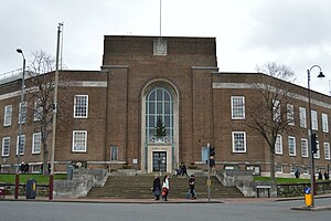
Tunbridge Wells Town Hall
Municipal building in Tunbridge Wells, Kent, England
Distance: Approx. 121 meters
Latitude and longitude: 51.1326,0.264
Tunbridge Wells Town Hall is a municipal building in Mount Pleasant Road, Royal Tunbridge Wells, Kent, England. The town hall, which is the headquarters of Tunbridge Wells Borough Council, is a Grade II listed building.

Ashton Lodge
House in Royal Tunbridge Wells, Kent
Distance: Approx. 205 meters
Latitude and longitude: 51.1326,0.25979
Ashton Lodge is a Grade II listed building in Royal Tunbridge Wells. It was formerly known as Jordan Lodge and appeared under that name in a 1738 map of the town by John Bowra, who named John Jeffrey as the owner. Thomas Bayes lived in the house from 1734 to 1761.
Weather in this IP's area
clear sky
8 Celsius
7 Celsius
7 Celsius
10 Celsius
1028 hPa
93 %
1028 hPa
1013 hPa
10000 meters
1.96 m/s
1.99 m/s
73 degree
4 %
07:04:12
16:21:18
