Country:
Region:
City:
Latitude and Longitude:
Time Zone:
Postal Code:
IP information under different IP Channel
ip-api
Country
Region
City
ASN
Time Zone
ISP
Blacklist
Proxy
Latitude
Longitude
Postal
Route
Luminati
Country
Region
eng
City
birmingham
ASN
Time Zone
Europe/London
ISP
Daisy Corporate Services Trading Ltd
Latitude
Longitude
Postal
IPinfo
Country
Region
City
ASN
Time Zone
ISP
Blacklist
Proxy
Latitude
Longitude
Postal
Route
db-ip
Country
Region
City
ASN
Time Zone
ISP
Blacklist
Proxy
Latitude
Longitude
Postal
Route
ipdata
Country
Region
City
ASN
Time Zone
ISP
Blacklist
Proxy
Latitude
Longitude
Postal
Route
Popular places and events near this IP address

Linlithgow Palace
Ruined palace in Scotland
Distance: Approx. 282 meters
Latitude and longitude: 55.9785,-3.60111111
The ruins of Linlithgow Palace are located in the town of Linlithgow, West Lothian, Scotland, 15 miles (24 km) west of Edinburgh. The palace was one of the principal residences of the monarchs of Scotland in the 15th and 16th centuries. Although maintained after Scotland's monarchs left for England in 1603, the palace was little used, and was burned out in 1746.

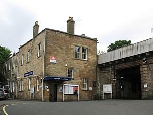
Linlithgow railway station
Railway station in West Lothian, Scotland
Distance: Approx. 495 meters
Latitude and longitude: 55.9764,-3.5957
Linlithgow railway station is a railway station serving the town of Linlithgow in West Lothian, Scotland. It is located on the Glasgow to Edinburgh via Falkirk Line, and is also served by ScotRail services from Edinburgh Waverley to Dunblane.
St Michael's Parish Church, Linlithgow
Church in West Lothian, Scotland
Distance: Approx. 177 meters
Latitude and longitude: 55.977,-3.601
St Michael's Parish Church is one of the largest burgh churches in the Church of Scotland. It is one of two parishes serving the West Lothian county town of Linlithgow, the other being St Ninian's Craigmailen. St Michael is the town's patron saint; the town's motto is "St Michael is kinde to strangers".

Linlithgow
Town in Scotland
Distance: Approx. 521 meters
Latitude and longitude: 55.97905,-3.61054
Linlithgow ( lin-LITH-goh; Scots: Lithgae; Scottish Gaelic: Gleann Iucha) is a town in West Lothian, Scotland. It was historically West Lothian's county town, reflected in the county's historical name of Linlithgowshire. An ancient town, it lies in the Central Belt on a historic route between Edinburgh and Falkirk beside Linlithgow Loch.

Linlithgow Academy
Secondary school in Linlithgow, West Lothian, Scotland
Distance: Approx. 795 meters
Latitude and longitude: 55.971,-3.612
Linlithgow Academy is a secondary school in Linlithgow, West Lothian, Scotland. The original academy was built in 1900 to a design by James Graham Fairley and replaced an earlier kirk institution, known as "Sang Schule".

Linlithgow Union Canal Society
Distance: Approx. 378 meters
Latitude and longitude: 55.9749,-3.5982
The Linlithgow Union Canal Society is a waterway society and a Scottish registered charity based at Linlithgow Canal Centre on the Union Canal at Linlithgow, West Lothian, Scotland. Also known as "LUCS", it was founded in 1975 by Melville Gray to "promote and encourage the restoration and use of the Union Canal, particularly in the vicinity of Linlithgow".

St Magdalene distillery
Distance: Approx. 763 meters
Latitude and longitude: 55.97638889,-3.59138889
St. Magdalene distillery was Lowland single malt Scotch whisky distillery in Linlithgow, Scotland. It operated between 1798 and 1983.
St Michael's Roman Catholic Church, Linlithgow
Church in Linlithgow, Scotland
Distance: Approx. 608 meters
Latitude and longitude: 55.97861111,-3.59472222
St Michael's Roman Catholic Church, Linlithgow is situated in the historic town of Linlithgow. The present church is situated at the East end of the town near the Low Port (entrance to the town). It is located beside the banks of Linlithgow loch and close to the old palace where Mary Queen of Scots was born.

St Michael's Hospital, Linlithgow
Hospital in West Lothian, Scotland
Distance: Approx. 1034 meters
Latitude and longitude: 55.975,-3.58722222
St Michael's Hospital, Linlithgow was a community hospital in Linlithgow, Scotland, operated by NHS Lothian.

Linlithgow Burgh Halls
Municipal building in Linlithgow, Scotland
Distance: Approx. 220 meters
Latitude and longitude: 55.9774,-3.6006
Linlithgow Burgh Halls is a municipal structure at The Cross, Linlithgow, Scotland. The complex includes the Town House, the former headquarters of Linlithgow Burgh Council, which is a Category A listed building. and the Old County Hall, the former headquarters of West Lothian County Council, which is a Category B listed building.

County Buildings, Linlithgow
County building in Linlithgow, Scotland
Distance: Approx. 174 meters
Latitude and longitude: 55.9767,-3.6009
The County Buildings are in the High Street, Linlithgow, Scotland. The complex, which was the headquarters of West Lothian County Council, is a Category B listed building.

Linlithgow Sheriff Court
Judicial building in Linlithgow, Scotland
Distance: Approx. 140 meters
Latitude and longitude: 55.9765,-3.6014
Linlithgow Sheriff Court is a former judicial building on the High Street in Linlithgow in Scotland. The building, which has been converted for residential use, is a Category B listed building.
Weather in this IP's area
scattered clouds
6 Celsius
3 Celsius
4 Celsius
7 Celsius
1038 hPa
100 %
1038 hPa
1030 hPa
10000 meters
4.63 m/s
250 degree
40 %
07:45:19
16:12:03

