Country:
 Great Britain
Region:
City:
Latitude and Longitude:
Time Zone:
Postal Code:
IP information under different IP Channel
ip-api
Country
Region
City
ASN
Time Zone
ISP
Blacklist
Proxy
Latitude
Longitude
Postal
Route
IPinfo
Country
Region
City
ASN
Time Zone
ISP
Blacklist
Proxy
Latitude
Longitude
Postal
Route
MaxMind
Country
Region
City
ASN
Time Zone
ISP
Blacklist
Proxy
Latitude
Longitude
Postal
Route
Luminati
Country
GBRegion
eng
City
ludlow
ASN
Time Zone
Europe/London
ISP
Daisy Corporate Services Trading Ltd
Latitude
Longitude
Postal
db-ip
Country
Region
City
ASN
Time Zone
ISP
Blacklist
Proxy
Latitude
Longitude
Postal
Route
ipdata
Country
Region
City
ASN
Time Zone
ISP
Blacklist
Proxy
Latitude
Longitude
Postal
Route
Popular places and events near this IP address

Aston
Human settlement in England
Distance: Approx. 549 meters
Latitude and longitude: 52.5,-1.88
Aston is an area of inner Birmingham, England. Located immediately to the north-west of Central Birmingham, Aston constitutes a ward within the metropolitan authority. It is approximately 1.5 miles (2.4 km) from Birmingham City Centre.
Duddeston
Inner-city area of the Nechells ward of Birmingham, England
Distance: Approx. 817 meters
Latitude and longitude: 52.4891,-1.8826
Duddeston is an inner-city area of the Nechells ward of central Birmingham, England. It was part of the Birmingham Duddeston constituency until that ceased to exist in 1950.

Lanchester Car Monument
Sculpture of an early motor car in Birmingham, England
Distance: Approx. 379 meters
Latitude and longitude: 52.493,-1.8729
The Lanchester Car Monument (grid reference SP087883) is an open-air galvanized steel sculpture of the Stanhope Phaeton, or Lanchester motor car. It is in Bloomsbury Village Green, a piece of reclaimed land in the Heartlands (Nechells) area of Birmingham, England. It was designed by Tim Tolkien to commemorate the work of Frederick William Lanchester.
Birmingham Aston (UK Parliament constituency)
Parliamentary constituency in the United Kingdom, 1918–1974
Distance: Approx. 549 meters
Latitude and longitude: 52.5,-1.88
Birmingham Aston was a constituency of the House of Commons of the Parliament of the United Kingdom. From 1918 to 1974 it elected one Member of Parliament (MP) by the first-past-the-post system of election.
Alpha Television
British television studio operator
Distance: Approx. 545 meters
Latitude and longitude: 52.497425,-1.884092
Alpha Television was a British limited company which operated television studios in Aston, Birmingham from 1956 to 1970.
Battle of Saltley Gate
Distance: Approx. 613 meters
Latitude and longitude: 52.494265,-1.867888
The Battle of Saltley Gate was the mass picketing of a fuel storage depot in Birmingham, England, in February 1972 during a national miners' strike. When the strike began on 9 January 1972, it was generally considered that the miners "could not possibly win." Woodrow Wyatt, writing in the Daily Mirror, said: "Rarely have strikers advanced to the barricades with less enthusiasm or hope of success... The miners have more stacked against them than the Light Brigade in their famous charge." The picketing of the fuel depot – out of which tens of thousands of tons of coke fuel were being distributed nationwide – became a pivotal, and symbolic, event during the strike.
St Mary's Church, Aston Brook
Church in Aston, England
Distance: Approx. 580 meters
Latitude and longitude: 52.49647222,-1.88511111
St Mary's Church, Aston Brook is a former parish church in the Church of England in Birmingham. The church was demolished in the 1970s. The church was built in 1863 to designs of the architect James Murray.
St Matthew's Church, Duddeston and Nechells
Church in Duddeston, England
Distance: Approx. 547 meters
Latitude and longitude: 52.49061111,-1.87747222
St Matthew's Church, Duddeston and Nechells is a Grade II listed parish church in the Church of England in Birmingham.
St Clement's Church, Nechells
Church in Nechells, England
Distance: Approx. 786 meters
Latitude and longitude: 52.49944444,-1.86708333
St Clement's Church, Nechells was a former parish church in the Church of England in Birmingham.
St Anne's Church, Duddeston
Church in Birmingham, England
Distance: Approx. 744 meters
Latitude and longitude: 52.49061111,-1.86922222
St Anne's Church, Duddeston is a former Church of England parish church in Ashted, Birmingham.
St Catherine's Church, Nechells
Church in Birmingham, England
Distance: Approx. 264 meters
Latitude and longitude: 52.49416667,-1.87347222
St Catherine's Church, Scholefield Street, Nechells is a former Church of England parish church in Birmingham.
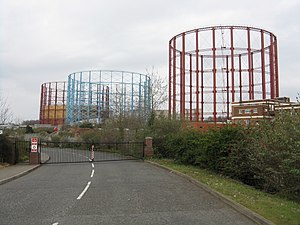
Windsor Street Gasworks
Former coal gas and coke manufacturing site in Birmingham, UK
Distance: Approx. 360 meters
Latitude and longitude: 52.49322222,-1.88047222
The Windsor Street Gasworks was a coal gas and coke manufacturing site in Nechells, Birmingham. The works were constructed in 1846 for the Birmingham Gas Light and Coke Company adjacent to the Birmingham and Fazeley Canal to allow for the bulk import of coal. The company was taken over by the Birmingham Corporation in 1875 and under mayor Joseph Chamberlain and engineer Charles Hunt the Windsor Street site was expanded and connected to the London and North Western Railway.
Weather in this IP's area
few clouds
18 Celsius
18 Celsius
18 Celsius
19 Celsius
1025 hPa
76 %
1025 hPa
1012 hPa
10000 meters
6.17 m/s
20 degree
20 %
06:48:57
19:13:33