Country:
Region:
City:
Latitude and Longitude:
Time Zone:
Postal Code:
IP information under different IP Channel
ip-api
Country
Region
City
ASN
Time Zone
ISP
Blacklist
Proxy
Latitude
Longitude
Postal
Route
Luminati
Country
Region
eng
City
camden
ASN
Time Zone
Europe/London
ISP
Daisy Corporate Services Trading Ltd
Latitude
Longitude
Postal
IPinfo
Country
Region
City
ASN
Time Zone
ISP
Blacklist
Proxy
Latitude
Longitude
Postal
Route
db-ip
Country
Region
City
ASN
Time Zone
ISP
Blacklist
Proxy
Latitude
Longitude
Postal
Route
ipdata
Country
Region
City
ASN
Time Zone
ISP
Blacklist
Proxy
Latitude
Longitude
Postal
Route
Popular places and events near this IP address

Portree
Town on the Isle of Skye, Scotland
Distance: Approx. 165 meters
Latitude and longitude: 57.412,-6.192
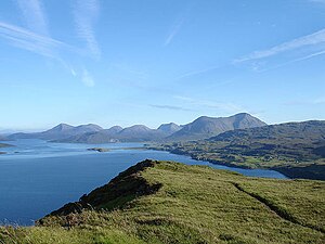
Portree (; Scottish Gaelic: Port Rìgh, pronounced [pʰɔrˠʃt̪ˈɾiː]) is the capital and largest town of the Isle of Skye in the Inner Hebrides of Scotland. It is a civil parish and lies within the Highland council area, around 74 miles (119 km) from its administrative centre of Inverness. Portree has a harbour, fringed by cliffs, with a pier designed by Thomas Telford.

Ben Tianavaig
Distance: Approx. 3942 meters
Latitude and longitude: 57.3902,-6.14374
Ben Tianavaig is a hill located on the Isle of Skye, near Portree . It is very prominent from Portree dominating the view from the harbour. It is a Marilyn (a hill with topographic prominence of at least 150m).

Achachork
Human settlement in Scotland
Distance: Approx. 2265 meters
Latitude and longitude: 57.433,-6.2
Achachork (Scottish Gaelic: Achadh a' Choirce) is a small village in the Scottish council area of the Highland. It is lies on the A855 road to the north of Portree in the east of the Isle of Skye. Robert Forrester is documented as being in Achachork in 1666.

Camastianavaig
Human settlement in Scotland
Distance: Approx. 4737 meters
Latitude and longitude: 57.378,-6.149
Camustianavaig (also English spelling: Camustinivaig) is a crofting township on the island of Skye in Scotland. It is located on the shores of the Sound of Raasay, 5 kilometres (3 miles) southeast of Portree. The Lòn Bàn watercourse flows from Loch Fada to "An Eas Mhòr" below which it is named "Allt Ósglan" and discharges into the sea at Camas Tianabhaig.
Radio Skye
Radio station in Portree, Isle of Skye
Distance: Approx. 468 meters
Latitude and longitude: 57.4171,-6.1938
Radio Skye is a local radio station which broadcasts from Portree to the Isle of Skye, as well as the region of Lochalsh, Wester Ross on the Scottish mainland.

Pairc nan Laoch
Stadium in Scotland
Distance: Approx. 1155 meters
Latitude and longitude: 57.412524,-6.213434
Pairc nan Laoch is a shinty stadium in Portree, Isle of Skye, Scotland. It is home to Skye Camanachd.

Mugeary
Human settlement in Scotland
Distance: Approx. 5993 meters
Latitude and longitude: 57.369,-6.252
Mugeary (Scottish Gaelic: Mùigearraidh) is a farm or croft and former settlement on the island of Skye, Scotland. Located 4 kilometres (2+1⁄2 miles) southwest of Portree, it is known as the location where the basaltic rock mugearite was first identified. The Gaelic name is derived from Old Norse and probably means "narrow field".
ATLAS Arts
Distance: Approx. 210 meters
Latitude and longitude: 57.411389,-6.192071
ATLAS Arts is a visual arts organisation dedicated to commissioning contemporary arts, culture, heritage, and education based in the Isle of Skye. It was formed in 2010 and since then has delivered a varied programme of contemporary art including installations, sculpture, live performances, film screenings, and collaborative public works. It is one of Creative Scotland's portfolio of regularly-funded organisations.
Bun-sgoil Ghàidhlig Phort Righ
Primary school in Portree, Scotland
Distance: Approx. 1024 meters
Latitude and longitude: 57.413227,-6.211252
Bun-sgoil Ghàidhlig Phort Righ is a Gaelic-medium primary school in Portree on Skye, Scotland. The school opened April 2018, becoming the third purpose-built Gaelic school in the Highland Council area. The £8.7 million building was built by Robertson Construction.

Portree Hospital
Hospital in Isle of Skye, Scotland
Distance: Approx. 273 meters
Latitude and longitude: 57.41049,-6.1933
The Portree Hospital is a health facility in Fancyhill, Portree on the Isle of Skye. It is managed by NHS Highland.

Portree Sheriff Court
Judicial building in Portree, Scotland
Distance: Approx. 45 meters
Latitude and longitude: 57.4128,-6.1949
Portree Sheriff Court is a judicial building in Somerled Square in Portree on the Isle of Skye in Scotland. The building, which continues to be used as a courthouse, is a Category C listed building.

Portree Lifeboat Station
RNLI Lifeboat station in Highland, Scotland
Distance: Approx. 344 meters
Latitude and longitude: 57.41075,-6.19005556
Portree Lifeboat Station is located at the Pier, on Quay Street, in Portree, the largest town on the Isle of Skye, one of the Inner Hebrides, overlooking the Sound of Raasay, on the north-west coast of Scotland, formerly in the county of Ross and Cromarty, now in the administrative region of Highland. A lifeboat was first placed at Portree by the Royal National Lifeboat Institution (RNLI) on 9 March 1991. The station currently operates a Trent-class All-weather lifeboat, 14-16 Stanley Watson Barker (ON 1214), on station since 1996.
Weather in this IP's area
overcast clouds
12 Celsius
12 Celsius
12 Celsius
12 Celsius
1023 hPa
90 %
1023 hPa
1021 hPa
10000 meters
3.85 m/s
7.95 m/s
159 degree
100 %
07:53:18
16:23:51