Country:
Region:
City:
Latitude and Longitude:
Time Zone:
Postal Code:
IP information under different IP Channel
ip-api
Country
Region
City
ASN
Time Zone
ISP
Blacklist
Proxy
Latitude
Longitude
Postal
Route
Luminati
Country
ASN
Time Zone
Europe/Berlin
ISP
Plusnet GmbH
Latitude
Longitude
Postal
IPinfo
Country
Region
City
ASN
Time Zone
ISP
Blacklist
Proxy
Latitude
Longitude
Postal
Route
db-ip
Country
Region
City
ASN
Time Zone
ISP
Blacklist
Proxy
Latitude
Longitude
Postal
Route
ipdata
Country
Region
City
ASN
Time Zone
ISP
Blacklist
Proxy
Latitude
Longitude
Postal
Route
Popular places and events near this IP address
Bad Krozingen
Town in Baden-Württemberg, Germany
Distance: Approx. 5581 meters
Latitude and longitude: 47.91666667,7.7
Bad Krozingen (German: [baːt ˈkʁɔt͡sɪŋən] ; Alemannic: Bad Chrotzige) is a spa town in the district Breisgau-Hochschwarzwald, in Baden-Württemberg, Germany. It is situated 15 km southwest of Freiburg. In the 1970s, the previously independent villages Biengen, Hausen an der Möhlin, Schlatt and Tunsel, including Schmidhofen, became part of Bad Krozingen.
Feldkirch (Hartheim)
Ortsteil of Hartheim am Rhein in Baden-Württemberg, Germany
Distance: Approx. 1212 meters
Latitude and longitude: 47.93583333,7.64861111
Feldkirch is a small town in Baden-Württemberg, Germany, a few minutes from the French border (4 km) and near Switzerland. It is part of the town Hartheim am Rhein. It has a small bakery, 3 restaurants, and 3 hotels (guesthouses).

Hartheim am Rhein
Municipality in Baden-Württemberg, Germany
Distance: Approx. 491 meters
Latitude and longitude: 47.93666667,7.62777778
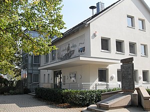
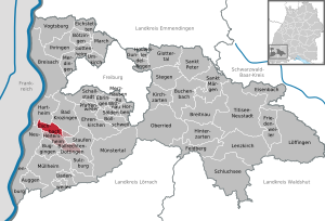
Hartheim am Rhein is a town in the Breisgau-Hochschwarzwald district, Baden-Württemberg, Germany with about 5000 inhabitants. The districts of Hartheim am Rhein are Bremgarten, Feldkirch and Hartheim. For the first time, Hartheim am Rhein ist referred to in the Lorsch Codex in 772.

Eschbach, Baden-Württemberg
Municipality in Baden-Württemberg, Germany
Distance: Approx. 5714 meters
Latitude and longitude: 47.89,7.655
Eschbach is a municipality in the Breisgau-Hochschwarzwald district, Baden-Württemberg, Germany.

Geiswasser
Commune in Grand Est, France
Distance: Approx. 4869 meters
Latitude and longitude: 47.9783,7.6039
Geiswasser is a commune in the Haut-Rhin department in Grand Est in north-eastern France.

Nambsheim
Commune in Grand Est, France
Distance: Approx. 5183 meters
Latitude and longitude: 47.9353,7.5639
Nambsheim is a commune in the Haut-Rhin department in Grand Est in north-eastern France.

Neumagen
River in Germany
Distance: Approx. 3146 meters
Latitude and longitude: 47.9494,7.6725
Neumagen is a river of Baden-Württemberg, Germany. It is a left tributary of the Möhlin near Bad Krozingen.
Tunsel
Ortsteil of Bad Krozingen in Baden-Württemberg, Germany
Distance: Approx. 4835 meters
Latitude and longitude: 47.90333333,7.66972222
Tunsel is a village in the district of Breisgau-Hochschwarzwald in Baden-Württemberg. Since January 1974, it is an Ortsteil of Bad Krozingen.

Bad Krozingen station
Railway station in Bad Krozingen, Germany
Distance: Approx. 5304 meters
Latitude and longitude: 47.9197413,7.69806594
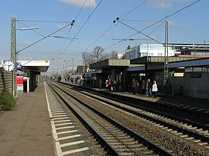
Bad Krozingen station is the most important station in the spa town of Bad Krozingen. It is located on the Rhine Valley Railway (Rheintalbahn) and the Bad Krozingen–Münstertal railway, which has started here since 1894.
Schlatt (Bad Krozingen)
Ortsteil of Bad Krozingen in Baden-Württemberg, Germany
Distance: Approx. 3364 meters
Latitude and longitude: 47.92583333,7.67361111
Schlatt is a village in the district of Breisgau-Hochschwarzwald in Baden-Württemberg. Since January 1973, it is an Ortsteil of Bad Krozingen.
Hausen an der Möhlin
Ortsteil of Bad Krozingen in Baden-Württemberg, Germany
Distance: Approx. 3269 meters
Latitude and longitude: 47.95722222,7.66777778
Hausen an der Möhlin is a village in the district of Breisgau-Hochschwarzwald in Baden-Württemberg. Since September 1973, it is an Ortsteil of Bad Krozingen.
Biengen
Ortsteil of Bad Krozingen in Baden-Württemberg, Germany
Distance: Approx. 4239 meters
Latitude and longitude: 47.93861111,7.69
Biengen is a village in the district of Breisgau-Hochschwarzwald in Baden-Württemberg. Since December 1971, it is an Ortsteil of Bad Krozingen.
Weather in this IP's area
overcast clouds
14 Celsius
14 Celsius
13 Celsius
18 Celsius
1024 hPa
79 %
1024 hPa
999 hPa
10000 meters
0.45 m/s
1.79 m/s
25 degree
100 %
07:20:46
17:05:21
