Country:
Region:
City:
Latitude and Longitude:
Time Zone:
Postal Code:
IP information under different IP Channel
ip-api
Country
Region
City
ASN
Time Zone
ISP
Blacklist
Proxy
Latitude
Longitude
Postal
Route
Luminati
Country
Region
ct
City
barcelona
ASN
Time Zone
Europe/Madrid
ISP
Mba Datacenters S.l.
Latitude
Longitude
Postal
IPinfo
Country
Region
City
ASN
Time Zone
ISP
Blacklist
Proxy
Latitude
Longitude
Postal
Route
db-ip
Country
Region
City
ASN
Time Zone
ISP
Blacklist
Proxy
Latitude
Longitude
Postal
Route
ipdata
Country
Region
City
ASN
Time Zone
ISP
Blacklist
Proxy
Latitude
Longitude
Postal
Route
Popular places and events near this IP address

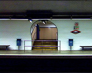
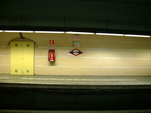
La Bonanova station
Railway station situated in the Sarrià-Sant Gervasi district of Barcelona
Distance: Approx. 667 meters
Latitude and longitude: 41.3978,2.13528
La Bonanova is a railway station situated under the Via Augusta at Carrer de Ganduxer in the Sarrià-Sant Gervasi district of Barcelona. It is served by line L6 of the Barcelona Metro and lines S1 and S2 of the Metro del Vallès commuter rail system. All these lines are operated by Ferrocarrils de la Generalitat de Catalunya, who also run the station.

Sant Gervasi station
Railway station in Barcelona, Spain
Distance: Approx. 558 meters
Latitude and longitude: 41.40111111,2.14722222
Sant Gervasi is a railway station located under Plaça Molina in the Sarrià-Sant Gervasi district of Barcelona. It is served by line L6 of the Barcelona Metro and lines S1 and S2 of the Metro del Vallès commuter rail system,. All these lines are operated by Ferrocarrils de la Generalitat de Catalunya, who also run the station.
Muntaner station
Railway station in Barcelona, Spain
Distance: Approx. 436 meters
Latitude and longitude: 41.39861111,2.14277778
Muntaner is a railway station located at the intersection of the Via Augusta with the Carrer de Santaló and Carrer de Muntaner, in the Sarrià-Sant Gervasi district of Barcelona. It is served by line L6 of the Barcelona Metro, together with lines S1 and S2 of the Metro del Vallès commuter rail system. All these lines are operated by Ferrocarrils de la Generalitat de Catalunya, who also run the station.

El Putxet (Barcelona–Vallès Line)
Metro station in Barcelona, Spain
Distance: Approx. 424 meters
Latitude and longitude: 41.40583333,2.13916667
El Putxet is a station of the Barcelona Metro on the FGC-operated line L7 (also known as Línia de Balmes). The station serves the El Putxet quarter of Sarrià-Sant Gervasi, and is situated under Carrer de Balmes. When first built speculatively in 1929, the station was named Mercado as it sits right next to Mercado de Sant Gervasi.

El Putxet i el Farró
Neighbourhood in the district of Sarrià-Sant Gervasi, Barcelona
Distance: Approx. 534 meters
Latitude and longitude: 41.40555556,2.14527778
El Putxet i Farró (not el Putget i el Farró) is a neighbourhood in the Sarrià-Sant Gervasi district of Barcelona, Catalonia (Spain), located on a hill between Vallcarca and Sant Gervasi, urbanised after the 1870s. It is formed by two quarters, the former neighborhoods of el Putxet and el Farró.

Sant Gervasi – la Bonanova
Distance: Approx. 754 meters
Latitude and longitude: 41.40638889,2.13361111
Sant Gervasi – la Bonanova is a neighbourhood in the Sarrià-Sant Gervasi district of Barcelona, Catalonia (Spain). Formerly it was with the neighbourhood of Sant Gervasi - Galvany, an independent municipality called Sant Gervasi de Cassoles. The neighbourhood is divided mainly into two distinct sectors: the area of Sant Gervasi, where it houses the oldest nucleus of the town of Sant Gervasi de Cassoles, and another sector, that of la Bonanova, born when it was built the road connecting Sarrià with Sant Gervasi.

Sant Gervasi – Galvany
Distance: Approx. 671 meters
Latitude and longitude: 41.39666667,2.14388889
Sant Gervasi – Galvany is a neighborhood in the Sarrià-Sant Gervasi district of Barcelona, Catalonia (Spain). The name of the neighborhood refers to Sant Gervasi de Cassoles, which was one of the parts of the former municipality of Sant Gervasi de Cassoles; and the Camp d'en Galvany urbanization which was begun in 1866 by its owner, Joseph Galvany Castelló. The Galvany name became popular when the market Galvany was built, located between the neighborhood streets Santaló, Calaf, Amigó and Madrazo, and the market has a plaque on the facade of Santaló street recalling that Josep Galvany Castelló gave the land on which the market was built to the municipality.
Pàdua (Barcelona–Vallès Line)
Metro station in Barcelona, Spain
Distance: Approx. 215 meters
Latitude and longitude: 41.40333333,2.14277778
Pàdua is a station of the Barcelona Metro on the FGC-operated line L7 (also known as Línia de Balmes). The station is situated under Carrer de Balmes. The station opened in 1953 with the opening of the line from Gràcia railway station to Avinguda Tibidabo.

Plaça Molina (Barcelona–Vallès Line)
Metro station in Barcelona, Spain
Distance: Approx. 575 meters
Latitude and longitude: 41.40138889,2.1475
Plaça Molina is a station of the Barcelona Metro on the FGC-operated line L7 (also known as Línia de Balmes). The station is situated under by Plaça Molina, a square in the Sarrià-Sant Gervasi district. It is connected by an underground pedestrian passageway to the nearby Sant Gervasi station on line L6 of the metro.

Joan Maragall Archive
Distance: Approx. 568 meters
Latitude and longitude: 41.40082222,2.14725278
The Joan Maragall Archive is a documentation center that brings together a documentary on the life and work of the poet Joan Maragall and Modernism in general. The centre is placed in the last residence of Joan Maragall, at Alfons XII street, in the neighbourhood of Sant Gervasi, Barcelona. It is a reserve section of the National Library of Catalonia and is open to researchers of the poet's work.

ESIC University
Private university in Spain
Distance: Approx. 801 meters
Latitude and longitude: 41.39616,2.14592
ESIC University (ESIC Business & Marketing School) is a private university located in Pozuelo de Alarcón, Spain, specialized in Marketing, Management and Digital Business.They are also found throughout Spain in cities such as Malaga, Barcelona, Pamplona, Seville, Granada, Zaragoza, Bilbao, and Valencia. Founded in 1965 as Escuela Superior de Ingenieros Comerciales (ESIC) by the religious congregation Priests of the Sacred Heart to train business professionals, ESIC was the first business school created in Spain for professionals in need to improve their training in the area of Marketing. It was later named ESIC Business & Marketing School, until university recognition was granted in 2019.

College of Saint Teresa-Ganduxer
School in Barcelona
Distance: Approx. 674 meters
Latitude and longitude: 41.39972222,2.13333333
The College of Saint Teresa-Ganduxer (Catalan: Col·legi de les Teresianes or Col·legi Santa Teresa—Ganduxer) is a school on the Carrer de Ganduxer in the old town of Sant Gervasi de Cassoles, currently part of the Tres Torres neighborhood of the Sarrià—Sant Gervasi district of Barcelona. The school offers all the courses of the regular education curriculum from the second cycle of infantile education to the baccalaureate. It used to be a girls-only school, but by the end of the twentieth century it was a mixed school.
Weather in this IP's area
broken clouds
15 Celsius
15 Celsius
14 Celsius
16 Celsius
1017 hPa
73 %
1017 hPa
1003 hPa
10000 meters
2.06 m/s
120 degree
75 %
07:43:56
17:29:43

