Country:
Region:
City:
Latitude and Longitude:
Time Zone:
Postal Code:
IP information under different IP Channel
ip-api
Country
Region
City
ASN
Time Zone
ISP
Blacklist
Proxy
Latitude
Longitude
Postal
Route
Luminati
Country
Region
kem
City
novokuznetsk
ASN
Time Zone
Asia/Novokuznetsk
ISP
Quantum CJSC
Latitude
Longitude
Postal
IPinfo
Country
Region
City
ASN
Time Zone
ISP
Blacklist
Proxy
Latitude
Longitude
Postal
Route
db-ip
Country
Region
City
ASN
Time Zone
ISP
Blacklist
Proxy
Latitude
Longitude
Postal
Route
ipdata
Country
Region
City
ASN
Time Zone
ISP
Blacklist
Proxy
Latitude
Longitude
Postal
Route
Popular places and events near this IP address
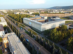
Novokuznetsk
City in Kemerovo Oblast, Russia
Distance: Approx. 1468 meters
Latitude and longitude: 53.76666667,87.13333333
Novokuznetsk (Russian: Новокузнецк, IPA: [nəvəkʊzˈnʲɛt͡sk], lit. 'new smith's'; Shor: Аба-тура, romanized: Aba-tura) is a city in Kemerovo Oblast (Kuzbass) in southwestern Siberia, Russia. It is the second-largest city in the oblast, after the administrative center Kemerovo. Population: 537,480 (2021 Census); 547,904 (2010 Census); 549,870 (2002 Census); 599,947 (1989 Soviet census).

Kuznetsk Metallurgists Sports Palace
Indoor sporting arena in Novokuznetsk, Russia
Distance: Approx. 722 meters
Latitude and longitude: 53.76777778,87.11555556
Kuznetsk Metallurgists Sports Palace (Russian: Арена кузнецких металлургов им. Олега Короленко) is an indoor sporting arena located in Novokuznetsk, Russia. The capacity of the arena is 6,818.

Ulyanovskaya Mine disaster
2007 methane explosion in the Ulyanovskaya longwall coal mine, Kemerovo Oblast, Russia
Distance: Approx. 1306 meters
Latitude and longitude: 53.75,87.1167
The Ulyanovskaya Mine disaster was caused by a methane explosion that occurred on March 19, 2007 in the Ulyanovskaya longwall coal mine in the Kemerovo Oblast. At least 108 people were reported to have been killed by the blast, which occurred at a depth of about 270 meters (885 feet) at 10:19 local time (3:19 GMT). The mine disaster was Russia's deadliest in more than a decade.

Kondoma
River in Russia
Distance: Approx. 5425 meters
Latitude and longitude: 53.7454,87.1906
The Kondoma (Russian: Ко́ндома; Shor: Қондум, Qondum) is a river in Kemerovo Oblast, Russia. It is left tributary of the Tom. It is 392 kilometres (244 mi) long, with a drainage basin of 8,270 square kilometres (3,190 sq mi).
Aba (Russia)
River in Russia
Distance: Approx. 2144 meters
Latitude and longitude: 53.7744,87.137
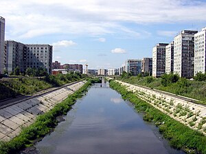
The Aba (Russian: река Аба) is a river in Russia; a left tributary of the Tom. It flows across the steppes, and merges with the Tom near Novokuznetsk. It is 71 kilometres (44 mi) long, and has a drainage basin of 867 square kilometres (335 sq mi).
Novokuznetsky District
District in Kemerovo Oblast, Russia
Distance: Approx. 1305 meters
Latitude and longitude: 53.75,87.11666667
Novokuznetsky District (Russian: Новокузне́цкий райо́н) is an administrative district (raion), one of the nineteen in Kemerovo Oblast, Russia. As a municipal division, it is incorporated as Novokuznetsky Municipal District. It is located in the center of the oblast and spans it from border to border in the southwest-northeast direction.

Siberian State Industrial University
Technical university in Novokuznetsk, Russia
Distance: Approx. 1305 meters
Latitude and longitude: 53.75,87.11666667
Siberian State Industrial University (Russian: Сибирский государственный индустриальный университет, abbreviated СибГИУ) is the oldest university in Novokuznetsk, Russia. It was established on June 23, 1930, to train professional personnel for the construction of the Kuznetsk Metallurgical Combine (Novokuznetsk Iron and Steel Plant). Prior to raising the status in 1994, it was named the Siberian Metallurgic Institute (SMI), then it was renamed the Siberian State Mining-Metallurgic Academy (SibGGMA).
Weather in this IP's area
overcast clouds
-3 Celsius
-8 Celsius
-3 Celsius
-3 Celsius
1026 hPa
73 %
1026 hPa
1000 hPa
10000 meters
5.05 m/s
11.22 m/s
238 degree
100 %
08:27:02
17:23:48


