Country:
Region:
City:
Latitude and Longitude:
Time Zone:
Postal Code:
IP information under different IP Channel
ip-api
Country
Region
City
ASN
Time Zone
ISP
Blacklist
Proxy
Latitude
Longitude
Postal
Route
Luminati
Country
ASN
Time Zone
Europe/Berlin
ISP
wilhelm.tel GmbH
Latitude
Longitude
Postal
IPinfo
Country
Region
City
ASN
Time Zone
ISP
Blacklist
Proxy
Latitude
Longitude
Postal
Route
db-ip
Country
Region
City
ASN
Time Zone
ISP
Blacklist
Proxy
Latitude
Longitude
Postal
Route
ipdata
Country
Region
City
ASN
Time Zone
ISP
Blacklist
Proxy
Latitude
Longitude
Postal
Route
Popular places and events near this IP address

Norderstedt
Town in Schleswig-Holstein, Germany
Distance: Approx. 1058 meters
Latitude and longitude: 53.70638889,10.01027778
Norderstedt (Northern Low Saxon: Noordersteed) is a city in Germany and part of the Hamburg Metropolitan Region (Metropolregion Hamburg), the fourth largest city (with approximately 84,100 inhabitants as of 2023) in the federal state of Schleswig-Holstein, belonging to the district Segeberg.

Hasloh
Municipality in Schleswig-Holstein, Germany
Distance: Approx. 5406 meters
Latitude and longitude: 53.69916667,9.91305556
Hasloh is a municipality in the district of Pinneberg, in Schleswig-Holstein, Germany.

Langenhorn, Hamburg
Quarter of Hamburg in Germany
Distance: Approx. 6268 meters
Latitude and longitude: 53.65,10
is a quarter in the borough Hamburg-Nord of Hamburg, Germany. In 2020 the population was 46,272.
Norderstedt Mitte station
Rapid transit station in Germany
Distance: Approx. 219 meters
Latitude and longitude: 53.70777778,9.99222222
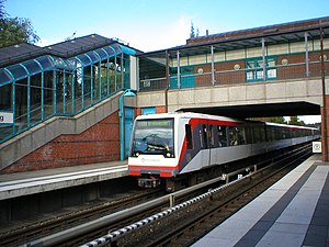
Norderstedt Mitte station is a railway station in Norderstedt, Germany. It is a terminus for the rapid transit trains of the line U1 of the Hamburg U-Bahn and connects the underground railway with the commuter trains of the AKN railway company line A2 (Alster Northern Railway).

Richtweg station
Rapid transit station in Germany
Distance: Approx. 1226 meters
Latitude and longitude: 53.69555556,9.98944444
Richtweg is a public transport station for the rapid transit trains of Hamburg's underground railway line U1, located in Norderstedt, Germany. It was opened in 1953 as a stop of the Alster Northern Railway (ANB) from Ulzburg Süd to Ochsenzoll with an island platform. Between 1994 and 1996 this section of the ANB was rebuilt for the Hamburg U-Bahn system.

Paninternational Flight 112
1971 aviation accident in Germany
Distance: Approx. 3429 meters
Latitude and longitude: 53.70277778,9.9425
Paninternational Flight 112 was a BAC One-Eleven operated by German airline Paninternational that crashed in Hamburg on 6 September 1971 while attempting to land on an autobahn following the failure of both engines. The accident killed 22 passengers and crew out of 121 on board.

Langenhorn Markt station
Railway station in Hamburg, Germany
Distance: Approx. 6534 meters
Latitude and longitude: 53.6491,10.0172
Langenhorn Markt (Langenhorn Marketplace) is a station on the Hamburg U-Bahn line U1. It was opened in July 1921 and is located in Hamburg, Germany, in the quarter of Langenhorn. Langenhorn is part of the borough of Hamburg-Nord.

Langenhorn Nord station
Railway station in Hamburg, Germany
Distance: Approx. 5282 meters
Latitude and longitude: 53.6608,10.0175
Langenhorn Nord (Langenhorn North) is a station on the Hamburg U-Bahn line U1. It was opened in July 1921 and is located in Hamburg, Germany, in the quarter of Langenhorn. Langenhorn is part of the borough of Hamburg-Nord.

Kiwittsmoor station
Railway station in Hamburg, Germany
Distance: Approx. 3771 meters
Latitude and longitude: 53.6749,10.0161
Kiwittsmoor is a station on the Hamburg U-Bahn line U1. It was opened in May 1960 and is located in Hamburg, Germany, in the quarter of Langenhorn. Langenhorn is part of the borough of Hamburg-Nord.
Ochsenzoll station
Railway station in Hamburg, Germany
Distance: Approx. 3164 meters
Latitude and longitude: 53.6781,10.0014
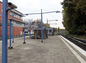
Ochsenzoll is a station on the Hamburg U-Bahn line U1. Until 1969, it was the north western terminus of the line. It was opened in July 1921 and is located in Hamburg, Germany, in the quarter of Langenhorn.

Garstedt station
Underground rapid transit station in Germany
Distance: Approx. 2485 meters
Latitude and longitude: 53.6844,9.9861
Garstedt is an underground station on the Hamburg U-Bahn line U 1. It was opened in June 1969 and is located in Norderstedt, Germany, in the borough of Garstedt, which was an independent municipality to the end of 1969.

Edmund-Plambeck-Stadion
Sports venue in Norderstedt, Germany
Distance: Approx. 3430 meters
Latitude and longitude: 53.6771,9.9771
The Edmund-Plambeck-Stadion (formerly known as the Stadion Ochsenzoller Straße) is a multi-use stadium in Norderstedt, Schleswig-Holstein, Germany.
Weather in this IP's area
overcast clouds
9 Celsius
7 Celsius
8 Celsius
10 Celsius
1028 hPa
89 %
1028 hPa
1024 hPa
10000 meters
3.6 m/s
120 degree
100 %
07:26:02
16:41:07

