Country:
Region:
City:
Latitude and Longitude:
Time Zone:
Postal Code:
IP information under different IP Channel
ip-api
Country
Region
City
ASN
Time Zone
ISP
Blacklist
Proxy
Latitude
Longitude
Postal
Route
Luminati
Country
ASN
Time Zone
Europe/Kyiv
ISP
Limited Liability Company KYIVSKI TELEKOMUNIKATSIYNI MEREZHI
Latitude
Longitude
Postal
IPinfo
Country
Region
City
ASN
Time Zone
ISP
Blacklist
Proxy
Latitude
Longitude
Postal
Route
db-ip
Country
Region
City
ASN
Time Zone
ISP
Blacklist
Proxy
Latitude
Longitude
Postal
Route
ipdata
Country
Region
City
ASN
Time Zone
ISP
Blacklist
Proxy
Latitude
Longitude
Postal
Route
Popular places and events near this IP address

Drohobych
City in Lviv Oblast, Ukraine
Distance: Approx. 8496 meters
Latitude and longitude: 49.35,23.5
Drohobych (Ukrainian: Дрогобич, pronounced [droˈɦɔbɪtʃ] ; Polish: Drohobycz [drɔˈxɔ.bɨt͡ʂ] ; Yiddish: דראָהאָבּיטש, romanized: drohobitsh) is a city in the south of Lviv Oblast, Ukraine. It is the administrative center of Drohobych Raion and hosts the administration of Drohobych urban hromada, one of the hromadas of Ukraine. In 1939–1941 and 1944–1959 it was the center of Drohobych Oblast.

Boryslav
City in Lviv Oblast, Ukraine
Distance: Approx. 5956 meters
Latitude and longitude: 49.28916667,23.41888889
Boryslav (Ukrainian: Борислав; Polish: Borysław) is a city located on the Tysmenytsia (a tributary of the Dniester), in Drohobych Raion, Lviv Oblast (region) of western Ukraine. It hosts the administration of Boryslav urban hromada, one of the hromadas of Ukraine. Boryslav is a major center of the petroleum and ozokerite industries.

Truskavets
City in Lviv Oblast, Ukraine
Distance: Approx. 942 meters
Latitude and longitude: 49.28055556,23.505
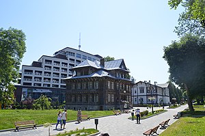
Truskavets (Ukrainian: Трускавець; Polish: Truskawiec) is a city in Drohobych Raion, western Ukraine's Lviv Oblast (region), near the border with Poland. It hosts the administration of Truskavets urban hromada, one of the hromadas of Ukraine. The population is approximately 28,287 (2022 estimate).

Stebnyk
City in Lviv Oblast, Ukraine
Distance: Approx. 5820 meters
Latitude and longitude: 49.3,23.56666667
Stebnyk (Ukrainian: Стебник) is a city in Drohobych Raion in Lviv Oblast (province) of western Ukraine, close to the border with Poland. It is located in the Drohobych municipality. It belongs to Drohobych urban hromada, one of the hromadas of Ukraine.

Drohobych Raion
Subdivision of Lviv Oblast, Ukraine
Distance: Approx. 8031 meters
Latitude and longitude: 49.34055556,23.45583333
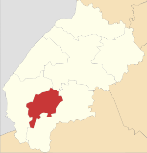
Drohobych Raion (Ukrainian: Дрогобицький район, romanized: Drohobytskyi raion) is a raion (district) of Lviv Oblast (region) of western Ukraine. Its administrative center is Drohobych. Population: 232,947 (2022 estimate).

Drohobych Oblast
Ukrainian Oblast
Distance: Approx. 8496 meters
Latitude and longitude: 49.35,23.5
Drohobych Oblast (Ukrainian: Дрогобицька область, romanized: Drohobytska oblast) was an oblast of the Ukrainian SSR from December 4, 1939 to May 21, 1959. It had an area of 9,600 square kilometres (3,700 sq mi) and, as of 1956, had a population of 853,000.

St. George's Church, Drohobych
UNESCO World Heritage Site in Lviv Oblast, Ukraine
Distance: Approx. 8248 meters
Latitude and longitude: 49.34777778,23.49944444
St. George's Church in Drohobych is one of the oldest and best preserved timber churches of Galicia. The church is a monument of Galician wooden architecture of the late 15th – early 16th centuries, one of the best preserved and one of the best monuments of ancient Ukrainian sacral architecture.

Zavadiv, Stryi Raion, Lviv Oblast
Rural locality in Lviv Oblast, Ukraine
Distance: Approx. 5286 meters
Latitude and longitude: 49.25333333,23.43166667
Zavadiv (Ukrainian: Зава́дів) – village (selo) in the Stryi Raion, Lviv Oblast (province) of Western Ukraine. It belongs to Stryi urban hromada, one of the hromadas of Ukraine. The first written mention dates back to the year 1504.

Bukovytsia
Distance: Approx. 3383 meters
Latitude and longitude: 49.27305556,23.45083333
Bukovytsia is a ski resort in the Eastern Beskyd Carpathian forests of Ukraine. It is located in Boryslav. The first mentions about winter sports for this resort are from the times of the Austro-Hungarian Empire.
Drohobych urban hromada
Urban hromada in Lviv Oblast, Ukraine
Distance: Approx. 8496 meters
Latitude and longitude: 49.35,23.5
Drohobych urban hromada (Ukrainian: Дрогобицька міська громада, romanized: Drohobytska miska hromada) is a hromada (municipality) in Lviv Oblast, in western Ukraine. The hromada's administrative centre is the city of Drohobych. Drohobych urban hromada has an area of 426.2 square kilometres (164.6 sq mi), with a population of 120,404 (2022 estimate).
Truskavets urban hromada
Urban hromada in Lviv Oblast, Ukraine
Distance: Approx. 942 meters
Latitude and longitude: 49.28055556,23.505
Truskavets urban territorial hromada (Ukrainian: Трускавецька міська територіальна громада, romanized: Truskavetska miska terytorialna hromada) is one of the hromadas of Ukraine, located in Drohobych Raion in the country's western Lviv Oblast. Its capital is the city of Truskavets. The hromada has an area of 207.9 km2 (80.3 sq mi), as well as a population of 40,793 (as of 2023).
Boryslav urban hromada
Urban hromada in Lviv Oblast
Distance: Approx. 5956 meters
Latitude and longitude: 49.28916667,23.41888889
Boryslav urban territorial hromada (Ukrainian: Бориславська міська територіальна громада, romanized: Boryslavska miska terytorialna hromada) is one of the hromadas of Ukraine, located in Lviv Oblast's Drohobych Raion. Its capital is the city of Boryslav. The hromada has an area of 159.2 km2 (61.5 sq mi), as well as a population of 41,676 (as of 2023).
Weather in this IP's area
clear sky
2 Celsius
1 Celsius
2 Celsius
2 Celsius
1036 hPa
77 %
1036 hPa
986 hPa
10000 meters
1.59 m/s
1.59 m/s
135 degree
07:25:36
16:54:01