77.118.61.93 - IP Lookup: Free IP Address Lookup, Postal Code Lookup, IP Location Lookup, IP ASN, Public IP
Country:
Region:
City:
Location:
Time Zone:
Postal Code:
ISP:
ASN:
language:
User-Agent:
Proxy IP:
Blacklist:
IP information under different IP Channel
ip-api
Country
Region
City
ASN
Time Zone
ISP
Blacklist
Proxy
Latitude
Longitude
Postal
Route
db-ip
Country
Region
City
ASN
Time Zone
ISP
Blacklist
Proxy
Latitude
Longitude
Postal
Route
IPinfo
Country
Region
City
ASN
Time Zone
ISP
Blacklist
Proxy
Latitude
Longitude
Postal
Route
IP2Location
77.118.61.93Country
Region
steiermark
City
oblarn
Time Zone
Europe/Vienna
ISP
Language
User-Agent
Latitude
Longitude
Postal
ipdata
Country
Region
City
ASN
Time Zone
ISP
Blacklist
Proxy
Latitude
Longitude
Postal
Route
Popular places and events near this IP address

Stein an der Enns
Distance: Approx. 5172 meters
Latitude and longitude: 47.43333333,13.93333333
Stein an der Enns is a village in the administrative district of Liezen, in the Austrian state of Styria. It is located in the valley of the river Enns, and part of the municipality Sölk.

Mitterberg
Former municipality in Styria, Austria
Distance: Approx. 4406 meters
Latitude and longitude: 47.45,13.93333333
Mitterberg is a municipality in the district of Liezen in Styria, Austria.

Gröbming
Municipality in Styria, Austria
Distance: Approx. 6881 meters
Latitude and longitude: 47.44555556,13.90111111
Gröbming (German: [ˈɡʁøːbmiŋ]) is a municipality in the district of Liezen in Styria, Austria.

Großsölk
Former municipality in Styria, Austria
Distance: Approx. 5996 meters
Latitude and longitude: 47.4075,13.96888889
Großsölk is a former municipality in the district of Liezen in Styria, Austria. Since the 2015 Styria municipal structural reform, it is part of the municipality Sölk.

Niederöblarn
Former municipality in Styria, Austria
Distance: Approx. 8347 meters
Latitude and longitude: 47.47,14.1
Niederöblarn is a former municipality in the district of Liezen in Styria, Austria. Since the 2015 Styria municipal structural reform, it is part of the municipality Öblarn.

Öblarn
Municipality in Styria, Austria
Distance: Approx. 1703 meters
Latitude and longitude: 47.45,14.00805556
Öblarn is a market town and municipality in the district of Liezen in Styria, Austria. It is located in the Eastern Alps.
Sankt Martin am Grimming
Former municipality in Styria, Austria
Distance: Approx. 3341 meters
Latitude and longitude: 47.48888889,13.98194444
Sankt Martin am Grimming is a former municipality in the judicial district of Schladming in the Austrian state of Styria. In 2015 it merged with the municipality of Mitterberg to form the municipality of Mitterberg-St Martin.
Schloss Grosssölk
Castle in Styria
Distance: Approx. 5849 meters
Latitude and longitude: 47.40944444,13.96611111
Schloss Grosssölk is a castle in Styria, Austria. Schloss Grosssölk is situated at an elevation of 932 m.

Grimming
Distance: Approx. 7099 meters
Latitude and longitude: 47.52055556,14.01694444
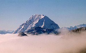
The Grimming (2,351 m, German: [ˈɡʁɪmiŋ]) is an isolated peak in the Dachstein Mountains of Austria and one of the few ultra-prominent mountains of the Alps.

Niederöblarn Airport
Airport in Austria
Distance: Approx. 2525 meters
Latitude and longitude: 47.47894444,14.00722222
Niederöblarn Airport (German: Flugplatz Niederöblarn, ICAO: LOGO) is a private use airport located 1 kilometre (0.6 mi) west-northwest of Niederöblarn, Styria, Austria.

Mitterberg-Sankt Martin
Municipality in Styria, Austria
Distance: Approx. 3341 meters
Latitude and longitude: 47.48888889,13.98194444
Mitterberg-Sankt Martin is a municipality since 2015 in the Expositur Gröbming in the Liezen District of Styria, Austria (judicial district Schladming). The municipality was founded as part of the Styria municipal structural reform, at the end of 2014, by merging the former towns Mitterberg and Sankt Martin am Grimming.
Sölk
Municipality in Styria, Austria
Distance: Approx. 5996 meters
Latitude and longitude: 47.4075,13.96888889
Sölk is a municipality since 2015 in the Liezen District of Styria, Austria. It was created as part of the Styria municipal structural reform, at the end of 2014, by merging the former independent towns Großsölk, Kleinsölk and Sankt Nikolai im Sölktal. A complaint from the commune St.
Weather in this IP's area
overcast clouds
4 Celsius
3 Celsius
4 Celsius
4 Celsius
1006 hPa
96 %
1006 hPa
862 hPa
10000 meters
1.48 m/s
2.08 m/s
240 degree
92 %


