77.118.58.95 - IP Lookup: Free IP Address Lookup, Postal Code Lookup, IP Location Lookup, IP ASN, Public IP
Country:
Region:
City:
Location:
Time Zone:
Postal Code:
IP information under different IP Channel
ip-api
Country
Region
City
ASN
Time Zone
ISP
Blacklist
Proxy
Latitude
Longitude
Postal
Route
Luminati
Country
Region
9
City
vienna
ASN
Time Zone
Europe/Vienna
ISP
Hutchison Drei Austria GmbH
Latitude
Longitude
Postal
IPinfo
Country
Region
City
ASN
Time Zone
ISP
Blacklist
Proxy
Latitude
Longitude
Postal
Route
IP2Location
77.118.58.95Country
Region
karnten
City
gmuend
Time Zone
Europe/Vienna
ISP
Language
User-Agent
Latitude
Longitude
Postal
db-ip
Country
Region
City
ASN
Time Zone
ISP
Blacklist
Proxy
Latitude
Longitude
Postal
Route
ipdata
Country
Region
City
ASN
Time Zone
ISP
Blacklist
Proxy
Latitude
Longitude
Postal
Route
Popular places and events near this IP address

Malta, Austria
Municipality in Carinthia, Austria
Distance: Approx. 6670 meters
Latitude and longitude: 46.96666667,13.51666667
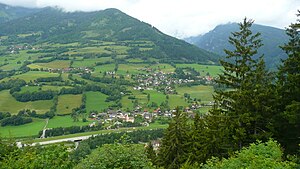
Malta is a municipality and a village in the district of Spittal an der Drau, in the Austrian state of Carinthia.
Gmünd, Carinthia
Municipality in Carinthia, Austria
Distance: Approx. 871 meters
Latitude and longitude: 46.9,13.53333333
Gmünd in Kärnten is a municipality and historic town in the district of Spittal an der Drau, in the Austrian state of Carinthia.

Maltatal
Distance: Approx. 597 meters
Latitude and longitude: 46.9025,13.5328
The Maltatal (Slovene: Dolina reke Malte) is a valley in the High Tauern mountain range of the Central Eastern Alps. It follows the course of the Malta river down towards its confluence with the Lieser, itself a left tributary of the Drava. Most of the area belongs to the municipality of Malta in Carinthia, Austria.

Fallbach Waterfall
Waterfall
Distance: Approx. 8259 meters
Latitude and longitude: 46.97266667,13.47791667
Fallbach Waterfall is a waterfall in the Maltatal valley of Austria in the Austrian Alps near Malta. It is particularly dramatic during snow-melt season. The waterfall is part of the Hohe Tauern National Park.

Krems, Carinthia
Municipality in Carinthia, Austria
Distance: Approx. 3002 meters
Latitude and longitude: 46.91666667,13.56666667
Krems in Kärnten is a municipality in the district of Spittal an der Drau in Carinthia in Austria.
Trebesing
Municipality in Carinthia, Austria
Distance: Approx. 2854 meters
Latitude and longitude: 46.88333333,13.51666667
Trebesing is a town in the district of Spittal an der Drau in the Austrian state of Carinthia.

Kremsbrücke Pressingberg
Bridge in Carinthia, Austria
Distance: Approx. 9174 meters
Latitude and longitude: 46.962,13.62
The Kremsbrücke Pressingberg bridge is the longest bridge in Austria at 2,607 metres (8,553 ft). The bridge is situated in Kremsbrücke, Carinthia, Austria. It is actually two cantilever truss bridges end to end (the Kremsbrücke and Pressingberg bridges).
Burgruine Gmünd
Distance: Approx. 512 meters
Latitude and longitude: 46.9086,13.5361
Burgruine Gmünd is a castle in Carinthia, Austria. Burgruine Gmünd is situated at an elevation of 768 m.
Burgruine Leobenegg
Distance: Approx. 6536 meters
Latitude and longitude: 46.9367,13.6041
Burgruine Leobenegg is a castle in Carinthia, Austria.

Burg Sommeregg
Medieval castle in Carinthia, Austria
Distance: Approx. 8165 meters
Latitude and longitude: 46.83416667,13.52361111
Sommeregg is a medieval castle near Seeboden in the Austrian state of Carinthia, Austria. It is situated in the foothills of the Nock Mountains at an altitude of 749 m. During the feudal period, Sommeregg was the seat of the Lord and Burgrave of Sommeregg until 1652.
Weather in this IP's area
clear sky
6 Celsius
6 Celsius
6 Celsius
6 Celsius
1034 hPa
51 %
1034 hPa
941 hPa
10000 meters
1 m/s
1.58 m/s
78 degree
2 %


