77.118.38.55 - IP Lookup: Free IP Address Lookup, Postal Code Lookup, IP Location Lookup, IP ASN, Public IP
Country:
Region:
City:
Location:
Time Zone:
Postal Code:
IP information under different IP Channel
ip-api
Country
Region
City
ASN
Time Zone
ISP
Blacklist
Proxy
Latitude
Longitude
Postal
Route
Luminati
Country
Region
9
City
vienna
ASN
Time Zone
Europe/Vienna
ISP
Hutchison Drei Austria GmbH
Latitude
Longitude
Postal
IPinfo
Country
Region
City
ASN
Time Zone
ISP
Blacklist
Proxy
Latitude
Longitude
Postal
Route
IP2Location
77.118.38.55Country
Region
niederosterreich
City
strasshof an der nordbahn
Time Zone
Europe/Vienna
ISP
Language
User-Agent
Latitude
Longitude
Postal
db-ip
Country
Region
City
ASN
Time Zone
ISP
Blacklist
Proxy
Latitude
Longitude
Postal
Route
ipdata
Country
Region
City
ASN
Time Zone
ISP
Blacklist
Proxy
Latitude
Longitude
Postal
Route
Popular places and events near this IP address

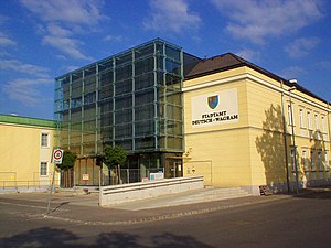
Deutsch-Wagram
Municipality in Lower Austria, Austria
Distance: Approx. 7636 meters
Latitude and longitude: 48.3,16.56666667
Deutsch-Wagram (literally "German Wagram", German pronunciation: [ˈvaːɡʁam] ), often shortened to Wagram, is a village in the Gänserndorf District, in the state of Lower Austria, Austria. It is in the Marchfeld Basin, close to the Vienna city limits, about 15 km (9 mi) northeast of the city centre.
Gänserndorf District
District in Lower Austria, Austria
Distance: Approx. 4662 meters
Latitude and longitude: 48.341,16.718
Bezirk Gänserndorf (German pronunciation: [ˈɡɛnzɐnˌdɔʁf] ) is a district of the state of Lower Austria in Austria. The Marchfeld lies in it.
Gänserndorf
Municipality in Lower Austria, Austria
Distance: Approx. 4603 meters
Latitude and longitude: 48.34055556,16.7175
Gänserndorf (German pronunciation: [ˈɡɛnzɐnˌdɔʁf] ) is a town on the Marchfeld in the state of Lower Austria, Austria and is the capital of Gänserndorf district. It lies about 20 km northeast of Vienna, to which it is connected by both the Angerner Straße (Bundesstraße, or federal highway, 8) and the North railway line.

Strasshof an der Nordbahn
Municipality in Lower Austria, Austria
Distance: Approx. 1454 meters
Latitude and longitude: 48.31944444,16.6475
Strasshof an der Nordbahn (meaning Strasshof at the Northern railway; Central Bavarian: Strasshof aun da Noadbauh) is a satellite town 25 km east of Vienna, Austria. A historical locomotive built by LOFAG is displayed in the town.
Auersthal
Town in Austria
Distance: Approx. 6786 meters
Latitude and longitude: 48.37416667,16.63611111
Auersthal is a town in the district of Gänserndorf in Lower Austria in Austria.
Markgrafneusiedl
Municipality in Lower Austria, Austria
Distance: Approx. 6690 meters
Latitude and longitude: 48.26666667,16.61666667
Markgrafneusiedl is a town in the district of Gänserndorf in the Austrian state of Lower Austria. During the battle of Wagram the town formed the left flank of the Austrian position, and it fell to the French after heavy fighting between IV Austrian Corps and the French III Corps.
Obersiebenbrunn
Municipality in Lower Austria, Austria
Distance: Approx. 5704 meters
Latitude and longitude: 48.26666667,16.68333333
Obersiebenbrunn is a town in the district of Gänserndorf in the Austrian state of Lower Austria.
Parbasdorf
Municipality in Lower Austria, Austria
Distance: Approx. 7205 meters
Latitude and longitude: 48.28333333,16.58333333
Parbasdorf is a town in the district of Gänserndorf in the Austrian state of Lower Austria.

Schönkirchen-Reyersdorf
Municipality in Lower Austria, Austria
Distance: Approx. 4451 meters
Latitude and longitude: 48.35,16.7
Schönkirchen-Reyersdorf is a town in the district of Gänserndorf in the Austrian state of Lower Austria.
Weikendorf
Municipality in Lower Austria, Austria
Distance: Approx. 8275 meters
Latitude and longitude: 48.35,16.76666667
Weikendorf is a town in the district of Gänserndorf in the State of Lower Austria, in northeast Austria.
Bockfließ
Municipality in Lower Austria, Austria
Distance: Approx. 6173 meters
Latitude and longitude: 48.35,16.6
Bockfließ is a town in the district of Mistelbach in the Austrian state of Lower Austria.
Großengersdorf
Municipality in Lower Austria, Austria
Distance: Approx. 8279 meters
Latitude and longitude: 48.35,16.56666667
Großengersdorf is a town in the district of Mistelbach in the Austrian state of Lower Austria.
Weather in this IP's area
few clouds
3 Celsius
1 Celsius
3 Celsius
6 Celsius
1038 hPa
71 %
1038 hPa
1018 hPa
10000 meters
2.88 m/s
3.93 m/s
339 degree
13 %


