77.118.33.169 - IP Lookup: Free IP Address Lookup, Postal Code Lookup, IP Location Lookup, IP ASN, Public IP
Country:
Region:
City:
Location:
Time Zone:
Postal Code:
IP information under different IP Channel
ip-api
Country
Region
City
ASN
Time Zone
ISP
Blacklist
Proxy
Latitude
Longitude
Postal
Route
Luminati
Country
Region
9
City
vienna
ASN
Time Zone
Europe/Vienna
ISP
Hutchison Drei Austria GmbH
Latitude
Longitude
Postal
IPinfo
Country
Region
City
ASN
Time Zone
ISP
Blacklist
Proxy
Latitude
Longitude
Postal
Route
IP2Location
77.118.33.169Country
Region
niederosterreich
City
gross-schweinbarth
Time Zone
Europe/Vienna
ISP
Language
User-Agent
Latitude
Longitude
Postal
db-ip
Country
Region
City
ASN
Time Zone
ISP
Blacklist
Proxy
Latitude
Longitude
Postal
Route
ipdata
Country
Region
City
ASN
Time Zone
ISP
Blacklist
Proxy
Latitude
Longitude
Postal
Route
Popular places and events near this IP address
Auersthal
Town in Austria
Distance: Approx. 4523 meters
Latitude and longitude: 48.37416667,16.63611111
Auersthal is a town in the district of Gänserndorf in Lower Austria in Austria.
Bad Pirawarth
Municipality in Lower Austria, Austria
Distance: Approx. 4582 meters
Latitude and longitude: 48.45,16.6
Bad Pirawarth is a town in the district of Gänserndorf in Lower Austria in Austria.
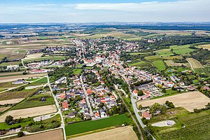
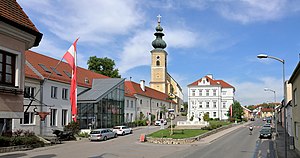
Groß-Schweinbarth
Municipality in Lower Austria, Austria
Distance: Approx. 243 meters
Latitude and longitude: 48.41666667,16.63333333
Groß-Schweinbarth is a town in the district of Gänserndorf in the Austrian state of Lower Austria.
Hohenruppersdorf
Municipality in Lower Austria, Austria
Distance: Approx. 4151 meters
Latitude and longitude: 48.45,16.65
Hohenruppersdorf is a town in the district of Gänserndorf in the Austrian state of Lower Austria.

Matzen-Raggendorf
Municipality in Lower Austria, Austria
Distance: Approx. 5292 meters
Latitude and longitude: 48.4,16.7
Matzen-Raggendorf is a municipality in the district of Gänserndorf in the Austrian state of Lower Austria.

Prottes
Municipality in Lower Austria, Austria
Distance: Approx. 8270 meters
Latitude and longitude: 48.38333333,16.73333333
Prottes is a town in the district of Gänserndorf in the Austrian state of Lower Austria.
Spannberg
Municipality in Lower Austria, Austria
Distance: Approx. 7392 meters
Latitude and longitude: 48.45,16.71666667
Spannberg is a town in the district of Gänserndorf in the Austrian state of Lower Austria.
Sulz im Weinviertel
Municipality in Lower Austria, Austria
Distance: Approx. 8060 meters
Latitude and longitude: 48.48333333,16.66666667
Sulz im Weinviertel is a town in the district of Gänserndorf in the Austrian state of Lower Austria. It is known for its open air museum in Niedersulz, the largest in Lower Austria.
Bockfließ
Municipality in Lower Austria, Austria
Distance: Approx. 7579 meters
Latitude and longitude: 48.35,16.6
Bockfließ is a town in the district of Mistelbach in the Austrian state of Lower Austria.
Gaweinstal
Municipality in Lower Austria, Austria
Distance: Approx. 8440 meters
Latitude and longitude: 48.48333333,16.58333333
Gaweinstal is a town in the district of Mistelbach in the Austrian state of Lower Austria.
Anabaptist Museum (Austria)
Distance: Approx. 8366 meters
Latitude and longitude: 48.4839,16.6761
The Anabaptist Museum is a part of the open-air museum Museumsdorf Niedersulz. The museum is located in the village of Sulz im Weinviertel, about 45 km north of Vienna in the province of Lower Austria. The museum houses an exhibition about the history of Anabaptist groups in Austria with a focus on the Hutterites.
Museumsdorf Niedersulz
Distance: Approx. 8449 meters
Latitude and longitude: 48.4844,16.6772
Museumsdorf Niedersulz is an open-air museum in Austria that displays traditional buildings and architecture from the Weinviertel. It is located in the village of Sulz im Weinviertel, about 45 km north of Vienna in the province of Lower Austria. The Museumsdorf Niedersulz has over 80 original buildings and structures that have been transported from their original sites.
Weather in this IP's area
few clouds
4 Celsius
1 Celsius
2 Celsius
6 Celsius
1038 hPa
72 %
1038 hPa
1017 hPa
10000 meters
2.68 m/s
4.92 m/s
338 degree
17 %


