Country:
Region:
City:
Latitude and Longitude:
Time Zone:
Postal Code:
IP information under different IP Channel
ip-api
Country
Region
City
ASN
Time Zone
ISP
Blacklist
Proxy
Latitude
Longitude
Postal
Route
IPinfo
Country
Region
City
ASN
Time Zone
ISP
Blacklist
Proxy
Latitude
Longitude
Postal
Route
MaxMind
Country
Region
City
ASN
Time Zone
ISP
Blacklist
Proxy
Latitude
Longitude
Postal
Route
Luminati
Country
ASN
Time Zone
Europe/Moscow
ISP
JSC Comcor
Latitude
Longitude
Postal
db-ip
Country
Region
City
ASN
Time Zone
ISP
Blacklist
Proxy
Latitude
Longitude
Postal
Route
ipdata
Country
Region
City
ASN
Time Zone
ISP
Blacklist
Proxy
Latitude
Longitude
Postal
Route
Popular places and events near this IP address
Tagansky District
Distance: Approx. 423 meters
Latitude and longitude: 55.74138889,37.65416667
Tagansky District (‹See Tfd›Russian: Тага́нский райо́н) is a district of Central Administrative Okrug of the federal city of Moscow, Russia, located between the Moskva and Yauza Rivers near the mouth of the latter. Population: 116,744 (2010 Census); 109,993 (2002 Census).

Yauza (river)
River in Moscow and Mytishchi, Russia
Distance: Approx. 662 meters
Latitude and longitude: 55.74722222,37.64027778
The Yauza (‹See Tfd›Russian: Я́уза) is a river in Moscow and Mytishchi, Russia, a tributary of the Moskva. It originates in the Losiny Ostrov National Park northeast of Moscow, flows through Mytishchi, enters Moscow in the Medvedkovo District and flows through the city in an irregular, meandering, generally north-south direction. The Yauza joins the Moskva River in Tagansky District just west of Tagansky Hill, now marked by the Kotelnicheskaya Embankment tower.

Taganskaya (Koltsevaya line)
Moscow Metro station
Distance: Approx. 279 meters
Latitude and longitude: 55.7418,37.6517
Taganskaya (‹See Tfd›Russian: Тага́нская) is a station on the Koltsevaya line of the Moscow Metro. It opened on 1 January 1950 with the first segment of the fourth stage of the system. The station is named after the Taganka Square which is a major junction of the Sadovoye Koltso.

Taganka Theatre
Distance: Approx. 319 meters
Latitude and longitude: 55.74361111,37.65388889
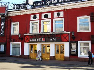
Taganka Theatre (‹See Tfd›Russian: Театр на Таганке, Театр драмы и комедии на Таганке, "Таганка") is a theater located in the Art Nouveau building on Taganka Square in Moscow.

Taganskaya (Tagansko-Krasnopresnenskaya line)
Moscow Metro station
Distance: Approx. 444 meters
Latitude and longitude: 55.7402,37.6522
Taganskaya (‹See Tfd›Russian: Таганская) is a Moscow Metro station in the Tagansky District, Central Administrative Okrug, Moscow. It is on the Tagansko–Krasnopresnenskaya line, between Kitay-gorod and Proletarskaya stations. Taganskaya opened in 1966 as part of the start of the Zhdanovsky (now Tagansky) radius.

Sadovnicheskaya Street
Distance: Approx. 601 meters
Latitude and longitude: 55.74194444,37.63972222
Sadovnicheskaya street (‹See Tfd›Russian: Садо́вническая у́лица, lit. Gardener's Street) is a street in the historical Zamoskvorechye District of Moscow, Russia, on a narrow island between Moskva River and the parallel old river bed (Vodootvodny Canal). The street runs from Balchug Street (across the Kremlin) south-east to the Garden Ring.
Tagansky Protected Command Point
Cold War Museum, restaurant in Moscow, Kotelnichesky Lane
Distance: Approx. 221 meters
Latitude and longitude: 55.741735,37.649277
The Cold War Museum (Moscow) or Bunker GO-42, also known as "facility-02" (1947), CHZ-293 (1951), CHZ-572 (1953), and GO-42 (from 1980), and now Exhibition Complex Bunker-42, is a once-secret military complex, bunker, communication center in Moscow, Russia, near the underground Moscow Metro station Taganskaya. It has an area of 7,000 square metres (75,000 sq ft) and is situated at a depth of 65 metres (213 ft) below ground.

Marksistskaya (Moscow Metro)
Moscow Metro station
Distance: Approx. 450 meters
Latitude and longitude: 55.7411,37.6543
Marksistskaya (‹See Tfd›Russian: Марксистская, lit. 'Marxism') is a station of the Moscow Metro's Kalininsko-Solntsevskaya Line. It was opened along with the initial segment on 30 December 1979. The station is named after the Marksistskaya (Marxist) Street and its architectural theme is the purity of Marxist ideals.

Kotelnicheskaya Embankment Building
Stalinist skyscraper in Russia
Distance: Approx. 544 meters
Latitude and longitude: 55.74722222,37.64277778
Kotelnicheskaya Embankment Building is one of seven Stalinist skyscrapers laid down in September 1947 and completed in 1952, designed by Dmitry Chechulin (then Chief Architect of Moscow) and Andrei Rostkovsky. The main tower has 32 levels (including mechanical floors) and is 176 metres (577 ft) tall. At the time of construction it was the tallest building in Europe.

Church of Saint Nicetas, Moscow
One of the oldest parish churches in Moscow
Distance: Approx. 348 meters
Latitude and longitude: 55.74575,37.644611
Church of St. Nicetas (Храм Никиты Мученика на Швивой горке) is one of the oldest parish churches in Moscow, dating to as early as 1476. Standing on Shvivova Gorka, the eastern slope of Taganka Hill, this small single-dome church once commanded a famous view of Zamoskvorechye (now blocked by the Kotelnicheskaya Embankment Building).

D. F. Belyaev Townhouse
Historic building located in the center of Moscow, Russia
Distance: Approx. 270 meters
Latitude and longitude: 55.7459,37.647
The D. F. Belyaev Townhouse (‹See Tfd›Russian: Городская усадьба Д. Ф. Беляева) is a building located in the center of Moscow (Ryumin lane, house 2). It was rebuilt from an older building in 1903 according to the project of architect A. A. Galetskiy, by request of the haberdasher, hereditary honorary citizen of Moscow, Dmitry Fyodorovich Belyaev. The building has the status of an identified cultural heritage site.
Rachka
River in Russia
Distance: Approx. 639 meters
Latitude and longitude: 55.74888889,37.64444444
The Rachka (‹See Tfd›Russian: Рачка) is a small river located in the Basmanny and Tagansky Districts, in the Central Administrative Okrug, in the center of Moscow and a former left tributary of the Moskva. Today it flows into the Yauza.
Weather in this IP's area
overcast clouds
13 Celsius
11 Celsius
11 Celsius
13 Celsius
1016 hPa
57 %
1016 hPa
999 hPa
10000 meters
2.83 m/s
3.31 m/s
356 degree
98 %
06:40:21
17:54:55
