76.8.87.204 - IP Lookup: Free IP Address Lookup, Postal Code Lookup, IP Location Lookup, IP ASN, Public IP
Country:
Region:
City:
Location:
Time Zone:
Postal Code:
ISP:
ASN:
language:
User-Agent:
Proxy IP:
Blacklist:
IP information under different IP Channel
ip-api
Country
Region
City
ASN
Time Zone
ISP
Blacklist
Proxy
Latitude
Longitude
Postal
Route
db-ip
Country
Region
City
ASN
Time Zone
ISP
Blacklist
Proxy
Latitude
Longitude
Postal
Route
IPinfo
Country
Region
City
ASN
Time Zone
ISP
Blacklist
Proxy
Latitude
Longitude
Postal
Route
IP2Location
76.8.87.204Country
Region
connecticut
City
greenwich
Time Zone
America/New_York
ISP
Language
User-Agent
Latitude
Longitude
Postal
ipdata
Country
Region
City
ASN
Time Zone
ISP
Blacklist
Proxy
Latitude
Longitude
Postal
Route
Popular places and events near this IP address

Leukemia & Lymphoma Society
North American blood cancer charitable organization
Distance: Approx. 2889 meters
Latitude and longitude: 41.05017,-73.6879
The Leukemia & Lymphoma Society (LLS), a 501(c)(3) charitable organization founded in 1949, is a voluntary health organization dedicated to fighting blood cancer world-wide. LLS funds blood cancer research on cures for leukemia, lymphoma, Hodgkin's disease, and myeloma. It provides free information and support services, and it advocates for blood cancer patients and their families seeking access to quality and affordable care.

Glenville, Connecticut
Census-designated place in Connecticut, United States
Distance: Approx. 2939 meters
Latitude and longitude: 41.03527778,-73.65972222
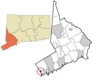
Glenville is a neighborhood and census-designated place in the town of Greenwich in Fairfield County, Connecticut, United States. As of the 2010 census, it had a population of 2,327. It is located in the western part of Greenwich at the falls of the Byram River, which provided waterpower when this was a mill village.

Putnam Cemetery
Cemetery in Fairfield County, Connecticut
Distance: Approx. 3008 meters
Latitude and longitude: 41.0572541,-73.6216265
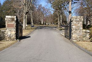
Putnam Cemetery is a non-sectarian cemetery located at 35 Parsonage Road in Greenwich, Connecticut. It is affiliated with adjacent Saint Mary's Cemetery at 399 North Street, which is a Catholic cemetery; the two cemeteries share the same office. The cemetery is located in a quiet residential neighborhood and is the final resting place of several notable people.

Glenville Historic District
Historic district in Connecticut, United States
Distance: Approx. 2691 meters
Latitude and longitude: 41.03819,-73.66498
Glenville Historic District, also known as Sherwood's Bridge, is a 33.9 acres (13.7 ha) historic district in the Glenville neighborhood of the town of Greenwich, Connecticut. It is the "most comprehensive example of a New England mill village within the Town of Greenwich". It "is also historically significant as one of the town's major staging areas of immigrants, predominantly Irish in the 19th century and Polish in the 20th century" and remains "the primary settlement of Poles in the town".

Glenville School (Greenwich, Connecticut)
United States historic place
Distance: Approx. 2845 meters
Latitude and longitude: 41.03666667,-73.66444444
The Glenville School is a historic school building at 449 Pemberwick Road in the Glenville section of Greenwich, Connecticut, United States. It was listed on the National Register of Historic Places in 2003. It was one of several schools built in the town in the 1920s, when it consolidated its former rural school districts into a modern school system, with modern buildings.

New Mill and Depot Building, Hawthorne Woolen Mill
United States historic place
Distance: Approx. 2903 meters
Latitude and longitude: 41.03638889,-73.66583333
The New Mill and Depot Building of the former Hawthorne Woolen Mill are located in Greenwich, Connecticut, United States. The two structures were built on an existing textile mill complex in the 1870s. The mill and its depot, in the Gothic Revival and Queen Anne architectural styles respectively, were unusually decorative for functional buildings of that era.

French Farm
United States historic place
Distance: Approx. 1787 meters
Latitude and longitude: 41.05194444,-73.64
The French Farm is a historic summer estate at the junction of Lake and Round Hill Roads in Greenwich, Connecticut. Developed in the early 1900s, it is a rare surviving estate from the period in which its size and major landscaping elements are preserved. Its major structures (main house and farm outbuildings) were designed by Henry Van Buren Magonigle, a protege of Calvert Vaux.
Rosemary Hall (Greenwich, Connecticut)
United States historic place
Distance: Approx. 3180 meters
Latitude and longitude: 41.0375,-73.63666667
Rosemary Hall was an independent girls school at Ridgeway and Zaccheus Mead Lane in Greenwich, Connecticut. It was later merged into Choate Rosemary Hall and moved to the Choate boys' school campus in Wallingford, Connecticut. The Greenwich campus of Rosemary Hall was opened in 1900.

The Nathaniel Witherell
United States historic place
Distance: Approx. 2525 meters
Latitude and longitude: 41.06150833,-73.62692222
The Nathaniel Witherell is a rehabilitation and skilled nursing facility at 70 Parsonage Road in Greenwich, Connecticut. It is owned and operated by the town on a non-profit basis, providing a range of primarily short-term care services on a 24-acre (9.7 ha) campus north of the central business district. It was established in 1903, and its campus has been listed on the National Register of Historic Places.
St. Paul Church (Connecticut)
Church in Connecticut, United States
Distance: Approx. 2873 meters
Latitude and longitude: 41.05365833,-73.68956389
St. Paul is a Roman Catholic church in the Glenville section of Greenwich, Connecticut, part of the Diocese of Bridgeport. This is one of the only parishes in Connecticut that also serve parishioners who live in New York.
Carmel Academy
Jewish private school in Connecticut, US
Distance: Approx. 3156 meters
Latitude and longitude: 41.0385,-73.6352
Carmel Academy (formerly the Westchester Fairfield Hebrew Academy, WFHA) was a Jewish private school in Greenwich, Connecticut, serving grades Kindergarten through 8. Also including transitional Kindergarten The school originally was located in Port Chester, New York. In 2020, Carmel Academy announced its plans to close at the end of the school year.
Rock Ridge, Connecticut
Census-designated place in Connecticut, United States
Distance: Approx. 2971 meters
Latitude and longitude: 41.03583333,-73.64777778
Rock Ridge is a census-designated place (CDP) in the town of Greenwich, Fairfield County, Connecticut, United States. It is in the western part of the town, just 1 mile (2 km) east of the New York state border. Rock Ridge was first listed as a CDP prior to the 2020 census.
Weather in this IP's area
clear sky
-12 Celsius
-17 Celsius
-13 Celsius
-11 Celsius
1033 hPa
60 %
1033 hPa
1024 hPa
10000 meters
2.57 m/s
270 degree
