Country:
Region:
City:
Latitude and Longitude:
Time Zone:
Postal Code:
IP information under different IP Channel
ip-api
Country
Region
City
ASN
Time Zone
ISP
Blacklist
Proxy
Latitude
Longitude
Postal
Route
IPinfo
Country
Region
City
ASN
Time Zone
ISP
Blacklist
Proxy
Latitude
Longitude
Postal
Route
MaxMind
Country
Region
City
ASN
Time Zone
ISP
Blacklist
Proxy
Latitude
Longitude
Postal
Route
Luminati
Country
Region
id
City
twinfalls
ASN
Time Zone
America/Boise
ISP
ANTHEMBB
Latitude
Longitude
Postal
db-ip
Country
Region
City
ASN
Time Zone
ISP
Blacklist
Proxy
Latitude
Longitude
Postal
Route
ipdata
Country
Region
City
ASN
Time Zone
ISP
Blacklist
Proxy
Latitude
Longitude
Postal
Route
Popular places and events near this IP address

Twin Falls, Idaho
City in Idaho, United States
Distance: Approx. 500 meters
Latitude and longitude: 42.55555556,-114.47083333
Twin Falls is the county seat and largest city of Twin Falls County, Idaho, United States. The city had a population of 51,807 as of the 2020 census. In the Magic Valley region, Twin Falls is the largest city in a 100-mile (160 km) radius, and is the regional commercial center for south-central Idaho and northeastern Nevada.
College of Southern Idaho
Public community college in Twin Falls, Idaho, US
Distance: Approx. 2539 meters
Latitude and longitude: 42.58,-114.475
College of Southern Idaho (CSI) is a public community college in Twin Falls, Idaho. It also has off-campus programs in Jerome, Hailey, Burley and Gooding. Together with the College of Western Idaho and North Idaho College, CSI is one of only three comprehensive community colleges in Idaho.
Twin Falls High School
Public school in Twin Falls, Idaho, United States
Distance: Approx. 1865 meters
Latitude and longitude: 42.572,-114.453
Twin Falls High School is a public secondary school in Twin Falls, Idaho, one of two traditional high schools operated by the Twin Falls School District #411.
Magic Valley High School
School in Twin Falls, Idaho
Distance: Approx. 759 meters
Latitude and longitude: 42.56027778,-114.47472222
Magic Valley High School is an alternative high school in Twin Falls, Idaho. It is part of the Twin Falls School District.
Lighthouse Christian School
Christian school in Twin Falls, Idaho, United States
Distance: Approx. 2208 meters
Latitude and longitude: 42.56055556,-114.43916667
Lighthouse Christian School is a private Christian school located in Twin Falls, Idaho. Lighthouse Christian Middle/High School is fully accredited through the Association of Christian Schools International (ACSI), Northwest Association of Accredited Schools (NAAS), and the state of Idaho. Lighthouse Christian School describes itself as "a discipleship school" with a "Biblically-integrated instructional program".
Twin Falls Christian Academy
Christian (baptist) school in Twin Falls, Idaho, United States
Distance: Approx. 2867 meters
Latitude and longitude: 42.57527778,-114.43972222
Twin Falls Christian Academy is a private Christian school in Twin Falls, Idaho. This school opened in 1975. It is a ministry of Grace Baptist Church.
KEZJ (AM)
Radio station in Twin Falls, Idaho
Distance: Approx. 1698 meters
Latitude and longitude: 42.54333333,-114.47055556
KEZJ (1450 AM) is a radio station licensed to Twin Falls, Idaho, United States, the station serves the Twin Falls area. The station is currently owned by Salt & Light Radio, Inc.

Twin Falls, Idaho metropolitan area
Metropolitan Statistical Area in Idaho, United States
Distance: Approx. 2450 meters
Latitude and longitude: 42.58,-114.47
The Twin Falls metropolitan statistical area (MSA), as defined by the United States Census Bureau, is an area consisting of two counties in the Magic Valley region of Idaho, anchored by the city of Twin Falls. As of the 2010 census, the MSA had a population of 99,604. According to 2016 estimates, the population grew 6.93% to 106,508.
Herrett Center for Arts and Science
Museum at the College of Southern Idaho in Twin Falls, Idaho, USA
Distance: Approx. 2918 meters
Latitude and longitude: 42.5842,-114.4704
The Herrett Center for Arts and Science, located on the main campus of the College of Southern Idaho in Twin Falls, Idaho, United States, is a museum of anthropology, natural history, astronomy, and art. The museum's collections primarily comprise anthropological artifacts and natural history specimens from the Americas, as well as works of local artists. The Center also houses the Faulkner Planetarium, the Centennial Observatory, a museum store, and a 2900 square foot (269 square meter) multi-purpose event space.

Twin Falls Original Townsite Residential Historic District
Historic district in Idaho, United States
Distance: Approx. 394 meters
Latitude and longitude: 42.560006,-114.470029
The Twin Falls Original Townsite Residential Historic District in Twin Falls, Idaho is a 264 acres (1.07 km2) historic district which was listed on the National Register of Historic Places in 2001. The district is roughly triangular, and roughly bounded by Blue Lakes Ave., Addison Ave., 2nd Ave. E, and 2nd Ave.

Burton Morse House
United States historic place
Distance: Approx. 605 meters
Latitude and longitude: 42.5625,-114.46138889
The Burton Morse House, at 136 Tenth Ave. N. in Twin Falls, Idaho, was built in 1908. It was listed on the National Register of Historic Places in 1993.

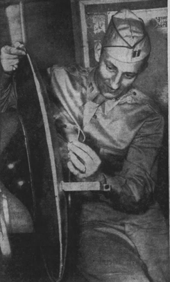
Twin Falls saucer hoax
Flying saucer hoax (1947)
Distance: Approx. 500 meters
Latitude and longitude: 42.55555556,-114.47083333
The Twin Falls saucer hoax was a hoaxed flying disc discovered in Twin Falls, Idaho, United States, on July 11, 1947. Amid a nationwide wave of alleged "flying disc" sightings, residents of Twin Falls reported recovering a 30 in (76 cm) "disc". FBI and Army officials took possession of the disc and quickly proclaimed the object to be a hoax.
Weather in this IP's area
clear sky
21 Celsius
20 Celsius
20 Celsius
22 Celsius
1019 hPa
30 %
1019 hPa
895 hPa
10000 meters
4.12 m/s
270 degree
07:39:56
19:12:00