76.8.191.22 - IP Lookup: Free IP Address Lookup, Postal Code Lookup, IP Location Lookup, IP ASN, Public IP
Country:
 USA
USARegion:
City:
Location:
Time Zone:
Postal Code:
ISP:
ASN:
language:
User-Agent:
Proxy IP:
Blacklist:
IP information under different IP Channel
ip-api
Country
Region
City
ASN
Time Zone
ISP
Blacklist
Proxy
Latitude
Longitude
Postal
Route
db-ip
Country
Region
City
ASN
Time Zone
ISP
Blacklist
Proxy
Latitude
Longitude
Postal
Route
IPinfo
Country
Region
City
ASN
Time Zone
ISP
Blacklist
Proxy
Latitude
Longitude
Postal
Route
IP2Location
76.8.191.22Country
usRegion
kentucky
City
lexington
Time Zone
America/New_York
ISP
Language
User-Agent
Latitude
Longitude
Postal
ipdata
Country
Region
City
ASN
Time Zone
ISP
Blacklist
Proxy
Latitude
Longitude
Postal
Route
Popular places and events near this IP address

Fayette County, Kentucky
County in Kentucky, United States
Distance: Approx. 2350 meters
Latitude and longitude: 38.04,-84.46
Fayette County is a county located in the central part of the U.S. state of Kentucky and is consolidated with the city of Lexington. As of the 2020 census, the population was 322,570, making it the second-most populous county in the commonwealth. Since 1974, its territory, population and government have been shared with Lexington.

Legends Field (Kentucky)
Baseball stadium in Lexington, Kentucky
Distance: Approx. 2298 meters
Latitude and longitude: 38.06545,-84.47852
Legends Field is a ballpark in Lexington, Kentucky. The ballpark was built in 2001 and holds 9,994 people. It is primarily used for baseball, and is the home field of the Lexington Legends of the Atlantic League of Professional Baseball, an official Partner League of Major League Baseball.

Bryan Station High School
American public high school
Distance: Approx. 775 meters
Latitude and longitude: 38.06666667,-84.45694444
Bryan Station High School, founded in 1958, is a high school within the Fayette County Public Schools system in Lexington, Kentucky, United States. During the 2006–2007 school year, students were moved to their newly built school known as Bryan Station High. The school was named for Bryan Station, an 18th-century pioneer settlement.

African Cemetery No. 2 (Lexington, Kentucky)
African American Cemetery
Distance: Approx. 2468 meters
Latitude and longitude: 38.05013889,-84.47805556
African Cemetery No. 2, also known as The Cemetery of the Union Benevolent Society No. 2, is a historic burial site located in Lexington, Kentucky, United States.
Bryan Station, Lexington, Kentucky
Place in Kentucky, United States
Distance: Approx. 374 meters
Latitude and longitude: 38.0622,-84.4567
Bryan Station is a neighborhood in Northeast Lexington, Kentucky, United States. It is named after the nearby pioneer settlement by the same name located just 2 miles (3 km) outside the current edge of the city. The neighborhood's boundaries are New Circle Road to the West, Old Paris Pike to the North, and Preakness Drive and Interstate 75 to the East.
Eastland, Lexington
Place in Kentucky, United States
Distance: Approx. 1631 meters
Latitude and longitude: 38.05,-84.44
Eastland is a neighborhood in northeast Lexington, Kentucky, United States. Its boundaries are I-75 to the east, New Circle Road to the west, Winchester Road to the south, and abandoned railroad tracks to the north.
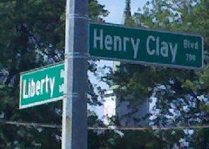
Liberty Heights, Lexington
Place in the United States
Distance: Approx. 2709 meters
Latitude and longitude: 38.037926,-84.464953
Liberty Heights is a neighborhood in southeastern Lexington, Kentucky, United States. Its boundaries are Winchester Road to the north, New Circle Road to the east, and R. J. Corman (former CSX) railroad tracks to the west and south.
Radcliffe, Lexington
Place in Kentucky, United States
Distance: Approx. 2307 meters
Latitude and longitude: 38.078,-84.467
Radcliffe is a neighborhood in northern Lexington, Kentucky, United States. It is alternatively called Marlboro. Its boundaries are Dover Road to the south, Paris Pike to the east, Russell Cave Road to the west, and I-75/ I-64 to the north.
Elkhorn Park, Lexington
Place in Kentucky, United States
Distance: Approx. 2032 meters
Latitude and longitude: 38.072,-84.471
Elkhorn Park is a neighborhood in northern Lexington, Kentucky, United States. Its boundaries are Dover Road to the north, North Broadway to the east, New Circle Road to the south, and Russell Cave Road to the west.

Loudoun House
Historic house in Kentucky, United States
Distance: Approx. 2073 meters
Latitude and longitude: 38.05527778,-84.47583333
The Loudoun House, located in Lexington, Kentucky, is considered one of the largest and finest examples of Gothic Revival architecture in the state. Designed by New York architect Alexander Jackson Davis, the house was built in 1851 for Francis Key Hunt (1817–1879), who was named after his mother's cousin, Francis Scott Key. The home was built on 50 acres of land given to Hunt and his wife, Julia Warfield, by her parents upon their marriage.
Frederick Douglass High School (Lexington, Kentucky)
Public school in Lexington, Kentucky, United States
Distance: Approx. 2778 meters
Latitude and longitude: 38.0396,-84.4356
Frederick Douglass High School is a public high school located on the eastern side of Lexington, Kentucky, United States. The school is one of six high schools in the Fayette County Public Schools district and was constructed to reduce overcrowding at Bryan Station High School and Henry Clay High School. Frederick Douglass High School is named after the 19th century African-American abolitionist Frederick Douglass.

James "Soup" Perkins
American jockey, Kentucky Derby winner (1879–1911)
Distance: Approx. 2468 meters
Latitude and longitude: 38.05013889,-84.47805556
James "Soup" Perkins (1879–1911) was born in Lexington, Kentucky, the son of former slaves. He and his entire family were involved in horse racing, training, and working in the stables. Perkins was the second youngest jockey ever to win the Kentucky Derby and the winningest jockey in America in 1895.
Weather in this IP's area
clear sky
5 Celsius
2 Celsius
4 Celsius
5 Celsius
1031 hPa
50 %
1031 hPa
995 hPa
10000 meters
3.09 m/s
360 degree