76.7.55.20 - IP Lookup: Free IP Address Lookup, Postal Code Lookup, IP Location Lookup, IP ASN, Public IP
Country:
Region:
City:
Location:
Time Zone:
Postal Code:
ISP:
ASN:
language:
User-Agent:
Proxy IP:
Blacklist:
IP information under different IP Channel
ip-api
Country
Region
City
ASN
Time Zone
ISP
Blacklist
Proxy
Latitude
Longitude
Postal
Route
db-ip
Country
Region
City
ASN
Time Zone
ISP
Blacklist
Proxy
Latitude
Longitude
Postal
Route
IPinfo
Country
Region
City
ASN
Time Zone
ISP
Blacklist
Proxy
Latitude
Longitude
Postal
Route
IP2Location
76.7.55.20Country
Region
virginia
City
charlottesville
Time Zone
America/New_York
ISP
Language
User-Agent
Latitude
Longitude
Postal
ipdata
Country
Region
City
ASN
Time Zone
ISP
Blacklist
Proxy
Latitude
Longitude
Postal
Route
Popular places and events near this IP address
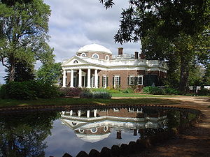
Monticello
Primary residence of U.S. Founding Father Thomas Jefferson
Distance: Approx. 1489 meters
Latitude and longitude: 38.01030556,-78.45233333
Monticello ( MON-tih-CHEL-oh) was the primary plantation of Thomas Jefferson, a Founding Father, author of the Declaration of Independence, and the third president of the United States. Jefferson began designing Monticello after inheriting land from his father at the age of 14. Located just outside Charlottesville, Virginia, in the Piedmont region, the plantation was originally 5,000 acres (20 km2), with Jefferson using the forced labor of black slaves for extensive cultivation of tobacco and mixed crops, later shifting from tobacco cultivation to wheat in response to changing markets.

Michie Tavern
Historic house in Virginia, United States
Distance: Approx. 942 meters
Latitude and longitude: 38.00867222,-78.46515278
Michie Tavern (Pron: /ˈmɪki/), located in Albemarle County, Virginia, is a Virginia Historic Landmark that was established in 1784 by Scotsman William Michie, though in Earlysville. The Tavern served as the social center of its community and provided travelers with food, drink and lodging. It remained in operation, in the Michie family, until 1910, when it came to be owned by the Commonwealth of Virginia.

Highland (James Monroe house)
Former Home of 5th President, Jamed Monroe
Distance: Approx. 2141 meters
Latitude and longitude: 37.98222222,-78.45527778
Highland, formerly Ash Lawn–Highland, located near Charlottesville, Virginia, United States, and adjacent to Thomas Jefferson's Monticello, was the estate of James Monroe, a Founding Father and fifth president of the United States. Purchased in 1793, Monroe and his family permanently settled on the property in 1799 and lived at Highland for twenty-five years. Personal debt forced Monroe to sell the plantation in 1825.

Monticello High School (Virginia)
Public school in Charlottesville, VA, United States
Distance: Approx. 2247 meters
Latitude and longitude: 37.99902778,-78.48916667
Monticello High School (MHS) is a suburban public high school located in Albemarle County, Virginia, United States outside Charlottesville. Opened in 1998, it is one of three traditional comprehensive high schools in the Albemarle County Public Schools System. The school is named after Monticello, the nearby estate of President Thomas Jefferson.
WCHV-FM
Radio station in Charlottesville, Virginia
Distance: Approx. 2269 meters
Latitude and longitude: 37.98472222,-78.48027778
WCHV-FM is a news/talk formatted broadcast radio station licensed to Charlottesville, Virginia, serving Charlottesville and Albemarle County, Virginia. WCHV-FM is owned and operated by Monticello Media.

Simeon, Virginia
Unincorporated community in Virginia, United States
Distance: Approx. 1957 meters
Latitude and longitude: 37.99166667,-78.44416667
Simeon is an unincorporated community in Albemarle County, Virginia. Morven, Highland, and Sunnyfields are listed on the National Register of Historic Places.

Piedmont Virginia Community College
Public college in Charlottesville, Virginia, US
Distance: Approx. 1983 meters
Latitude and longitude: 38.0063054,-78.4848792
Piedmont Virginia Community College (PVCC) is a public community college in Charlottesville, Virginia. It offers associate degrees, certificates, continuing education, and workforce training. The campus is located in Albemarle County, Virginia, south of Charlottesville.
StreamWatch
Distance: Approx. 2431 meters
Latitude and longitude: 38.01418,-78.4422
StreamWatch is an environmental monitoring program focused on the 766-square-mile (1,980 km2) Rivanna River watershed in central Virginia in the United States. The data StreamWatch collects helps communities in the city of Charlottesville and in Albemarle, Fluvanna, and Greene gauge stream conditions and to inform planning and environmental management decisions. StreamWatch was founded in 2002 as a joint project of The Nature Conservancy, the Rivanna Conservation Society, the Thomas Jefferson Soil and Water Conservation District, the Rivanna River Basin Commission and the Thomas Jefferson Planning District Commission.

Sunnyfields (Simeon, Virginia)
Historic house in Virginia, United States
Distance: Approx. 1269 meters
Latitude and longitude: 37.9925,-78.45305556
Sunnyfields is a historic home located between Monticello and Ash Lawn-Highland near Simeon, Albemarle County, Virginia. It was built in 1833, and is a two-story, nearly square brick structure painted white. It has a two-story corner tower, dating to either from just before or just after the American Civil War, and two-story, frame wing.
Young Building
Historic commercial building in Virginia, United States
Distance: Approx. 2311 meters
Latitude and longitude: 38.02083333,-78.4675
Young Building is a historic office building located at Charlottesville, Virginia. It was built in 1916, and is a two-story, five-bay, single pile brick building in the Jacobean Revival style. It has a large rear wing.
Charlottesville Woolen Mills
Distance: Approx. 2333 meters
Latitude and longitude: 38.0204287,-78.45619256
The Charlottesville Woolen Mills is an historic industrial site in Charlottesville, Virginia on which there was a working mill from the 1790s the 1960s. The mills were built, in part, on property once owned by Thomas Jefferson. Company leadership was unusual in offering assistance to employees of all ages to purchase properties for homes near the mill, leading to a neighborhood containing homes at various income levels.

Blue Ridge Sanatorium
Charlottesville-area sanatorium
Distance: Approx. 1234 meters
Latitude and longitude: 38.00888889,-78.4725
Blue Ridge Sanatorium was a sanatorium for the treatment of tuberculosis located outside of Charlottesville, Virginia, United States. The site was originally known as Moore's Brook and was operated as a private mental institution. One of its central buildings, Lyman Mansion, dates to 1875.
Weather in this IP's area
clear sky
2 Celsius
-0 Celsius
2 Celsius
3 Celsius
1022 hPa
33 %
1022 hPa
1001 hPa
10000 meters
2.24 m/s
2.68 m/s
145 degree

