Country:
Region:
City:
Latitude and Longitude:
Time Zone:
Postal Code:
IP information under different IP Channel
ip-api
Country
Region
City
ASN
Time Zone
ISP
Blacklist
Proxy
Latitude
Longitude
Postal
Route
IPinfo
Country
Region
City
ASN
Time Zone
ISP
Blacklist
Proxy
Latitude
Longitude
Postal
Route
MaxMind
Country
Region
City
ASN
Time Zone
ISP
Blacklist
Proxy
Latitude
Longitude
Postal
Route
Luminati
Country
ASN
Time Zone
America/Chicago
ISP
INTERNAP-BLK3
Latitude
Longitude
Postal
db-ip
Country
Region
City
ASN
Time Zone
ISP
Blacklist
Proxy
Latitude
Longitude
Postal
Route
ipdata
Country
Region
City
ASN
Time Zone
ISP
Blacklist
Proxy
Latitude
Longitude
Postal
Route
Popular places and events near this IP address

Warrington Township, Bucks County, Pennsylvania
Township in Pennsylvania, United States
Distance: Approx. 2195 meters
Latitude and longitude: 40.23972222,-75.14166667
Warrington Township is a township in Bucks County, Pennsylvania, United States. Warrington Township is a northern suburb of Philadelphia. The population was 25,639 at the 2020 census.

Horsham Township, Pennsylvania
Home rule municipality in Pennsylvania, United States
Distance: Approx. 3122 meters
Latitude and longitude: 40.19916667,-75.16638889
Horsham Township is a home rule municipality in Montgomery County, Pennsylvania. It is located ten miles north of Center City Philadelphia. The township, incorporated in 1717, is one of the oldest original municipalities in Montgomery County.

Naval Air Station Joint Reserve Base Willow Grove
Naval airbase
Distance: Approx. 2314 meters
Latitude and longitude: 40.1998,-75.1482
Naval Air Station Joint Reserve Base Willow Grove or NASJRB Willow Grove (IATA: NXX, ICAO: KNXX, FAA LID: NXX) was a Naval Air Station owned by the U.S. Navy and located in Horsham Township, Montgomery County, Pennsylvania, United States four miles (6 km) northwest of the central business district of Willow Grove, which is north of Philadelphia. The installation was transferred to the Pennsylvania Air National Guard and the name changed to the Horsham Air Guard Station after the U.S. Navy departed in 2011.
WRDV
Radio station in Warminster, Pennsylvania
Distance: Approx. 3368 meters
Latitude and longitude: 40.2054,-75.1071
WRDV is a U.S. public radio station serving some northern suburbs of the Philadelphia, Pennsylvania area. The radio station studio is located in Hatboro and the broadcast tower in Warminster. WRDV's program hosts are volunteers who frequently play their own album collections on the air.

Hatboro-Horsham Senior High School
Public school in Horsham, Pennsylvania, United States
Distance: Approx. 3181 meters
Latitude and longitude: 40.197,-75.164
Hatboro-Horsham Senior High School is a comprehensive public high school, serving grades 9 -12, located in Horsham, Pennsylvania, about 17 miles outside of Philadelphia. Hatboro-Horsham Senior High School, a successor of the Loller Academy, originally opened in 1950 on Old York Road in Hatboro following the jointure of the Hatboro-Horsham School District. In 1964, the High School relocated to Meetinghouse Road, originally built as Keith Valley Junior High in 1957.

Log College
First seminary serving Presbyterians in North America
Distance: Approx. 3654 meters
Latitude and longitude: 40.214869,-75.099343
The Log College, founded in 1727, was the first theological seminary serving Presbyterians in North America, and was located in what is now Warminster, Pennsylvania. It was founded by William Tennent and operated from 1727 until Tennent's death in 1746, and it graduated proponents on the New Side of the significant Old Side–New Side Controversy that divided presbyterianism in colonial America at the time. The Log College was, as a physical structure, very plain, according to George Whitefield's journal; it was a private institution that had no charter.

Graeme Park
Historic house in Pennsylvania, United States
Distance: Approx. 790 meters
Latitude and longitude: 40.21666667,-75.15
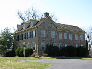
Graeme Park is an historic site and National Historic Landmark at 859 County Line Road in Horsham, Pennsylvania, United States. It is owned by the Pennsylvania Historical and Museum Commission and operated by the non-profit group, The Friends of Graeme Park. It is the only surviving residence of a colonial-era Pennsylvania governor.
Wings of Freedom Aviation Museum
Aviation museum in Pennsylvania, United States
Distance: Approx. 2015 meters
Latitude and longitude: 40.201961,-75.139875
The Wings of Freedom Aviation Museum in Horsham, Pennsylvania is a museum dedicated to preserving the aviation history of the Greater Delaware Valley including NAS Willow Grove and Harold F. Pitcairn. It is owned and operated by the Delaware Valley Historical Aircraft Association (DVHAA), a non-profit organization. Opened in 2004, the museum features restored historic aircraft, flight helmets, flight gear, air to air missiles, Martin-Baker ejection seats, and military service medals.

Benjamin Obdyke
Distance: Approx. 3135 meters
Latitude and longitude: 40.20135,-75.16943
Benjamin Obdyke Incorporated is a building materials manufacturer based in the Philadelphia suburb of Horsham, Pennsylvania. The company was started by its namesake, Benjamin P. Obdyke in 1868. Benjamin P. Obdyke is credited with creating and manufacturing the first corrugated downspout while the company itself claims patents on three products that have been integral in the advancement of building practices over the past 20 years: Roll Vent the first rolled ridge vent, Cedar Breather the first wood roofing underlayment, and Home Slicker the first rolled product to provide drainage and air flow in rainscreen wall assemblies.
Kenderdine Mill Complex
United States historic place
Distance: Approx. 2761 meters
Latitude and longitude: 40.20888889,-75.17083333
The Kenderdine Mill Complex is an historic, American grist mill complex that is located in Horsham Township, Montgomery County, Pennsylvania. It was added to the National Register of Historic Places in 1992.
Neshaminy, Pennsylvania
Unincorporated community in Pennsylvania, United States
Distance: Approx. 1080 meters
Latitude and longitude: 40.22944444,-75.13888889
Neshaminy is an unincorporated community in Warrington Township in Bucks County, Pennsylvania, United States. Neshaminy is located at the intersection of Pennsylvania Route 611 and Pennsylvania Route 132.

Park Creek (Little Neshaminy Creek tributary)
River in Pennsylvania, United States
Distance: Approx. 447 meters
Latitude and longitude: 40.22333333,-75.14472222
Park Creek is a tributary of the Little Neshaminy Creek, part of the Delaware River Watershed meeting its confluence at the Little Neshaminy's 9.00 river mile.
Weather in this IP's area
broken clouds
22 Celsius
22 Celsius
21 Celsius
23 Celsius
1010 hPa
58 %
1010 hPa
1002 hPa
10000 meters
4.63 m/s
330 degree
75 %
07:03:14
18:32:58
