Country:
 USA
USARegion:
City:
Latitude and Longitude:
Time Zone:
Postal Code:
IP information under different IP Channel
ip-api
Country
Region
City
ASN
Time Zone
ISP
Blacklist
Proxy
Latitude
Longitude
Postal
Route
IPinfo
Country
Region
City
ASN
Time Zone
ISP
Blacklist
Proxy
Latitude
Longitude
Postal
Route
MaxMind
Country
Region
City
ASN
Time Zone
ISP
Blacklist
Proxy
Latitude
Longitude
Postal
Route
Luminati
Country
USRegion
pa
City
wrightsville
ASN
Time Zone
America/New_York
ISP
COMCAST-7922
Latitude
Longitude
Postal
db-ip
Country
Region
City
ASN
Time Zone
ISP
Blacklist
Proxy
Latitude
Longitude
Postal
Route
ipdata
Country
Region
City
ASN
Time Zone
ISP
Blacklist
Proxy
Latitude
Longitude
Postal
Route
Popular places and events near this IP address

East Prospect, Pennsylvania
Borough in Pennsylvania, United States
Distance: Approx. 3011 meters
Latitude and longitude: 39.97138889,-76.52055556
East Prospect is a borough in York County, Pennsylvania, United States. The population was 932 at the 2020 census. It is part of the York–Hanover metropolitan area.

Wrightsville, Pennsylvania
Borough in Pennsylvania, United States
Distance: Approx. 2993 meters
Latitude and longitude: 40.02444444,-76.53111111
Wrightsville is a borough in York County, Pennsylvania, United States. The population was 2,257 at the time of the 2020 census. It is part of the York–Hanover metropolitan area.

Columbia–Wrightsville Bridge
Road and sidewalk overpass in Pennsylvania
Distance: Approx. 3426 meters
Latitude and longitude: 40.02888889,-76.51694444
The Columbia–Wrightsville Bridge, officially the Veterans Memorial Bridge, spans the Susquehanna River between Columbia and Wrightsville, Pennsylvania, and carries Pennsylvania Route 462 and BicyclePA Route S. Built originally as the Lancaster-York Intercounty Bridge, construction began in 1929, and the bridge opened September 30, 1930. On November 11, 1980, it was officially dedicated as Veterans Memorial Bridge, though it is still referenced locally as the Columbia–Wrightsville Bridge. In nominating the present Columbia–Wrightsville Bridge as an engineering landmark, the Pennsylvania section of the American Society of Civil Engineers noted that it is "a splendid example of the graceful multiple-span, reinforced-concrete arched form popular in early 20th Century highway bridges in the United States." The bridge is designated State Route 462 and is listed on the National Register of Historic Places, and is also a National Historic Civil Engineering Landmark.
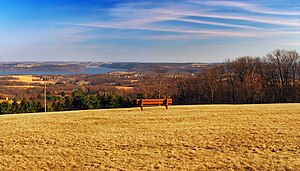
Samuel S. Lewis State Park
State park in York County, Pennsylvania
Distance: Approx. 2294 meters
Latitude and longitude: 39.99638889,-76.54916667
Samuel S. Lewis State Park is an 85-acre (34 ha) Pennsylvania state park in Lower Windsor Township, York County, Pennsylvania, in the United States. Mt. Pisgah is an 885-foot-high (270 m) ridge that is the focus of recreation for the park.
Kreutz Creek
Distance: Approx. 2359 meters
Latitude and longitude: 40.01944444,-76.51916667
Kreutz Creek is a 17.8-mile-long (28.6 km) tributary of the Susquehanna River in York County, Pennsylvania in the United States. Kreutz Creek joins the Susquehanna River at the borough of Wrightsville.

Dritt Mansion
Historic house in Pennsylvania, United States
Distance: Approx. 3198 meters
Latitude and longitude: 39.9775,-76.49666667
Dritt Mansion, named after its longest occupants, and also called Pleasant Garden, and current home to the Zimmerman Center for Heritage, is a historic home located at Lower Windsor Township, York County, Pennsylvania. It was built about 1758, and is a 2+1⁄2-story, fieldstone dwelling. It measures 50 feet (15.2 m) long and 40 (12.2 m) feet wide, with a cedar-shingled gable roof.
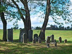
Byrd Leibhart Site
United States historic place
Distance: Approx. 3047 meters
Latitude and longitude: 39.97816667,-76.49833333
The Byrd Leibhart Site, designated 36 YO 170 is a historic archaeological site located in Native Lands County Park at Lower Windsor Township, York County, Pennsylvania. It was the site of a late 17th-century fortified settlement. Artifacts were first discovered in 1929, and an excavation undertaken by the Pennsylvania Historical and Museum Commission took place in July–August 1970.
Oscar Leibhart Site
United States historic place
Distance: Approx. 2157 meters
Latitude and longitude: 39.989,-76.50027778
The Oscar Leibhart Site, designated (36YO9) is a archaeological site located in Lower Windsor Township, York County, Pennsylvania. It was the site of both prehistoric and protohistoric occupation. Digging by landowner Oscar Leibhart began by 1910 with extensive amateur excavations of burials occurring between 1925 and 1936.

Wrightsville Historic District
Historic district in Pennsylvania, United States
Distance: Approx. 2878 meters
Latitude and longitude: 40.02388889,-76.52805556
The Wrightsville Historic District is a national historic district that is located in Wrightsville in York County, Pennsylvania. It was listed on the National Register of Historic Places in 1983.
Mount Pisgah (York County, Pennsylvania)
Mountain in Pennsylvania, United States
Distance: Approx. 2328 meters
Latitude and longitude: 39.99555556,-76.54944444
Mount Pisgah is a peak in York County, Pennsylvania situated south-southwest of Wrightsville.
Strickler, Pennsylvania
Unincorporated community in Pennsylvania, United States
Distance: Approx. 2828 meters
Latitude and longitude: 40.01111111,-76.55111111
Strickler is an unincorporated community in York County, Pennsylvania, United States.
Susquehanna National Heritage Area
United States National Heritage Area in Pennsylvania
Distance: Approx. 3198 meters
Latitude and longitude: 39.9775,-76.49666667
Susquehanna National Heritage Area is a federally designated National Heritage Area in south-central Pennsylvania. The national heritage area commemorates and promotes the region surrounding the Susquehanna River. The national heritage area includes all of Lancaster County and York County.
Weather in this IP's area
overcast clouds
20 Celsius
20 Celsius
18 Celsius
21 Celsius
1015 hPa
79 %
1015 hPa
992 hPa
10000 meters
1.53 m/s
1.69 m/s
67 degree
100 %
06:50:21
19:09:54