75.140.129.44 - IP Lookup: Free IP Address Lookup, Postal Code Lookup, IP Location Lookup, IP ASN, Public IP
Country:
Region:
City:
Location:
Time Zone:
Postal Code:
ISP:
ASN:
language:
User-Agent:
Proxy IP:
Blacklist:
IP information under different IP Channel
ip-api
Country
Region
City
ASN
Time Zone
ISP
Blacklist
Proxy
Latitude
Longitude
Postal
Route
db-ip
Country
Region
City
ASN
Time Zone
ISP
Blacklist
Proxy
Latitude
Longitude
Postal
Route
IPinfo
Country
Region
City
ASN
Time Zone
ISP
Blacklist
Proxy
Latitude
Longitude
Postal
Route
IP2Location
75.140.129.44Country
Region
california
City
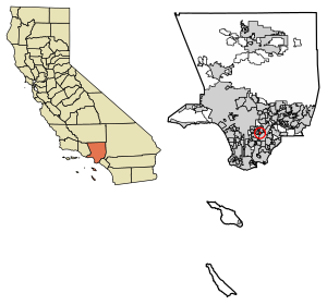
commerce
Time Zone
America/Los_Angeles
ISP
Language
User-Agent
Latitude
Longitude
Postal
ipdata
Country
Region
City
ASN
Time Zone
ISP
Blacklist
Proxy
Latitude
Longitude
Postal
Route
Popular places and events near this IP address

Bell Gardens, California
City in California, United States
Distance: Approx. 2711 meters
Latitude and longitude: 33.96805556,-118.15611111
Bell Gardens is a city in the U.S. state of California in the Los Angeles metropolitan area. Located in Los Angeles County, the city's population was 42,072 at the 2010 census, down from 44,054 at the 2000 census. Bell Gardens is part of the Gateway Cities Region, a largely urbanized region located in southeastern Los Angeles County.

Rancho San Antonio (Lugo)
Land grant given to Antonio Maria Lugo
Distance: Approx. 2686 meters
Latitude and longitude: 34,-118.12
Rancho San Antonio is a 29,513-acre (119.43 km2) Spanish land grant in present-day Los Angeles County, California that was granted to Antonio Maria Lugo. The rancho included in some part the present-day cities of Bell, Bell Gardens, Maywood, Vernon, Huntington Park, Walnut Park, Cudahy, South Gate, Lynwood, Montebello and Commerce.

Commerce Casino
Card room in Commerce, California
Distance: Approx. 2793 meters
Latitude and longitude: 33.998407,-118.144587
Commerce Casino is a cardroom located in the Los Angeles suburb of Commerce. With over 240 tables on site, Commerce Casino is the largest cardroom in the world. Established in 1983, the casino accounted for 38% of Commerce's tax revenues for the 2006-2007 fiscal year.

Commerce station (California)
Rail station in Commerce, California, United States
Distance: Approx. 2019 meters
Latitude and longitude: 33.99055556,-118.14333333
Commerce station is a Metrolink commuter rail station in the city of Commerce, California. It is served by Metrolink's Orange County Line running from Los Angeles Union Station to Oceanside. The 91/Perris Valley Line from Los Angeles Union Station to Riverside shares the track with the Orange County Line however, no 91/Perris Valley Line trains actually serve the Commerce station.
Los Angeles Assembly
Former Ford assembly plant in Pico Rivera, California, USA
Distance: Approx. 2705 meters
Latitude and longitude: 33.983,-118.1004
Los Angeles Assembly was a former American Ford Motor Company assembly plant located at 8820 Washington Boulevard and Rosemead Boulevard, in Pico Rivera, southeastern Los Angeles County, California.
Los Angeles (Maywood) Assembly
Former Chrysler assembly plant in Commerce, California, USA
Distance: Approx. 3166 meters
Latitude and longitude: 33.9853,-118.1616
Los Angeles (Maywood) Assembly was a Chrysler assembly plant located in the City of Commerce, near Maywood in southeastern Los Angeles County, California. It was an assembly location where vehicles were shipped by railroad in "knock-down kits" from Detroit, where they were locally assembled, combined with locally sourced parts. Vehicles assembled at Maywood were largely sold in California and the Western United States.
Maywood Assembly
Former Ford assembly plant in Commerce, California, USA
Distance: Approx. 3239 meters
Latitude and longitude: 33.9851,-118.1625
Maywood Assembly or Los Angeles No. 1, was a Ford Motor Company assembly plant located in City of Commerce, southwestern Los Angeles County, California.
Vail High School (Montebello, California)
Public school in the United States
Distance: Approx. 1804 meters
Latitude and longitude: 33.9932,-118.1292
Vail High School is a continuation school located in the city of Montebello, California. It is a small campus whose students are drawn from all the other high schools in the Montebello Unified School District, which include Schurr High School, Montebello High School, Bell Gardens High School and Applied Technology Center. The students are typically sent to Vail by their original high schools once it is determined that they are in danger of not graduating due to lack of eligible credits or poor grades.
Ellen Ochoa Prep Academy
High school in California, United States
Distance: Approx. 1659 meters
Latitude and longitude: 33.9699,-118.113
Ellen Ochoa Prep Academy is a magnet high school in Pico Rivera, California, United States. It is a part of the El Rancho Unified School District. Ochoa Prep provides a college preparatory curriculum.
Casa de Parley Johnson
Historic house in California, United States
Distance: Approx. 2289 meters
Latitude and longitude: 33.95666667,-118.1325
The Casa de Parley Johnson is a historic house in Downey, California, U.S. It was built for Alexander Parley Johnson, an heir to citrus fields, real estate and oil investments, in 1927. It was designed in the Spanish Revival architectural style by Roland Coate. It has been listed on the National Register of Historic Places since March 20, 1986.

Casa de Rancho San Antonio
California historic landmark
Distance: Approx. 781 meters
Latitude and longitude: 33.971854,-118.134548
The Casa de Rancho San Antonio, also known as the Gage Mansion, is the oldest remaining house in Los Angeles County. Construction began in 1795 by Antonio María Lugo, a prominent Californio ranchero. Today, the California Historic Landmark is located within the city of Bell Gardens, California.

Vail Airport, Montebello
Former airport in California, 1926–1953
Distance: Approx. 3044 meters
Latitude and longitude: 34.004,-118.134
Vail Airport, Montebello was an airport in Montebello, California from 1926 to 1953. The airport was owned and operated by Western Air Express. Western Air Express purchased 700 acres of Vail farm to build the private airport from the Vail brothers.
Weather in this IP's area
overcast clouds
10 Celsius
8 Celsius
9 Celsius
11 Celsius
1015 hPa
86 %
1015 hPa
1012 hPa
10000 meters
2.57 m/s
80 degree
100 %
