75.127.38.10 - IP Lookup: Free IP Address Lookup, Postal Code Lookup, IP Location Lookup, IP ASN, Public IP
Country:
Region:
City:
Location:
Time Zone:
Postal Code:
IP information under different IP Channel
ip-api
Country
Region
City
ASN
Time Zone
ISP
Blacklist
Proxy
Latitude
Longitude
Postal
Route
Luminati
Country
ASN
Time Zone
America/Chicago
ISP
PTPA
Latitude
Longitude
Postal
IPinfo
Country
Region
City
ASN
Time Zone
ISP
Blacklist
Proxy
Latitude
Longitude
Postal
Route
IP2Location
75.127.38.10Country
Region
connecticut
City
east hartford
Time Zone
America/New_York
ISP
Language
User-Agent
Latitude
Longitude
Postal
db-ip
Country
Region
City
ASN
Time Zone
ISP
Blacklist
Proxy
Latitude
Longitude
Postal
Route
ipdata
Country
Region
City
ASN
Time Zone
ISP
Blacklist
Proxy
Latitude
Longitude
Postal
Route
Popular places and events near this IP address

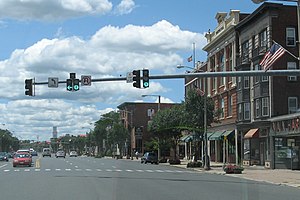
East Hartford, Connecticut
Town in Connecticut, United States
Distance: Approx. 1438 meters
Latitude and longitude: 41.76138889,-72.61527778
East Hartford is a town in the Capitol Planning Region, Connecticut, United States. The population was 51,045 at the 2020 census. The town is located on the east bank of the Connecticut River, directly across from Hartford.

Pratt & Whitney Stadium at Rentschler Field
Football stadium in East Hartford, Connecticut
Distance: Approx. 1547 meters
Latitude and longitude: 41.75972222,-72.61888889
Pratt & Whitney Stadium at Rentschler Field is a stadium in East Hartford, Connecticut. It is primarily used for football and soccer, and is the home field of the University of Connecticut Huskies (UConn). In 2010, it was home to the Hartford Colonials of the United Football League.

East Hartford High School
Public school in East Hartford, Hartford County, Connecticut, United States
Distance: Approx. 2525 meters
Latitude and longitude: 41.7544,-72.6049
East Hartford High School is a public high school of the East Hartford, Connecticut Public Schools. East Hartford High Schools shares its campus and many of its programs with the Connecticut International Baccalaureate Academy (CIBA), an honors college-preparatory high school for grades 9–12.

First Congregational Church of East Hartford and Parsonage
Historic church in Connecticut, United States
Distance: Approx. 2011 meters
Latitude and longitude: 41.76888889,-72.64472222
The First Congregational Church of East Hartford and Parsonage is a historic church at 829-837 Main Street in East Hartford, Connecticut. The congregation was founded around 1699 and the current church building was constructed around 1833. The building was added to the National Register of Historic Places in 1982.
St. John's Episcopal Church (East Hartford, Connecticut)
Historic church in Connecticut, United States
Distance: Approx. 1622 meters
Latitude and longitude: 41.77361111,-72.64083333
St. John's Episcopal Church is a historic church building at 1160 Main Street in East Hartford, Connecticut. It was designed by Edward T. Potter and was built in 1867, and is a prominent local example of High Gothic Revival executed in stone.

Makens Bemont House
Historic house in Connecticut, United States
Distance: Approx. 420 meters
Latitude and longitude: 41.77583333,-72.62527778
The Makens Bemont House, commonly called the Huguenot House, is a historic house museum at 307 Burnside Avenue in East Hartford, Connecticut. Built in 1761, it is one of the town's few surviving 18th-century buildings, and is one of several buildings located in Martin Park that are operated by the Historical Society of East Hartford as the Historical Houses at Martin Park. It was listed on the National Register of Historic Places in 1982.
Downtown Main Street Historic District (East Hartford, Connecticut)
Historic district in Connecticut, United States
Distance: Approx. 1720 meters
Latitude and longitude: 41.77222222,-72.64194444
The Downtown Main Street Historic District encompasses a well-preserved historical section of downtown East Hartford, Connecticut, United States. It extends along Main Street from between Burnside Avenue and Governor Street, and along Chapman Street to Chapman Place. Developed between about 1890 and 1945, its architecture encapsulates the town's transition from a main agrarian community to a modern suburb.

Central Avenue-Center Cemetery Historic District
Historic district in Connecticut, United States
Distance: Approx. 1736 meters
Latitude and longitude: 41.76916667,-72.64138889
The Central Avenue-Center Cemetery Historic District encompasses part of the town center of East Hartford, Connecticut. Although it was founded in the mid-17th century, it is now dominated by architecture of the late 19th and early 20th centuries. The Center Cemetery is the town's oldest surviving property, and includes the grave of William Pitkin, a colonial governor.
Garvan-Carroll Historic District
Historic district in Connecticut, United States
Distance: Approx. 2316 meters
Latitude and longitude: 41.76694444,-72.64777778
The Garvan-Carroll Historic District encompasses a primarily residential area near the center of East Hartford, Connecticut. Located just southwest of its Main Street downtown on South Prospect and Garvan Streets, and Carroll and Tower Roads, this area retains a high concentration of residential architecture built mainly between 1890 and the 1920s. It was listed on the National Register of Historic Places in 1991.

Gilman-Hayden House
Historic house in Connecticut, United States
Distance: Approx. 2266 meters
Latitude and longitude: 41.79166667,-72.63361111
The Gilman-Hayden House is a historic house at 1871 Main Street in East Hartford, Connecticut. Built in 1784, it is a good local example of Georgian architecture, and is also notable as the home of Edward Hayden, a diarist of the American Civil War. It was listed on the National Register of Historic Places in 1984.

Podunk River
Stream in Connecticut, US
Distance: Approx. 2287 meters
Latitude and longitude: 41.78555556,-72.64361111
The Podunk River is a stream in Hartford County, Connecticut. It is a tributary to the Connecticut River. The stream headwaters arise at 41°51′09″N 72°31′31″W at an elevation of 305 ft (93 m).

East Hartford Yard
Railroad yard in East Hartford, Connecticut
Distance: Approx. 859 meters
Latitude and longitude: 41.7784,-72.6293
East Hartford Yard is a classification yard in East Hartford, Connecticut. The yard was originally built by the New York and New England Railroad between 1881 and 1883. The opening of the yard marked the beginning of industrial development in East Hartford.
Weather in this IP's area
clear sky
-1 Celsius
-5 Celsius
-3 Celsius
1 Celsius
1028 hPa
85 %
1028 hPa
1027 hPa
10000 meters
2.57 m/s
180 degree

