74.81.188.79 - IP Lookup: Free IP Address Lookup, Postal Code Lookup, IP Location Lookup, IP ASN, Public IP
Country:
Region:
City:
Location:
Time Zone:
Postal Code:
IP information under different IP Channel
ip-api
Country
Region
City
ASN
Time Zone
ISP
Blacklist
Proxy
Latitude
Longitude
Postal
Route
Luminati
Country
ASN
Time Zone
America/Chicago
ISP
CCCAS-1
Latitude
Longitude
Postal
IPinfo
Country
Region
City
ASN
Time Zone
ISP
Blacklist
Proxy
Latitude
Longitude
Postal
Route
IP2Location
74.81.188.79Country
Region
south carolina
City
charleston
Time Zone
America/New_York
ISP
Language
User-Agent
Latitude
Longitude
Postal
db-ip
Country
Region
City
ASN
Time Zone
ISP
Blacklist
Proxy
Latitude
Longitude
Postal
Route
ipdata
Country
Region
City
ASN
Time Zone
ISP
Blacklist
Proxy
Latitude
Longitude
Postal
Route
Popular places and events near this IP address

Cathedral of Saint John the Baptist (Charleston, South Carolina)
Church in South Carolina , United States
Distance: Approx. 380 meters
Latitude and longitude: 32.7765,-79.9345
The Cathedral of St. John the Baptist is the mother church of the Roman Catholic Diocese of Charleston, located in Charleston, South Carolina. Designed by Brooklyn architect Patrick Keely, the construction of the cathedral started in 1890 to replace a cathedral that burned down in 1861.

Unitarian Church in Charleston
Historic church in South Carolina, United States
Distance: Approx. 328 meters
Latitude and longitude: 32.7785,-79.9342
The Unitarian Church in Charleston, home to a Unitarian Universalist congregation, is a historic church located at 4 Archdale Street in Charleston, South Carolina. It is the oldest Unitarian church in the South and the second oldest church building on the peninsula of Charleston. The church has received Welcoming Congregation status from the Unitarian Universalist Association as well as Green Sanctuary certification.

United States Marine Hospital (Charleston, South Carolina)
United States historic place
Distance: Approx. 106 meters
Latitude and longitude: 32.77777778,-79.93713889
The Old Marine Hospital is a historic medical building at 20 Franklin Street in Charleston, South Carolina. Built 1831–33 to a design by Robert Mills, it was designated a National Historic Landmark in 1973 for its association with Mills, and as a high-quality example of Gothic Revival architecture. The hospital was built as a public facility for the treatment of sick sailors and other transient persons.

Twenty-One Magazine
Event venue in Charleston, South Carolina
Distance: Approx. 77 meters
Latitude and longitude: 32.77833333,-79.93694444
Twenty-One Magazine, also known as the Old Charleston Jail, is a structure of historical and architectural significance in Charleston, South Carolina, United States. Operational between 1802 and 1939, the jail held many notable figures, among them Denmark Vesey, Union officers and Colored Troops during the American Civil War, and high-seas pirates. The Old Charleston Jail went through a renovation starting in 2016.

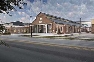
American College of the Building Arts
College in Charleston, South Carolina
Distance: Approx. 48 meters
Latitude and longitude: 32.7785,-79.9372
American College of the Building Arts (ACBA) is a private, four-year liberal arts and sciences college located in Charleston, South Carolina, United States. It is licensed by the South Carolina Commission on Higher Education to grant a Bachelor of Applied Science and an Associate of Applied Science in six craft specializations in the building arts. The college's model focuses on total integration of a liberal arts and science education and the traditional building arts skills.

Philip Porcher House
Distance: Approx. 271 meters
Latitude and longitude: 32.77891,-79.934833
The Philip Porcher House was built on what had previously been part of a 34-acre plantation located outside the city limits of Charleston, South Carolina. The lands passed to Isaac Mayzck and then, after his death in 1735, to his son, Isaac Mayzck II. The younger Isaac Mayzck gave land at the corner of Archdale and Magazine Streets to his daughter, Mary Mayzck Porcher, for her and her husband, Philip Porcher, to build a house. The house they built is similar to plantations of the time, built on a high foundation.

Grace Church Cathedral
Historic church in South Carolina, United States
Distance: Approx. 353 meters
Latitude and longitude: 32.78167,-79.93676
Grace Church Cathedral, located in Charleston, South Carolina, is the diocesan cathedral of the Episcopal Church in South Carolina. It is also a contributing property in the Charleston Historic District. The parish was founded as the city's fifth Episcopal Church congregation in 1846.
Charleston Theatre
Distance: Approx. 333 meters
Latitude and longitude: 32.77580278,-79.93644722
Charleston Theatre, also called Broad Street Theatre was a theatre in Charleston, South Carolina between 1794 and 1833. It was the first permanent theatre in Charleston, the first with a permanent staff, and the only theater for much of its duration. It was succeeded by the New Charleston Theatre (1837–1861).

Wentworth Mansion
United States historic place
Distance: Approx. 249 meters
Latitude and longitude: 32.77985,-79.9399
The Wentworth Mansion is a hotel in Charleston, South Carolina, United States. It was built in 1886 as a home for cotton merchant Francis Silas Rodgers and his family. The mansion is Second Empire in style.

Robert Mills Manor
Historic house in South Carolina, United States
Distance: Approx. 93 meters
Latitude and longitude: 32.77777778,-79.9375
The Robert Mills Manor is housing complex located in Harleston Village in Charleston, South Carolina that is included on the National Register.

Memminger Auditorium
Historic building in Charleston, South Carolina
Distance: Approx. 250 meters
Latitude and longitude: 32.78055556,-79.93638889
Memminger Auditorium (also known as Festival Hall) is a live performance and special events venue in Charleston, South Carolina.

Charleston Workhouse Slave Rebellion
1849 slave revolt in Charleston, South Carolina, U.S.
Distance: Approx. 47 meters
Latitude and longitude: 32.77857,-79.9372
The Charleston Workhouse Slave Rebellion was a rebellion of enslaved South Carolinians that took place in Charleston, South Carolina, in July 1849. On July 13, 1849, an enslaved man named Nicholas Kelly led an insurrection, wounding several guards with improvised weapons and liberating 37 enslaved people. Most were quickly captured, and Nicholas and two others were tried and hanged.
Weather in this IP's area
clear sky
6 Celsius
1 Celsius
4 Celsius
7 Celsius
1023 hPa
33 %
1023 hPa
1022 hPa
10000 meters
6.69 m/s
10.29 m/s
340 degree