74.80.207.141 - IP Lookup: Free IP Address Lookup, Postal Code Lookup, IP Location Lookup, IP ASN, Public IP
Country:
Region:
City:
Location:
Time Zone:
Postal Code:
IP information under different IP Channel
ip-api
Country
Region
City
ASN
Time Zone
ISP
Blacklist
Proxy
Latitude
Longitude
Postal
Route
Luminati
Country
Region
de
City
claymont
ASN
Time Zone
America/New_York
ISP
PHRG
Latitude
Longitude
Postal
IPinfo
Country
Region
City
ASN
Time Zone
ISP
Blacklist
Proxy
Latitude
Longitude
Postal
Route
IP2Location
74.80.207.141Country
Region
pennsylvania
City
chester
Time Zone
America/New_York
ISP
Language
User-Agent
Latitude
Longitude
Postal
db-ip
Country
Region
City
ASN
Time Zone
ISP
Blacklist
Proxy
Latitude
Longitude
Postal
Route
ipdata
Country
Region
City
ASN
Time Zone
ISP
Blacklist
Proxy
Latitude
Longitude
Postal
Route
Popular places and events near this IP address
Chester, Pennsylvania
First city in Pennsylvania, United States
Distance: Approx. 320 meters
Latitude and longitude: 39.84722222,-75.37277778
Chester is a city in Delaware County, Pennsylvania, United States. It is located in the Philadelphia metropolitan area (also known as the Delaware Valley) on the western bank of the Delaware River between Philadelphia and Wilmington, Delaware. The population of Chester was 32,605 at the 2020 census.

Upland, Pennsylvania
Borough in Pennsylvania, United States
Distance: Approx. 1116 meters
Latitude and longitude: 39.85666667,-75.37944444
Upland is a borough in Delaware County, Pennsylvania, United States. Upland is governed by an elected seven-member borough council. The population was 3,239 at the 2010 census, up from 2,974 at the 2000 census.

Caleb Pusey House
Historic house in Pennsylvania, United States
Distance: Approx. 1008 meters
Latitude and longitude: 39.85111111,-75.38694444
The Caleb Pusey House, built in 1683 near Chester Creek in Upland, Pennsylvania in the United States, is the oldest English-built house in Pennsylvania. It is the only remaining house that William Penn, the founder of Pennsylvania, is known to have visited. Caleb Pusey was a friend and business partner of Penn's.
Crozer Theological Seminary
United States historic place
Distance: Approx. 1086 meters
Latitude and longitude: 39.85583333,-75.37138889
The Crozer Theological Seminary was a Baptist seminary located in Upland, Pennsylvania, and founded in 1868. It was named after the wealthy industrialist, John Price Crozer. Martin Luther King Jr.
Chester High School (Chester, Pennsylvania)
Public school in Pennsylvania, United States
Distance: Approx. 888 meters
Latitude and longitude: 39.8506,-75.3673
Chester High School is an urban, public high school located in Chester, Delaware County, Pennsylvania, United States, with a ZIP code of 19013-4288. Chester is a part of the Chester-Upland School District. The school serves the City of Chester, Chester Township, and Upland.
Lamokin Street station
Distance: Approx. 551 meters
Latitude and longitude: 39.842,-75.3756
Lamokin Street is a former regional rail station that was located on the SEPTA Regional Rail Wilmington/Newark Line at Lamokin Street in Chester, Pennsylvania. Until 1972, it was the junction for the Chester Creek Branch, controlled by nearby Lamokin Tower. The branch line was operated by the Pennsylvania Railroad and later Penn Central, until service ended in 1972 due to damage caused by Hurricane Agnes.
Delaware River Iron Ship Building and Engine Works
Distance: Approx. 1224 meters
Latitude and longitude: 39.83796389,-75.36815278
The Delaware River Iron Ship Building and Engine Works (founded in 1871) was a major late-19th-century American shipyard located on the Delaware River in Chester, Pennsylvania. It was founded by the industrialist John Roach and is often referred to by its parent company name of John Roach & Sons, or just known as the Roach shipyard. For the first fifteen years of its existence, the shipyard was by far the largest and most productive in the United States, building more tonnage of ships than its next two major competitors combined, in addition to being the U.S. Navy's largest contractor.
Lamokin Tower
Distance: Approx. 472 meters
Latitude and longitude: 39.8432,-75.3738
Lamokin Tower was a closed interlocking tower of the Pennsylvania Railroad in Chester, Pennsylvania. It was located along the northwest corner of the Lloyd Street Bridge over the Amtrak Northeast Corridor and SEPTA Wilmington/Newark Line. The tower suffered from serious neglect after its closure and was demolished in 2017 along with the adjacent Lloyd Street Bridge.
Pusey–Crozier Mill Historic District
Historic district in Pennsylvania, United States
Distance: Approx. 1002 meters
Latitude and longitude: 39.85138889,-75.38666667
The Pusey–Crozier Mill Historic District, also known as the Pusey Plantation and Landingford, is an historic, American mill complex and national historic district that is located in Upland, Delaware County, Pennsylvania. It was added to the National Register of Historic Places in 1976.
Chester Assembly
Ford manufacturing plant in Pennsylvania, US
Distance: Approx. 1102 meters
Latitude and longitude: 39.8386373,-75.3693949
Chester Assembly is a former Ford manufacturing plant in Chester, Pennsylvania. It was located at Front & Lloyd Streets and occupied over 50 acres when it was open, and occupied the former Roach's Shipyard and Merchant Shipbuilding Corporation on Front Street from Fulton to Pennell streets. The factory began operations in August 1927 building the Ford Model A and was closed in February 1961, and operations were transferred to Mahwah, New Jersey.

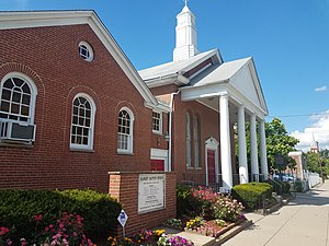
Upland Baptist Church
Historic church in Pennsylvania
Distance: Approx. 858 meters
Latitude and longitude: 39.853258,-75.382175
Upland Baptist Church is a Baptist church built in 1851 in Upland, Pennsylvania.

Calvary Baptist Church (Chester, Pennsylvania)
Baptist church in Pennsylvania
Distance: Approx. 1073 meters
Latitude and longitude: 39.837347,-75.378145
Calvary Baptist Church is a Baptist Church founded in 1879 in Chester, Delaware County, Pennsylvania, United States. It is affiliated with the Progressive National Baptist Convention, and the American Baptist Churches, USA. Martin Luther King Jr. attended and worked with Calvary Baptist Church while he studied at the Crozer Theological Seminary from 1948 to 1951.
Weather in this IP's area
overcast clouds
-1 Celsius
-1 Celsius
-2 Celsius
1 Celsius
1018 hPa
75 %
1018 hPa
1012 hPa
10000 meters
0.89 m/s
1.79 m/s
45 degree
100 %


