Country:
Region:
City:
Latitude and Longitude:
Time Zone:
Postal Code:
IP information under different IP Channel
ip-api
Country
Region
City
ASN
Time Zone
ISP
Blacklist
Proxy
Latitude
Longitude
Postal
Route
Luminati
Country
ASN
Time Zone
America/Chicago
ISP
INTERNAP-BLK
Latitude
Longitude
Postal
IPinfo
Country
Region
City
ASN
Time Zone
ISP
Blacklist
Proxy
Latitude
Longitude
Postal
Route
db-ip
Country
Region
City
ASN
Time Zone
ISP
Blacklist
Proxy
Latitude
Longitude
Postal
Route
ipdata
Country
Region
City
ASN
Time Zone
ISP
Blacklist
Proxy
Latitude
Longitude
Postal
Route
Popular places and events near this IP address

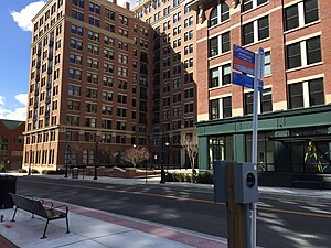
Braddock Road station
Washington Metro station
Distance: Approx. 875 meters
Latitude and longitude: 38.81388889,-77.05388889
Braddock Road station is an island-platformed Washington Metro station in Alexandria, Virginia, United States. The station was opened on December 17, 1983, and is operated by the Washington Metropolitan Area Transit Authority (WMATA). Providing service for both the Blue and Yellow Lines, the station is located at Braddock Road and West Street.
George Washington Middle School (Virginia)
Public school in Alexandria, Virginia, United States
Distance: Approx. 850 meters
Latitude and longitude: 38.815,-77.055
George Washington Middle School in Alexandria, Virginia, is located at 1005 Mount Vernon Avenue, part of Alexandria City Public Schools. Named after the nation's first president, it originally opened in 1935 as a high school; it consolidated the city's two previous schools, Alexandria and George Mason. The Tulloch Memorial Gym was built in 1952.

Alexandria, Virginia
Independent city in Virginia, US
Distance: Approx. 224 meters
Latitude and longitude: 38.82027778,-77.05027778
Alexandria is an independent city in the northern region of the Commonwealth of Virginia, United States. It lies on the western bank of the Potomac River approximately 7 miles (11 km) south of downtown Washington, D.C. Alexandria is the third-largest principal city of the Washington metropolitan area, which is part of the larger Washington–Baltimore combined statistical area. As of 2022, the city's population of 159,467 made it the sixth-most populous city in Virginia and the 173rd-most populous city in the nation.
Uptown–Parker–Gray Historic District
Historic district in Virginia, United States
Distance: Approx. 1001 meters
Latitude and longitude: 38.81138889,-77.05055556
Uptown–Parker–Gray Historic District is a national historic district located at Alexandria, Virginia. The district encompasses 984 contributing buildings in the northwestern quadrant of the Old Town Alexandria street grid as it was laid out in 1797. It mostly consists of small row houses and town houses, but there are also many commercial buildings.

Potomac station (Metroway)
Distance: Approx. 359 meters
Latitude and longitude: 38.82277778,-77.05
Potomac is a bus rapid transit station in Alexandria, Virginia, located at the intersection of Richmond Highway (U.S. Route 1) and Potomac Avenue. It is a stop on the portion of the dedicated bus-only highway along the Metroway bus rapid transit line, providing two-way service along the route. The station provides service to the southern Potomac Yard and Del Ray communities in Alexandria.

Custis station
Distance: Approx. 706 meters
Latitude and longitude: 38.82611111,-77.05027778
Custis is a bus rapid transit station in Alexandria, Virginia, located at the intersection of Richmond Highway (U.S. Route 1) and East Custis Avenue. It is a stop on the portion of dedicated bus-only highway along the Metroway bus rapid transit line, providing two-way service along the route. The station provides service to the central Potomac Yard and Potomac communities in Alexandria.

Fayette station
Distance: Approx. 504 meters
Latitude and longitude: 38.81605556,-77.05030556
Fayette is a bus rapid transit station in Alexandria, Virginia. It is located in the mixed-traffic portion of the Metroway bus rapid transit line providing two-way service along the route. The station provides service to the North Ridge community in Alexandria.
Congressional baseball shooting
2017 mass shooting in Alexandria, Virginia
Distance: Approx. 519 meters
Latitude and longitude: 38.82166667,-77.05333333
On June 14, 2017, a mass shooting occurred during a practice session for the annual Congressional Baseball Game in Alexandria, Virginia. 66-year-old James Hodgkinson shot four people, including then U.S. House Majority Whip Steve Scalise, U.S. Capitol Police officer Crystal Griner, congressional aide Zack Barth, and lobbyist Matt Mika. A ten-minute shootout took place between Hodgkinson and officers from the Capitol and Alexandria Police before officers shot Hodgkinson, who died from his wounds later that day at the George Washington University Hospital.
American Opportunity
American economic policy and education think tank
Distance: Approx. 697 meters
Latitude and longitude: 38.81433333,-77.04458333
American Opportunity (formerly the Free Congress Research and Education Foundation) is a conservative think tank founded by Paul Weyrich. The full name of the organization is American Opportunity and Security but its DBA name is American Opportunity Foundation. Based in Alexandria Virginia it is a nonprofit research and education organization.
Alexandria Black History Museum
Museum
Distance: Approx. 895 meters
Latitude and longitude: 38.81206,-77.04803
The Alexandria Black History Museum, located at 902 Wythe St., Alexandria, Virginia, is operated by the City of Alexandria. The building was formerly the Robert Robinson Library, originally constructed in 1940 as the first "separate but equal" library for African Americans in the segregated city.

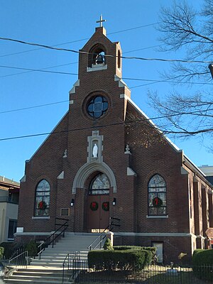
Saint Joseph Catholic Church (Alexandria, Virginia)
Church in Virginia, United States
Distance: Approx. 890 meters
Latitude and longitude: 38.81216944,-77.04642778
Saint Joseph Catholic Church is a predominantly Black Catholic church located at 711 N. Columbus St in historic Old Town Alexandria, Virginia. It was founded in 1916 to provide African-American parishioners of the local St. Mary's Roman Catholic Parish with their own church, freed from the customary restrictions that segregation imposed on them.
Robert H. Robinson Library
Distance: Approx. 895 meters
Latitude and longitude: 38.81206,-77.04803
Robert H. Robinson Library was one of the earliest libraries for Colored People in the United States, during the Jim Crow laws era. Robert Robinson Library was located at 902 Wythe St., Alexandria, Virginia, and was operated since 1940 by the City of Alexandria.
Weather in this IP's area
clear sky
13 Celsius
12 Celsius
12 Celsius
14 Celsius
1018 hPa
56 %
1018 hPa
1017 hPa
10000 meters
2.24 m/s
2.68 m/s
354 degree
06:52:28
16:53:56
