Country:
Region:
City:
Latitude and Longitude:
Time Zone:
Postal Code:
IP information under different IP Channel
ip-api
Country
Region
City
ASN
Time Zone
ISP
Blacklist
Proxy
Latitude
Longitude
Postal
Route
Luminati
Country
ASN
Time Zone
America/Chicago
ISP
INTERNAP-BLK
Latitude
Longitude
Postal
IPinfo
Country
Region
City
ASN
Time Zone
ISP
Blacklist
Proxy
Latitude
Longitude
Postal
Route
db-ip
Country
Region
City
ASN
Time Zone
ISP
Blacklist
Proxy
Latitude
Longitude
Postal
Route
ipdata
Country
Region
City
ASN
Time Zone
ISP
Blacklist
Proxy
Latitude
Longitude
Postal
Route
Popular places and events near this IP address

Greektown, Chicago
Neighborhood in Chicago
Distance: Approx. 335 meters
Latitude and longitude: 41.8792,-87.6473
Greektown is a social and dining district, located on the Near West Side of Chicago. Today, Greektown consists mostly of restaurants and businesses, although a cultural museum and an annual parade and festival still remain in the neighborhood. The district can be found along Halsted Street, between Van Buren and Madison Streets.
Lexington College
College in Illinois
Distance: Approx. 59 meters
Latitude and longitude: 41.877413,-87.649735
Lexington College was a Catholic women's college located in Chicago, Illinois. The curriculum was focused entirely on hospitality management studies. Originally known as the Lexington Institute of Hospitality Careers, the college opened in 1977 and closed in 2014.

UIC–Halsted station
Chicago "L" station
Distance: Approx. 157 meters
Latitude and longitude: 41.8755,-87.6497
UIC–Halsted, (formerly Halsted and U of I-Halsted) is a Chicago "L" station on the CTA's Blue Line. The station serves the University of Illinois at Chicago, the University Village neighborhood, and the Greektown neighborhood all located in the Near West Side.

Jane Byrne Interchange
Highway interchange in Chicago
Distance: Approx. 390 meters
Latitude and longitude: 41.87555556,-87.64555556
The Jane Byrne Interchange (until 2014, Circle Interchange) is a major freeway interchange near downtown Chicago, Illinois. It is the junction between the Dan Ryan, Kennedy and Eisenhower Expressways (I-90/I-94 and I-290), and Ida B. Wells Drive. In a dedication ceremony held on August 29, 2014, the interchange was renamed in honor of former Chicago mayor Jane M. Byrne (1979–1983).

University Hall (University of Illinois Chicago)
Office, education in Illinois , United States
Distance: Approx. 359 meters
Latitude and longitude: 41.87377778,-87.651
University Hall is the seat of the University of Illinois Chicago administration. Located at 601 S. Morgan Street, it is 338 feet (103 m) tall, making it the tallest building on Chicago's West Side. An unusual feature of its design is that instead of setbacks, it actually widens in two stages, so that it is twenty feet (6 m) wider at the top floor than at its base.
Greek Islands (restaurant)
Restaurant in Chicago, Illinois, U.S.
Distance: Approx. 298 meters
Latitude and longitude: 41.87888889,-87.6475
Greek Islands is a restaurant in Chicago, Illinois, founded by Konstantinos Koutsogeorgas and located at 200 S. Halsted Street in the Greektown neighborhood to the immediate west of downtown Chicago.

International Tailoring Company Building
United States historic place
Distance: Approx. 102 meters
Latitude and longitude: 41.8777,-87.6493
The International Tailoring Company Building, also known as White Tower Building, is a historic building in Chicago that was listed on the National Register on April 18, 2008. Designed by architects Mundie & Jensen and constructed in 1915–1916, with a substantial addition completed in 1922. In 1915–1916, when the International Tailoring Company built its ten-story building on Jackson Boulevard, it joined a handful of other businesses that since the 1890s had built and operated massive Chicago clothing factories.
Gallery 400
Distance: Approx. 48 meters
Latitude and longitude: 41.8765,-87.6497
Gallery 400 is a not-for-profit arts exhibition space within the College of Architecture, Design, and the Arts at the University of Illinois at Chicago. It was founded in 1983 to exhibit and support art, design and architecture. Over its history Gallery 400 has presented many exhibitions, lectures, and artist commissions.

National Hellenic Museum
Museum about Greek-American heritage in Chicago, Illinois
Distance: Approx. 247 meters
Latitude and longitude: 41.87687,-87.64692
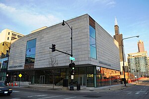
The National Hellenic Museum is the second oldest American institution dedicated to displaying and celebrating the cultural contributions of Greeks and Greek-Americans. Formerly known as the Hellenic Museum and Cultural Center, the National Hellenic Museum is located in Chicago’s Greektown, at the corner of Halsted and Van Buren Streets. The National Hellenic Museum has recently undergone a modernization program that cumulated in the museum moving to its current building in December 2011.
Chicago Virtual Charter School
Charter school in Chicago, Illinois
Distance: Approx. 437 meters
Latitude and longitude: 41.8808261,-87.6500188
The Chicago Virtual Charter School (CVCS) was a state-funded nonprofit K-12 charter school located in Chicago, Illinois in the Near West Side neighborhood. It was also the region's only public virtual school, where students followed a nontraditional model of partial attendance. The school closed on July 1, 2020.
Automatic Electric Company Building
United States historic place
Distance: Approx. 201 meters
Latitude and longitude: 41.87638889,-87.65222222
The Automatic Electric Company Building, located at 1000 W. Van Buren Street in Chicago, Illinois, is the original headquarters of the Automatic Electric Company. The company developed and popularized the automatic telephone exchange in the early 20th century. Inventor Almon Strowger had begun producing and selling automatic switches in the 1890s, but never had a permanent factory; when he helped form the Automatic Electric Company in 1901, the company constructed the building on Van Buren as a factory and headquarters.
Halsted station (CTA Metropolitan Main Line)
Rapid transit station in Chicago, 1895–1958
Distance: Approx. 217 meters
Latitude and longitude: 41.875916,-87.647643
Halsted was a rapid transit station located on the Metropolitan main line of the Chicago "L". It was in existence from 1895 to 1958, when the entire main line was replaced by the Congress Line located in the median of the nearby Eisenhower Expressway. Halsted station in particular was replaced by UIC-Halsted on the Congress Line, which eventually became part of the Blue Line.
Weather in this IP's area
overcast clouds
10 Celsius
9 Celsius
9 Celsius
11 Celsius
1016 hPa
71 %
1016 hPa
995 hPa
10000 meters
1.79 m/s
2.68 m/s
182 degree
86 %
06:42:11
16:29:03
