Country:
 USA
USARegion:
City:
Latitude and Longitude:
Time Zone:
Postal Code:
IP information under different IP Channel
ip-api
Country
Region
City
ASN
Time Zone
ISP
Blacklist
Proxy
Latitude
Longitude
Postal
Route
IPinfo
Country
Region
City
ASN
Time Zone
ISP
Blacklist
Proxy
Latitude
Longitude
Postal
Route
MaxMind
Country
Region
City
ASN
Time Zone
ISP
Blacklist
Proxy
Latitude
Longitude
Postal
Route
Luminati
Country
USASN
Time Zone
America/Chicago
ISP
INTERNAP-BLOCK-4
Latitude
Longitude
Postal
db-ip
Country
Region
City
ASN
Time Zone
ISP
Blacklist
Proxy
Latitude
Longitude
Postal
Route
ipdata
Country
Region
City
ASN
Time Zone
ISP
Blacklist
Proxy
Latitude
Longitude
Postal
Route
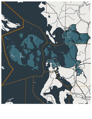
Popular places and events near this IP address

Anacortes, Washington
City in Washington, United States
Distance: Approx. 1421 meters
Latitude and longitude: 48.50194444,-122.62361111
Anacortes ( AN-ə-KOR-təs) is a city in Skagit County, Washington, United States. The name "Anacortes" is an adaptation of the name of Anne Curtis Bowman, who was the wife of early Fidalgo Island settler Amos Bowman. Anacortes' population was 17,637 at the time of the 2020 census.

Guemes Island
Small island in the Salish Sea, northwest Washington, United States
Distance: Approx. 3554 meters
Latitude and longitude: 48.54444444,-122.61638889
Guemes Island is a small island in western Skagit County, Washington, United States. It is located north of Fidalgo Island and the city of Anacortes, and is accessible by private boat and by the Guemes Island ferry operated by Skagit County. Guemes Island was named after the Viceroy of New Spain, Juan Vicente de Güemes, who commissioned an expedition that revealed the islands to Spain in 1794.
Little Cranberry Lake (Washington)
Lake of the United States of America
Distance: Approx. 2977 meters
Latitude and longitude: 48.494,-122.642
Little Cranberry Lake is located within Anacortes Community Forest Lands on Fidalgo Island in the northwestern corner of the U.S. state of Washington. The lake is deepened by a dam on the northern end which was constructed in the 1930s. The previous dam had broken in 1921 releasing a large amount of water which crashed down the hills to the beach.

Department of Safety
Defunct community space in Anacortes, Washington
Distance: Approx. 46 meters
Latitude and longitude: 48.5125,-122.61361111
The Department of Safety was an artist-run community space founded in 2002, located in Anacortes, Washington's old police and fire station. It housed an all-ages music venue, art gallery, artist residency program, zine library, darkroom, artists' studios and living amenities for a handful of residents. Department of Safety provided hostel accommodations for travelers from 2002 until 2005, when the operators decided to focus on the Artist in Residence program.

W. T. Preston
Distance: Approx. 482 meters
Latitude and longitude: 48.51611111,-122.60916667
W. T. Preston is a specialized sternwheeler that operated as a snagboat, removing log jams and natural debris that prevented river navigation on several Puget Sound-area rivers. She is now the centerpiece of the Snagboat Heritage Center in Anacortes, Washington. She was designated a National Historic Landmark in 1989.
Oyster Run
Annual motorcycle rally in Anacortes, Washington, USA
Distance: Approx. 2175 meters
Latitude and longitude: 48.49777778,-122.63222222
The Oyster Run is a motorcycle rally held annually each September since 1981 in Anacortes, Washington. It is the largest rally in the Pacific Northwest with 2006 attendance estimated in the tens of thousands. There was no rally in 2020 or 2021 due to the COVID-19 pandemic.

Wilson Hotel
United States historic place
Distance: Approx. 560 meters
Latitude and longitude: 48.51763333,-122.61293611
The Wilson Hotel (also known as the Wilson Block) is a historic building in downtown Anacortes, Washington, United States. It was built in 1890 during a speculative land boom when cites across northern Puget Sound were competing to become the western terminus of the Great Northern Railway's transcontinental route. It was designed by the firm of Pickles and Sutton and built by capitalist David Wilson, all of Tacoma, and was built of locally made brick.
Anacortes High School
Secondary school in Anacortes, Washington, United States
Distance: Approx. 928 meters
Latitude and longitude: 48.50711823,-122.6224823
Anacortes High School is a high school in Anacortes, Washington, United States. It is operated by Anacortes School District, also known as Anacortes School District No. 103.
Washington's 40th legislative district
Distance: Approx. 4172 meters
Latitude and longitude: 48.55,-122.61666667
Washington's 40th legislative district is one of forty-nine districts in Washington state for representation in the state legislature. The district includes San Juan County as well as portions of Whatcom and Skagit counties. The district's legislators are state senator Liz Lovelett and state representatives Debra Lekanoff (position 1) and Alex Ramel (position 2), all Democrats.

2010 Tesoro Anacortes Refinery disaster
Distance: Approx. 4159 meters
Latitude and longitude: 48.493,-122.565
The 2010 Tesoro Anacortes Refinery disaster was an industrial accident that occurred at the Tesoro Anacortes Refinery in Anacortes, Washington on April 2, 2010. Seven workers received fatal burns in an explosion and ensuing fire when a heat exchanger violently ruptured after a maintenance restart.
Saddlebag Island Marine State Park
State park in Washington (state), United States
Distance: Approx. 4910 meters
Latitude and longitude: 48.53583333,-122.55638889
Saddlebag Island Marine State Park is a public recreation area made up of 26-acre (11 ha) Saddlebag Island, part of the San Juan Islands, in Skagit County, Washington. The island sits in Padilla Bay four miles (6.4 km) northeast of Anacortes, Washington. Dot Island and Huckleberry Island lie nearby.
Fidalgo, Washington
Unincorporated community in Washington, US
Distance: Approx. 5116 meters
Latitude and longitude: 48.47611111,-122.57083333
Fidalgo is an unincorporated community in Skagit County, in the U.S. state of Washington.
Weather in this IP's area
fog
9 Celsius
9 Celsius
8 Celsius
10 Celsius
1018 hPa
93 %
1018 hPa
1018 hPa
10000 meters
07:19:14
18:36:40