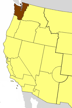
Country:
Region:
City:
Latitude and Longitude:
Time Zone:
Postal Code:
IP information under different IP Channel
ip-api
Country
Region
City
ASN
Time Zone
ISP
Blacklist
Proxy
Latitude
Longitude
Postal
Route
Luminati
Country
ASN
Time Zone
America/Chicago
ISP
INTERNAP-BLOCK-4
Latitude
Longitude
Postal
IPinfo
Country
Region
City
ASN
Time Zone
ISP
Blacklist
Proxy
Latitude
Longitude
Postal
Route
db-ip
Country
Region
City
ASN
Time Zone
ISP
Blacklist
Proxy
Latitude
Longitude
Postal
Route
ipdata
Country
Region
City
ASN
Time Zone
ISP
Blacklist
Proxy
Latitude
Longitude
Postal
Route
Popular places and events near this IP address

Occidental Park
Public park in Seattle, Washington, U.S.
Distance: Approx. 188 meters
Latitude and longitude: 47.60002778,-122.33290278
Occidental Park, also referred to as Occidental Square (north of S. Main Street) and Occidental Mall (south of S. Main Street), is a 0.6 acre (2,400 m2) public park located in the Pioneer Square district of Seattle, Washington.
Garden of Allah (cabaret)
Gay cabaret in Seattle, Washington, US
Distance: Approx. 118 meters
Latitude and longitude: 47.6,-122.33416667
The Garden of Allah was a mid-20th century gay cabaret that opened in 1946 in the basement of the Victorian-era Arlington Hotel in Seattle's Pioneer Square. It was Seattle's most popular gay cabaret in the late 1940s and 1950s and one of the first gay-owned gay bars in the United States. Prior to becoming a cabaret, the space had been a speakeasy, during Prohibition, and then a tavern.

OK Hotel
Former bar and music venue
Distance: Approx. 147 meters
Latitude and longitude: 47.60041111,-122.33519444
The OK Hotel was an American bar and music venue located at 212 Alaskan Way South in Seattle's Pioneer Square district. It is now a location of low income units. The club's 15-year-plus life span came to an end with the Nisqually earthquake of February 28, 2001, which damaged numerous buildings in the historic district.

Episcopal Diocese of Olympia
Diocese of the Episcopal Church in the United States
Distance: Approx. 160 meters
Latitude and longitude: 47.6,-122.33333333
The Episcopal Diocese of Olympia, also known as the Episcopal Church in Western Washington, is a diocese of the Episcopal Church in Washington state west of the Cascade Range. It is one of 17 dioceses and an area mission that make up Province 8. The diocese started as a missionary district in 1853 and was formally established in 1910.

Basel Action Network
Nonprofit environmental organization
Distance: Approx. 189 meters
Latitude and longitude: 47.600663,-122.334033
The Basel Action Network (BAN), a charitable non-governmental organization, works to combat the export of toxic waste from technology and other products from industrialized societies to developing countries. BAN is based in Seattle, Washington, United States, with a partner office in the Philippines. BAN is named after the Basel Convention, a 1989 United Nations treaty designed to control and prevent the dumping of toxic wastes, particularly on developing countries.

Union Trust Building (Seattle)
United States historic place
Distance: Approx. 150 meters
Latitude and longitude: 47.59982222,-122.33331389
The Union Trust Building is a commercial building in Seattle, Washington, United States. Located in the city's Pioneer Square neighborhood, on the corner of Main Street and Occidental Way South (Occidental Mall), it was one of the first rehabilitated buildings in the neighborhood, which is now officially a historic district. In the 1960s, when Pioneer Square was better known as "Skid Road", architect Ralph Anderson purchased the building from investor Sam Israel for $50,000 and set about remodeling it, a project that set a pattern for the next several decades of development in the neighborhood.
Fallen Firefighters Memorial (Wu)
Sculpture by Hai Ying Wu in Seattle, Washington, U.S.
Distance: Approx. 197 meters
Latitude and longitude: 47.60018333,-122.33291667
Fallen Firefighters Memorial is a bronze sculpture group by Hai Ying Wu. It is located in Occidental Park, Seattle, near the intersection of Occidental Avenue and Main Street. It was inspired by the deaths of four Seattle firefighters who died January 5, 1995 fighting a fire in the Mary Pang warehouse in Seattle's International District.

Shelly's Leg
Former gay bar in Seattle, Washington (USA)
Distance: Approx. 133 meters
Latitude and longitude: 47.60027778,-122.33527778
Shelly's Leg was the first openly operated gay bar in Seattle. It operated from 1973 until sometime c. 1978.

Mutual Life Building (Seattle)
United States historic place
Distance: Approx. 150 meters
Latitude and longitude: 47.59982222,-122.33331389
The Mutual Life Building, originally known as the Yesler Building, is an historic office building located in Seattle's Pioneer Square neighborhood that anchors the West side of the square. The building sits on one of the most historic sites in the city; the original location of Henry Yesler's cookhouse that served his sawmill in the early 1850s and was one of Seattle's first community gathering spaces. It was also the site of the first sermon delivered and first lawsuit tried in King County.

Central Saloon
Bar and restaurant in Seattle, Washington, U.S.
Distance: Approx. 173 meters
Latitude and longitude: 47.60061111,-122.33444444
Central Saloon is a bar, restaurant and music venue in Seattle, in the U.S. state of Washington. Established in 1892, the bar is among the city's oldest. The bar is located in the Pioneer Square neighborhood, the oldest in the city.

The London Plane
Defunct restaurant in Seattle, Washington, U.S.
Distance: Approx. 199 meters
Latitude and longitude: 47.59994444,-122.33266667
The London Plane was a restaurant, bakery, and grocery store in Seattle's Pioneer Square district, in the U.S. state of Washington.

Ballast Island (Seattle)
United States historic place
Distance: Approx. 182 meters
Latitude and longitude: 47.60055556,-122.33611111
Ballast Island was a small artificial island located on the Seattle Waterfront during the late 1800s. Frequent illegal dumping of ballast led to the designation of a specific region of the Seattle harbor where dumping was permitted. Emerging above the surface around 1880, it grew rapidly following additional dock developments in 1881 which largely encircled the island.
Weather in this IP's area
broken clouds
7 Celsius
7 Celsius
5 Celsius
9 Celsius
1019 hPa
83 %
1019 hPa
1018 hPa
10000 meters
0.89 m/s
1.34 m/s
85 degree
75 %
07:15:30
16:32:50