Country:
 USA
USARegion:
City:
Latitude and Longitude:
Time Zone:
Postal Code:
IP information under different IP Channel
ip-api
Country
Region
City
ASN
Time Zone
ISP
Blacklist
Proxy
Latitude
Longitude
Postal
Route
IPinfo
Country
Region
City
ASN
Time Zone
ISP
Blacklist
Proxy
Latitude
Longitude
Postal
Route
MaxMind
Country
Region
City
ASN
Time Zone
ISP
Blacklist
Proxy
Latitude
Longitude
Postal
Route
Luminati
Country
USASN
Time Zone
America/Chicago
ISP
INTERNAP-2BLK
Latitude
Longitude
Postal
db-ip
Country
Region
City
ASN
Time Zone
ISP
Blacklist
Proxy
Latitude
Longitude
Postal
Route
ipdata
Country
Region
City
ASN
Time Zone
ISP
Blacklist
Proxy
Latitude
Longitude
Postal
Route
Popular places and events near this IP address
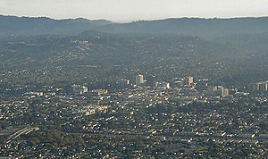
San Mateo, California
City in California, United States
Distance: Approx. 866 meters
Latitude and longitude: 37.55416667,-122.31305556
San Mateo (Spanish for 'Saint Matthew') ( SAN mə-TAY-oh) is a city in San Mateo County, California, United States, on the San Francisco Peninsula. About 20 miles (32 km) south of San Francisco, the city borders Burlingame to the north, Hillsborough to the west, San Francisco Bay and Foster City to the east and Belmont to the south. The population was 105,661 at the 2020 census.

Junípero Serra High School (San Mateo, California)
Private school in the United States
Distance: Approx. 853 meters
Latitude and longitude: 37.54611111,-122.3175
Junípero Serra High School (commonly Serra or JSHS) is a Catholic college preparatory high school in San Mateo, California, United States, serving students in grades 9–12. A part of the Roman Catholic Archdiocese of San Francisco, this school provides education for young men. The school has an academic focus with a college preparatory curriculum.
Bay Meadows Racetrack
Auto and horse racing track in San Mateo, California
Distance: Approx. 1016 meters
Latitude and longitude: 37.543361,-122.297739
Bay Meadows was a horse racing track in San Mateo, California from 1934 until 2008, in the San Francisco Bay Area in the United States.

Hillsdale station (Caltrain)
Train station in San Mateo, California, U.S.
Distance: Approx. 867 meters
Latitude and longitude: 37.54194444,-122.30111111
Hillsdale station is one of three Caltrain stations in San Mateo, California. The station is next to the Bay Meadows neighborhood and close to the Hillsdale Shopping Center.

Hayward Park station
Train station in San Mateo, California, U.S.
Distance: Approx. 662 meters
Latitude and longitude: 37.55333333,-122.30944444
Hayward Park station is one of three Caltrain stations in San Mateo, California. It is located just to the north of the State Route 92 overcrossing, about 1,200 ft (370 m) south of the site of the original Southern Pacific station in Hayward Park (known as Leslie Station prior to 1936). It was relocated in 1999 because of a lack of parking at the original site, and because the previous station had been sited along a curve in the tracks near 16th Avenue.
San Mateo-Foster City School District
School district in California
Distance: Approx. 280 meters
Latitude and longitude: 37.55,-122.30833333
San Mateo-Foster City School District is a school district in San Mateo and Foster City, California. It consists of twenty schools: three middle schools (Grades 6–8), fourteen elementary schools (TK/K–5), and three schools with all grades (K–8). With a total enrollment of approximately 12,500 students (in 2015–16), it is the largest school district in San Mateo County.

Peninsula Library System
Distance: Approx. 364 meters
Latitude and longitude: 37.544342,-122.306928
The Peninsula Library System (PLS) is a consortium of public and community college libraries in San Mateo County, California, United States, which serves the part of the San Francisco Bay Area known as "The Peninsula". The system has dozens of branches in local communities and at various area community colleges, a bookmobile, and automated book kiosks called Library-a-Go-Go.
Japan Expo USA
Distance: Approx. 604 meters
Latitude and longitude: 37.54611111,-122.30138889
Japan Expo USA was a three-day anime convention held in August at the San Mateo Event Center in San Mateo, California, United States. The convention was organized by SEFA Entertainment, based in San Francisco, California. It was the American subsidiary of the JTS Group, the organizing group of Japan Expo in Paris, France.
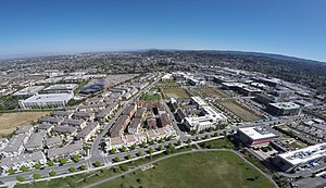
Bay Meadows (neighborhood)
Neighborhood in San Mateo, CA, US
Distance: Approx. 1016 meters
Latitude and longitude: 37.543361,-122.297739
Bay Meadows is an 83-acre mixed-use, transit-oriented development in the City of San Mateo, California. The neighborhood is divided into station/mixed-use and residential districts, which are further divided into 18 development blocks. The station/mixed-use district is primarily adjacent to Delaware Street, the major north–south street through the neighborhood.
Gurnick Academy
Private medical school in California
Distance: Approx. 31 meters
Latitude and longitude: 37.54722,-122.30802
Gurnick Academy (also known as Gurnick Academy of Medical Arts) is a private for-profit higher-education institution in California providing nursing, imaging and allied health programs. The school’s corporate office is located in San Jose, California, and it operates six campuses, in San Jose, Concord, Modesto, Fresno, Sacramento and Los Angeles, as well as offering distance education online. The academy is operated and owned by the Gurnick Academy of Medical Arts, with Konstantin Gourji as the chief executive officer.
Pacific Recorders
Independent recording studio in San Mateo
Distance: Approx. 631 meters
Latitude and longitude: 37.55154,-122.31302
Pacific Recorders (also referred to as Pacific Recording) was an independent recording studio in San Mateo, California. Founded in 1968, the studio was the location for recordings by such notable artists as Santana, the Grateful Dead, The Doobie Brothers, Moby Grape, and Taj Majal.
All Spice
Restaurant in San Mateo, California, U.S.
Distance: Approx. 908 meters
Latitude and longitude: 37.55291667,-122.31569444
All Spice is a restaurant in San Mateo, California. The restaurant has received a Michelin star.
Weather in this IP's area
clear sky
13 Celsius
13 Celsius
12 Celsius
16 Celsius
1011 hPa
92 %
1011 hPa
1011 hPa
10000 meters
1.54 m/s
290 degree
06:45:59
19:27:46