Country:
 USA
USARegion:
City:
Latitude and Longitude:
Time Zone:
Postal Code:
IP information under different IP Channel
ip-api
Country
Region
City
ASN
Time Zone
ISP
Blacklist
Proxy
Latitude
Longitude
Postal
Route
IPinfo
Country
Region
City
ASN
Time Zone
ISP
Blacklist
Proxy
Latitude
Longitude
Postal
Route
MaxMind
Country
Region
City
ASN
Time Zone
ISP
Blacklist
Proxy
Latitude
Longitude
Postal
Route
Luminati
Country
USASN
Time Zone
America/Chicago
ISP
INTERNAP-2BLK
Latitude
Longitude
Postal
db-ip
Country
Region
City
ASN
Time Zone
ISP
Blacklist
Proxy
Latitude
Longitude
Postal
Route
ipdata
Country
Region
City
ASN
Time Zone
ISP
Blacklist
Proxy
Latitude
Longitude
Postal
Route
Popular places and events near this IP address

Dublin, California
City in California, United States
Distance: Approx. 2629 meters
Latitude and longitude: 37.70222222,-121.93583333
Dublin is a suburban city of the East Bay in California, United States. It is located within the Amador Valley of Alameda County's Tri-Valley region. It is located along the north side of Interstate 580 at the intersection with Interstate 680, roughly 35 miles (56 km) east of downtown San Francisco, 23 miles (37 km) east of downtown Oakland, and 31 miles (50 km) north of downtown San Jose.

Dublin/Pleasanton station
Rapid transit station in Pleasanton, California, US
Distance: Approx. 923 meters
Latitude and longitude: 37.701663,-121.899232
Dublin/Pleasanton station is a Bay Area Rapid Transit (BART) station on the border of Dublin and Pleasanton in California. It is the eastern terminus of the Blue Line. It is also a major bus terminal served by six providers.

Federal Correctional Institution, Dublin
U.S. federal prison
Distance: Approx. 2621 meters
Latitude and longitude: 37.71833333,-121.89722222
The Federal Correctional Institution, Dublin (FCI Dublin) was a low-security United States federal prison for female inmates in Dublin, California. The facility also has an adjacent satellite prison camp housing minimum-security female offenders. FCI Dublin is located 20 miles southeast of Oakland on the Parks Reserve Forces Training Area.

Stoneridge Shopping Center
Shopping mall in Pleasanton, California
Distance: Approx. 1911 meters
Latitude and longitude: 37.695324,-121.928678
Stoneridge Shopping Center is an upscale major shopping mall in Pleasanton, California. The mall is managed and co-owned by Simon Property Group, and is adjacent to Interstate 680. The mall features JCPenney and Macy's and Macy's Women's Store.

West Dublin/Pleasanton station
Rapid transit station in San Francisco Bay Area
Distance: Approx. 1917 meters
Latitude and longitude: 37.699726,-121.928273
West Dublin/Pleasanton station is a Bay Area Rapid Transit (BART) station on the border of Dublin and Pleasanton in California, located in the median of I-580. The station is served by the Blue Line. It has a single island platform between the highway travel lanes with a fare mezzanine above.
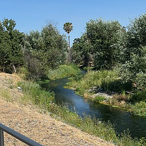
Arroyo Mocho
River in California, United States
Distance: Approx. 2181 meters
Latitude and longitude: 37.67694444,-121.91222222
Arroyo Mocho is a 34.7-mile-long (55.8 km) stream which originates in the far northeastern corner of Santa Clara County and flows northwesterly into eastern Alameda County, California. After traversing the cities of Livermore and Pleasanton it joins South San Ramon Creek to become Arroyo de la Laguna, which in turn flows to Alameda Creek and thence to San Francisco Bay.
South San Ramon Creek
River in California, United States
Distance: Approx. 2181 meters
Latitude and longitude: 37.67694444,-121.91222222
South San Ramon Creek is a 9.3-mile-long (15.0 km) southward-flowing stream in Alameda County and southern Contra Costa County, in the East Bay region of northern California. The creek is a tributary to Arroyo de la Laguna, flowing in the western Livermore Valley through Dublin and Pleasanton.

Hacienda Business Park
Job and housing center in Pleasanton, California
Distance: Approx. 917 meters
Latitude and longitude: 37.69,-121.9
Hacienda Business Park is a 900-acre (364 hectare) mixed-use job center and housing development in Pleasanton, California.
Dougherty, California
Unincorporated community in California, United States
Distance: Approx. 1688 meters
Latitude and longitude: 37.71111111,-121.90972222
Dougherty (also, Amador's, Amador Valley, and Dougherty Station) was an unincorporated community in Alameda County, California. It was associated with two separate areas near Dublin, the first at an elevation of 348 feet (106 m). James Witt Dougherty purchased the land in and around what is now Dublin, CA, in 1852.
Komandorski Village, California
Unincorporated community in California, United States
Distance: Approx. 2234 meters
Latitude and longitude: 37.71611111,-121.90888889
Komandorski Village was a temporary low-rent housing development in Dublin, Alameda County, California. It was built to hold the overflow of military personnel and families from Camp Parks. It was sold by the United States government to a housing authority in 1954, and was required to be demolished in 1984.
Chabot–Las Positas Community College District
Local college administrative unit in California, USA
Distance: Approx. 2172 meters
Latitude and longitude: 37.703545,-121.9298
The Chabot–Las Positas Community College District is a public school district based in Alameda County, California, in the United States. Colleges in the district include Chabot College in Hayward, and Las Positas College in Livermore.
Valley High School (Dublin, California)
Public school in the United States
Distance: Approx. 1953 meters
Latitude and longitude: 37.70944444,-121.92138889
Valley High School is the continuation high school for the Dublin Unified School District, located in Dublin, California. As of the 2018–2019 school year, it had a staff of 8 teachers for 72 students in grades 10–12.
Weather in this IP's area
clear sky
24 Celsius
23 Celsius
21 Celsius
25 Celsius
1016 hPa
22 %
1016 hPa
1005 hPa
10000 meters
5.14 m/s
360 degree
07:19:11
18:25:48