Country:
 USA
USARegion:
City:
Latitude and Longitude:
Time Zone:
Postal Code:
IP information under different IP Channel
ip-api
Country
Region
City
ASN
Time Zone
ISP
Blacklist
Proxy
Latitude
Longitude
Postal
Route
IPinfo
Country
Region
City
ASN
Time Zone
ISP
Blacklist
Proxy
Latitude
Longitude
Postal
Route
MaxMind
Country
Region
City
ASN
Time Zone
ISP
Blacklist
Proxy
Latitude
Longitude
Postal
Route
Luminati
Country
USASN
Time Zone
America/Chicago
ISP
INTERNAP-BLK
Latitude
Longitude
Postal
db-ip
Country
Region
City
ASN
Time Zone
ISP
Blacklist
Proxy
Latitude
Longitude
Postal
Route
ipdata
Country
Region
City
ASN
Time Zone
ISP
Blacklist
Proxy
Latitude
Longitude
Postal
Route
Popular places and events near this IP address
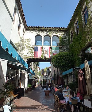
Santa Barbara, California
City in California, United States
Distance: Approx. 258 meters
Latitude and longitude: 34.41666667,-119.7
Santa Barbara (Spanish: Santa Bárbara, meaning 'Saint Barbara') is a coastal city in Santa Barbara County, California, of which it is also the county seat. Situated on a south-facing section of coastline, the longest such section on the West Coast of the United States excepting Alaska, the city lies between the steeply rising Santa Ynez Mountains and the Pacific Ocean. Santa Barbara's climate is often described as Mediterranean, and the city has been dubbed "The American Riviera".
Santa Barbara News-Press
Newspaper in Santa Barbara, California
Distance: Approx. 147 meters
Latitude and longitude: 34.41962,-119.69812
The Santa Barbara News-Press was a broadsheet newspaper based in Santa Barbara, California. It was founded in 1868 as the Post and merged with the rival News to form the News-Press in 1932. On July 21, 2023, it filed for bankruptcy and ceased publication.

Arlington Theatre
Theater in Santa Barbara, California
Distance: Approx. 102 meters
Latitude and longitude: 34.4179,-119.697
The Arlington Theatre is a historic movie theatre in Santa Barbara, California, United States. Combining the Mission Revival and Spanish Colonial Revival styles of architecture, it the largest movie theater and principal performing arts venue the city. In addition to regular screenings and artists, it is home to many events associated with the annual Santa Barbara International Film Festival.
National Center for Ecological Analysis and Synthesis
Distance: Approx. 161 meters
Latitude and longitude: 34.4192,-119.69937
The National Center for Ecological Analysis and Synthesis (NCEAS) is a research center at the University of California, Santa Barbara, in Santa Barbara, California. Better known by its acronym, NCEAS (pronounced “n-seas”) opened in May 1995. Funding for NCEAS is diverse and includes supporters such as the U.S. National Science Foundation, the State of California, and the University of California, Santa Barbara.

Casa de la Guerra
Historic house in California, United States
Distance: Approx. 245 meters
Latitude and longitude: 34.42027778,-119.69916667
The Casa de la Guerra was the residence of the fifth commandant of the Presidio de Santa Barbara, José de la Guerra y Noriega, founder of the Guerra family of California (a prominent Californio family) from 1828 until his death in 1858. Descendants of José lived in the home until 1943. The site is currently owned and operated by the Santa Barbara Trust for Historic Preservation as a historic house museum.

Plaza de la Guerra
Distance: Approx. 168 meters
Latitude and longitude: 34.41972222,-119.69861111
Plaza de la Guerra, also known as De La Guerra Plaza, is a public plaza in downtown Santa Barbara, California, USA, located right next to the Santa Barbara News-Press offices. It is best known for the activities that take place there during Santa Barbara's annual Fiesta in early August. There are booths, musical performances and many festivities for the downtown area in De La Guerra Plaza.

Antioch University Santa Barbara
Private university in Santa Barbara, California
Distance: Approx. 228 meters
Latitude and longitude: 34.41923,-119.69579
Antioch University Santa Barbara (AUSB) is a private liberal arts university in downtown Santa Barbara, California. It is part of the Antioch University system that includes campuses in Keene, New Hampshire; Seattle, Washington; Los Angeles, California; and Yellow Springs, Ohio, also home to Antioch College. Antioch University has operated in Santa Barbara since 1977.

Paseo de la Guerra
Distance: Approx. 255 meters
Latitude and longitude: 34.42005278,-119.69978056
The Paseo de la Guerra is a complex of historic buildings in downtown Santa Barbara, California. Since 1977 it is listed (as El Paseo and Casa de la Guerra) in National Register of Historic Places. It is named for the Guerra family of California, a historically prominent Californio family in Santa Barbara.
Stampa Barbara
Distance: Approx. 58 meters
Latitude and longitude: 34.41798,-119.6985
Stampa Barbara was a store in Santa Barbara, California that focused exclusively on rubber stamps. Opened in 1985, by Gary Dorothy, the store was the first of its kind. The store created their own designs, as well as selling several other companies' stamps.
Museum of Contemporary Art Santa Barbara
Art museum; contemporary museum for the 21st century in Santa Barbara, CA United States
Distance: Approx. 206 meters
Latitude and longitude: 34.41869444,-119.70019444
The Museum of Contemporary Art Santa Barbara (MCASB) is a contemporary art museum in Santa Barbara, California, United States.

Paseo Nuevo
Shopping center in Santa Barbara, California
Distance: Approx. 242 meters
Latitude and longitude: 34.419,-119.7005
Paseo Nuevo is an 458,000-square-foot (42,500 m2) open-air shopping center in downtown Santa Barbara, California. It is integrated into the street grid on and around lower State Street, both in terms of its Spanish Colonial Revival architecture, but also in that its pedestrian promenades, are similarly positioned mid-block at right angles to the surrounding streets, as are the traditional alleyways of the city's downtown. The center opened in 1990, was anchored by Nordstrom and a 140,000-square-foot (13,000 m2) Broadway department store.

Arlington Hotel (Santa Barbara, California)
Historic hotel in Santa Barbara, California
Distance: Approx. 102 meters
Latitude and longitude: 34.4179,-119.697
The Arlington Hotel was a historic hotel in Santa Barbara, California, United States. Opened in 1876, it was one of the grandest hotels in the West. The original building burned down on 15 August 1909, and a replacement hotel was completed in 1911 at a cost of over one and a half million dollars.
Weather in this IP's area
clear sky
24 Celsius
24 Celsius
22 Celsius
26 Celsius
1014 hPa
37 %
1014 hPa
1012 hPa
10000 meters
5.14 m/s
240 degree
07:06:59
18:20:19