74.127.95.200 - IP Lookup: Free IP Address Lookup, Postal Code Lookup, IP Location Lookup, IP ASN, Public IP
Country:
Region:
City:
Location:
Time Zone:
Postal Code:
ISP:
ASN:
language:
User-Agent:
Proxy IP:
Blacklist:
IP information under different IP Channel
ip-api
Country
Region
City
ASN
Time Zone
ISP
Blacklist
Proxy
Latitude
Longitude
Postal
Route
db-ip
Country
Region
City
ASN
Time Zone
ISP
Blacklist
Proxy
Latitude
Longitude
Postal
Route
IPinfo
Country
Region
City
ASN
Time Zone
ISP
Blacklist
Proxy
Latitude
Longitude
Postal
Route
IP2Location
74.127.95.200Country
Region
virginia
City
herndon
Time Zone
America/New_York
ISP
Language
User-Agent
Latitude
Longitude
Postal
ipdata
Country
Region
City
ASN
Time Zone
ISP
Blacklist
Proxy
Latitude
Longitude
Postal
Route
Popular places and events near this IP address

Frying Pan Farm Park
Park Fairfax County, Virginia, U.S.
Distance: Approx. 1565 meters
Latitude and longitude: 38.93683333,-77.41058333
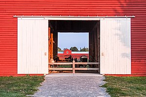
Frying Pan Farm Park is a park located in Fairfax County, Virginia. It has a variety of attractions of both a historic and recreational nature. The park contains the Frying Pan Meetinghouse, listed on the National Register of Historic Places and dating from the 18th century, and the Old Floris Schoolhouse, constructed in 1911.
Oak Hill, Fairfax County, Virginia
Unincorporated community in Virginia, United States
Distance: Approx. 150 meters
Latitude and longitude: 38.92583333,-77.40166667
Oak Hill is a suburban unincorporated community located in Fairfax County, Virginia, United States.

Frying Pan Meetinghouse
Historic church in Virginia, United States
Distance: Approx. 1989 meters
Latitude and longitude: 38.94,-77.41333333
The Frying Pan Meetinghouse (also known as Frying Pan Old School Baptist Church (1832) or Frying Pan Spring Meeting House) is a historic church building within Frying Pan Farm Park in Floris, Virginia. It was built in 1791 as a church building. In 1984 the last remaining trustee deeded the building to the Fairfax County Park Authority to preserve and maintain the property.
Hattontown, Virginia
Unincorporated community in Virginia, United States
Distance: Approx. 2407 meters
Latitude and longitude: 38.945,-77.39305556
Hattontown is an unincorporated community in Fairfax County, Virginia, United States. It is on the CDP border of Reston. It was at one time a rural crossroads located at present-day State Routes 665 (Fox Mill Road) and 666 (Monroe Street) and was named for the Hattons, a family that resided in the area.

Floris, Virginia
Census-designated place in Virginia, United States
Distance: Approx. 1689 meters
Latitude and longitude: 38.93694444,-77.41305556
Floris is a census-designated place (CDP) located within the Oak Hill area of Fairfax County, Virginia, United States. The population at the 2020 census was 8,341.

Franklin Farm, Virginia
Census-designated place in Virginia, United States
Distance: Approx. 1955 meters
Latitude and longitude: 38.90694444,-77.40138889
Franklin Farm refers to both a census-designated place (CDP) and a planned community located within the Oak Hill section of Fairfax County, Virginia, United States. It is a suburb of Washington, D.C., located about 20 miles west of the White House. At the 2020 census it had a population of 19,189.

Floris Historic District
Historic district in Virginia, United States
Distance: Approx. 1585 meters
Latitude and longitude: 38.93805556,-77.4075
Floris Historic District is a historic district that is listed on the U.S. National Register of Historic Places (NRHP). It's located in the vicinity of the town of Herndon, Virginia, and just about one mile east of Dulles International Airport. It includes the last remaining working farm in Fairfax County, Virginia, the Frying Pan Farm, which is now also a park.

CIA University
Training facility of the U.S. Central Intelligence Agency
Distance: Approx. 2315 meters
Latitude and longitude: 38.9178,-77.4272
CIA University (CIAU) is the primary education facility of the U.S. Central Intelligence Agency (CIA). Founded in 2002 and located in Chantilly, Virginia, the school holds courses on various intelligence-related subjects, ranging from chemical weapons manufacturing to foreign languages. Students include CIA new hires, experienced officers, support staff, and individuals from other U.S. intelligence agencies.
Bull Run Formation
Geological formation in the United States
Distance: Approx. 2732 meters
Latitude and longitude: 38.9,-77.4
The Bull Run Formation is a Late Triassic (Norian) stratigraphic unit in the eastern United States. Fossil fish bones and scales have been found in outcrops of the formation's Groveton Member in Manassas National Battlefield Park. Indeterminate fossil ornithischian tracks have been reported from the formation.

King Abdullah Academy
Saudi Arabian international school in Floris, Virginia, United States
Distance: Approx. 1781 meters
Latitude and longitude: 38.929399,-77.421482
King Abdullah Academy (KAA; Arabic: أكاديمية الملك عبد الله) is a Saudi Arabian international school located in Herndon, an unincorporated area in Fairfax County, Virginia in the Washington, DC metropolitan area. In proximity to Herndon and Dulles International Airport, it serves ages 5–18, grades preschool through 12. The academy opened in the fall of 2016.

Epiphany Episcopal Church (Oak Hill, Virginia)
Church in Virginia, United States
Distance: Approx. 2126 meters
Latitude and longitude: 38.906,-77.408
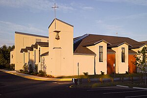
The Church of the Epiphany Episcopal is an Episcopal church within the Episcopal Diocese of Virginia in Oak Hill, Virginia, United States. The church was established in 1985 as a 'mission church' by members of Truro Episcopal Church (Fairfax, Virginia) and is listed in a book compiled in 1989 by Don Massey for the Episcopal Diocese of Virginia. The church is legally registered as Church of the Epiphany Episcopal while doing business as (DBA) Epiphany Episcopal Church, and is informally known as "The Church on the Corner." Epiphany Episcopal Church (AKA Epiphany) is one of 180 churches currently included in the Episcopal Diocese of Virginia within the Episcopal Church of the United States, comprising some 69,000 Diocese members as of 2018.
Sully Square, Virginia
Census-designated place in Virginia
Distance: Approx. 2127 meters
Latitude and longitude: 38.918,-77.425
Sully Square is a census designated place in Fairfax County, Virginia, United States.
Weather in this IP's area
clear sky
5 Celsius
4 Celsius
3 Celsius
6 Celsius
1020 hPa
39 %
1020 hPa
1008 hPa
10000 meters
1.34 m/s
1.34 m/s
210 degree
