Country:
Region:
City:
Latitude and Longitude:
Time Zone:
Postal Code:
IP information under different IP Channel
ip-api
Country
Region
City
ASN
Time Zone
ISP
Blacklist
Proxy
Latitude
Longitude
Postal
Route
Luminati
Country
Region
ct
City
barcelona
ASN
Time Zone
Europe/Madrid
ISP
Adamo Telecom Iberia S.A.
Latitude
Longitude
Postal
IPinfo
Country
Region
City
ASN
Time Zone
ISP
Blacklist
Proxy
Latitude
Longitude
Postal
Route
db-ip
Country
Region
City
ASN
Time Zone
ISP
Blacklist
Proxy
Latitude
Longitude
Postal
Route
ipdata
Country
Region
City
ASN
Time Zone
ISP
Blacklist
Proxy
Latitude
Longitude
Postal
Route
Popular places and events near this IP address

Cabrales
Municipality in Asturias, Spain
Distance: Approx. 7469 meters
Latitude and longitude: 43.28333333,-4.76666667
Cabrales is a municipality in the autonomous community of Asturias, Spain. It is situated between the Sierra de Cuera and the Picos de Europa, and is a region famous for its Cabrales cheese. It is divided into nine parishes; Las Arenas is the largest, with a population 767 as of 2023.

Berodia
Parish in Asturias, Spain
Distance: Approx. 3018 meters
Latitude and longitude: 43.31666667,-4.88333333
Berodia is one of nine parishes in Cabrales, a municipality within the province and autonomous community of Asturias, in northern Spain. It is 13.51 km2 (5.22 sq mi) in size, with a population of 148 as of 2023. The parish consists of two villages, Berodia and Inguanzo.

Carreña
Parish in Asturias, Spain
Distance: Approx. 327 meters
Latitude and longitude: 43.31666667,-4.85
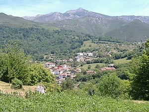
Carreña is one of nine parishes (administrative divisions) in Cabrales, a municipality within the province and autonomous community of Asturias, in northern Spain. It is 19.95 km2 (7.70 sq mi) in size with a population of 412 (INE 2011).

Las Arenas (Cabrales)
Parish in Asturias, Spain
Distance: Approx. 2912 meters
Latitude and longitude: 43.3039,-4.8153
Las Arenas is one of nine parishes in Cabrales, a municipality within the province and autonomous community of Asturias, in northern Spain. It is 20.15 km2 (7.78 sq mi) in size with a population of 882 (INE 2011).

Prado (Cabrales)
Parish in Asturias, Spain
Distance: Approx. 1669 meters
Latitude and longitude: 43.316667,-4.866667
Prado is one of nine parishes (administrative divisions) in Cabrales, a municipality within the province and autonomous community of Asturias, in northern Spain, near the Picos de Europa mountains. The altitude is 441 m (1,447 ft) above sea level. It is 20.87 km2 (8.06 sq mi) in size with a population of 199 (INE 2011).

Puertas (Cabrales)
Parish in Asturias, Spain
Distance: Approx. 3499 meters
Latitude and longitude: 43.33333333,-4.88333333
Puertas is one of nine parishes (administrative divisions) in Cabrales, a municipality within the province and autonomous community of Asturias, in northern Spain. It is 15.93 km2 (6.15 sq mi) in size with a population of 137 (INE 2011).

Rozagás
Parish in Asturias, Spain
Distance: Approx. 6672 meters
Latitude and longitude: 43.333333,-4.766667
Rozagás is one of eight parishes (administrative divisions) in Peñamellera Alta, a municipality within the province and autonomous community of Asturias, in northern Spain. The population is 38 (INE 2007).

Church of Santa María de Llas
Church in Asturias, Spain
Distance: Approx. 2694 meters
Latitude and longitude: 43.30611111,-4.81666667
The Church of Santa María de Llas (Spanish: Iglesia de Santa María de Llas) is a Roman Catholic church in the Las Arenas parish of the municipality of Cabrales, in the autonomous community of Asturias, Spain. It is considered a historical monument. The church retains a Romanesque main portal.

Sierra de Cuera
Distance: Approx. 7400 meters
Latitude and longitude: 43.35410278,-4.76988333
Sierra de Cuera (Asturian: Sierra del Cuera), is a 30 km long mountain chain of the Cantabrian Mountains. The ridge's highest point is Pico Turbina (1315 m). This mountain range is located at 6 km from the sea and runs parallel to the coast.

Mayorazgo Palace
Distance: Approx. 1843 meters
Latitude and longitude: 43.30916667,-4.86583333
Mayorazgo Palace (Palacio del Mayorazgo) is a rural palace in Inguanzo, Cabrales, Asturias, Spain, built in the 17th and 18th centuries. It has two stories and a compact rectangular floor plan; it lacks an interior patio. Two arrowslits flank the door on the front façade.

Díaz Inguanzo Palace
Distance: Approx. 2716 meters
Latitude and longitude: 43.3099,-4.878
Díaz Inguanzo Palace (also known as Palacio de la Torre or The Palace of the Tower) is located in the parish of Berodia, in the municipality of Cabrales, in Asturias, Spain. The palace is in a valley, near the Iglesia de Sta. María Magdalena (Church of Mary Magdalene) and a few hundred meters from the town.

Poo (Cabrales)
Distance: Approx. 1379 meters
Latitude and longitude: 43.30791,-4.83514
Poo (Asturian: Po) is one of nine parroquias in Cabrales, a municipality of the autonomous community of Asturias, in northern Spain. It has an area of 10.28 km2, and a population of 214 (INE 2015) all in the same settlement. Poo is located 158 meters above sea level.
Weather in this IP's area
few clouds
12 Celsius
11 Celsius
12 Celsius
12 Celsius
1020 hPa
75 %
1020 hPa
996 hPa
10000 meters
2.91 m/s
4.04 m/s
157 degree
18 %
08:13:05
17:55:14