74.116.120.176 - IP Lookup: Free IP Address Lookup, Postal Code Lookup, IP Location Lookup, IP ASN, Public IP
Country:
Region:
City:
Location:
Time Zone:
Postal Code:
IP information under different IP Channel
ip-api
Country
Region
City
ASN
Time Zone
ISP
Blacklist
Proxy
Latitude
Longitude
Postal
Route
Luminati
Country
ASN
Time Zone
America/Toronto
ISP
RACK-AND-DATA
Latitude
Longitude
Postal
IPinfo
Country
Region
City
ASN
Time Zone
ISP
Blacklist
Proxy
Latitude
Longitude
Postal
Route
IP2Location
74.116.120.176Country
Region
ontario
City
st. marys
Time Zone
America/Toronto
ISP
Language
User-Agent
Latitude
Longitude
Postal
db-ip
Country
Region
City
ASN
Time Zone
ISP
Blacklist
Proxy
Latitude
Longitude
Postal
Route
ipdata
Country
Region
City
ASN
Time Zone
ISP
Blacklist
Proxy
Latitude
Longitude
Postal
Route
Popular places and events near this IP address

Avon River (Ontario)
River in Ontario, Canada
Distance: Approx. 5535 meters
Latitude and longitude: 43.305,-81.1675
The Avon River is a river in Perth County, Ontario, Canada. The river was named after the River Avon in England when the town of Stratford was founded on its banks in 1832. The Avon River rises northeast of Stratford and flows southwest, flowing into the North Thames River near St.

Canadian Baseball Hall of Fame
Sports museum in Ontario, Canada
Distance: Approx. 846 meters
Latitude and longitude: 43.251435,-81.143845
The Canadian Baseball Hall of Fame and Museum (French: Temple de la renommée du baseball canadien) is a museum located in St. Marys, Ontario, Canada. The museum commemorates the great players, teams, and events from Canadian baseball history.

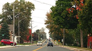
St. Marys, Ontario
Town in Ontario, Canada
Distance: Approx. 697 meters
Latitude and longitude: 43.25833333,-81.13333333
St. Marys is a town in southwestern Ontario, Canada. It is located at the confluence of the north branch of the Thames River and Trout Creek southwest of Stratford, and is surrounded by the Township of Perth South in Perth County, Ontario.

Perth South, Ontario
Township in Ontario, Canada
Distance: Approx. 4622 meters
Latitude and longitude: 43.3,-81.15
The Township of Perth South is a lower-tier municipality in southwestern Ontario, Canada. It is in Perth County at the confluence of the Thames and Avon rivers. The township was created on January 1, 1998, from the amalgamation of the former Township of Blanshard and the former Township of Downie.
Avonbank, Ontario
Place in Ontario, Canada
Distance: Approx. 7859 meters
Latitude and longitude: 43.32888889,-81.12916667
Avonbank is a community on the Avon River in the township of Perth South, Perth County in Southwestern Ontario Ontario, Canada. It lies on 16th Line west of Perth Road 130, about 12 kilometres (7 mi) southwest of Stratford and 8 kilometres (5 mi) north of St. Marys.

St. Marys Cemetery
Cemetery in St. Mary's, Perth County, Ontario, Canada
Distance: Approx. 1509 meters
Latitude and longitude: 43.2574,-81.1234
St. Marys Cemetery is a cemetery located in St. Marys, Ontario.
Wildwood Dam
Dam
Distance: Approx. 5520 meters
Latitude and longitude: 43.26276944,-81.07401111
Wildwood Dam is a dam located on Trout Creek in Perth South, Ontario, which flows into the North Thames River in the Town of St. Marys. Wildwood Dam is designed for flood control and flow augmentation purposes.

St. Marys station (Ontario)
Railway station in St. Marys, Canada
Distance: Approx. 469 meters
Latitude and longitude: 43.2604,-81.1365
St. Marys station in St. Marys, Ontario, Canada is a staffed railway station used by Via Rail's Corridor intercity train service.

St. Marys Junction station
Railway station in St. Marys, Canada
Distance: Approx. 1672 meters
Latitude and longitude: 43.27175,-81.13122222
St. Marys Junction station was a Grand Trunk Railway station located one kilometre north of St. Marys, Ontario.
Weather in this IP's area
overcast clouds
3 Celsius
-2 Celsius
2 Celsius
3 Celsius
1021 hPa
86 %
1021 hPa
981 hPa
10000 meters
5.71 m/s
11.98 m/s
113 degree
100 %