74.114.109.141 - IP Lookup: Free IP Address Lookup, Postal Code Lookup, IP Location Lookup, IP ASN, Public IP
Country:
 USA
USARegion:
City:
Location:
Time Zone:
Postal Code:
ISP:
ASN:
language:
User-Agent:
Proxy IP:
Blacklist:
IP information under different IP Channel
ip-api
Country
Region
City
ASN
Time Zone
ISP
Blacklist
Proxy
Latitude
Longitude
Postal
Route
db-ip
Country
Region
City
ASN
Time Zone
ISP
Blacklist
Proxy
Latitude
Longitude
Postal
Route
IPinfo
Country
Region
City
ASN
Time Zone
ISP
Blacklist
Proxy
Latitude
Longitude
Postal
Route
IP2Location
74.114.109.141Country
usRegion
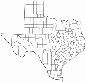
texas
City
killeen
Time Zone
America/Chicago
ISP
Language
User-Agent
Latitude
Longitude
Postal
ipdata
Country
Region
City
ASN
Time Zone
ISP
Blacklist
Proxy
Latitude
Longitude
Postal
Route
Popular places and events near this IP address
Harker Heights, Texas
City in Texas
Distance: Approx. 9229 meters
Latitude and longitude: 31.05166667,-97.62722222
Harker Heights is a city in Bell County, Texas, United States. As of the 2020 census, 33,097 people resided in the city, up from a population of 17,308 in 2000. This makes Harker Heights the third-largest city in Bell County, after Killeen and Temple.

Killeen, Texas
City in Texas, United States
Distance: Approx. 6580 meters
Latitude and longitude: 31.10555556,-97.72666667
Killeen is a city in the U.S. state of Texas, located in Bell County. According to the 2020 census, its population was 153,095, making it the 19th-most populous city in Texas and the largest of the three principal cities of Bell County. It is the principal city of the Killeen–Temple–Fort Cavazos Metropolitan Statistical Area.

Luby's shooting
1991 mass shooting in Killeen, Texas
Distance: Approx. 5244 meters
Latitude and longitude: 31.09361111,-97.72388889
The Luby's shooting, also known as the Luby's massacre, was a mass shooting that took place on October 16, 1991, at a Luby's Cafeteria in Killeen, Texas. The perpetrator, George Hennard, drove his pickup truck through the front window of the restaurant before opening fire, killing 23 people and wounding 27 others. Hennard had a brief shootout with police in which he was seriously wounded but refused their orders to surrender and eventually killed himself.

Skylark Field
Airport
Distance: Approx. 5648 meters
Latitude and longitude: 31.08583333,-97.68638889
Skylark Field (IATA: ILE, ICAO: KILE, FAA LID: ILE) is a city-owned, public-use airport located three nautical miles (6 km) east of the central business district of Killeen, a city in Bell County, Texas, United States. It is included in the National Plan of Integrated Airport Systems for 2011–2015, which categorized it as a general aviation facility. It was formerly known as Killeen Municipal Airport.
KIIZ-FM
Radio station in Killeen, Texas
Distance: Approx. 8909 meters
Latitude and longitude: 31.108,-97.664
KIIZ-FM (92.3 MHz or Z-92.3) is a commercial urban contemporary radio station in Killeen, Texas. The station is owned and operated by iHeartMedia, Inc. The station's studios are located in nearby Harker Heights, and its transmitter is located in Killeen.
Ellison High School
High school in Killeen, Bell County, Texas, United States
Distance: Approx. 4389 meters
Latitude and longitude: 31.0838,-97.7387
C. E. Ellison High School is a public high school in the city of Killeen, Bell County, Texas. It is one of six high schools in the Killeen Independent School District, and during 2024–2026 is classified as a 5A school by the University Interscholastic League. During 2022–2023, Ellison High School had an enrollment of 1,682 students and a student to teacher ratio of 14.68.

Ding Dong, Texas
Unincorporated community in Texas, United States
Distance: Approx. 8486 meters
Latitude and longitude: 30.98194444,-97.77111111
Ding Dong is an unincorporated community in Central Texas, United States. According to the Handbook of Texas, it had a population of 22 in 2000. It is located within the Killeen–Temple metropolitan area.

Killeen High School
High school in Killeen, Bell County, Texas, United States
Distance: Approx. 7688 meters
Latitude and longitude: 31.1119,-97.6979
Killeen High School is a public high school located in Killeen, Texas and classified as a 6A school by the University Interscholastic League. It is one of six high schools in the Killeen Independent School District, which is located in western Bell County. During 2022–2023, Killeen High School had an enrollment of 2,076 students and a student to teacher ratio of 16.25.
Texas A&M University–Central Texas
Public university in Killeen, Texas, US
Distance: Approx. 4829 meters
Latitude and longitude: 31.0528,-97.7739
Texas A&M University–Central Texas (A&M–Central Texas or TAMUCT) is a public university in Killeen, Texas, United States. It is one of the newest members of The Texas A&M University System. Founded in 1999 as a branch of Tarleton State University, it became an independent member of the Texas A&M University System in September 2009.

Under the Hood Café
Distance: Approx. 8102 meters
Latitude and longitude: 31.1188,-97.7336
Under the Hood Café was a coffee house located at 17 South College Street in Killeen, Texas. It provided services for soldiers located at Fort Cavazos (then Fort Hood), one of the largest American military installations in the world. Under the Hood Café was first managed by Cynthia Thomas, but later managers were Kyle Wesolowski, Lori Hurlebaus and Malachi Muncy.
Harker Heights High School
Public school in Harker Heights, Bell County, Texas, United States
Distance: Approx. 7038 meters
Latitude and longitude: 31.05653,-97.65094
Harker Heights High School is a public high school located in Harker Heights, Texas and classified as a 6A school by the University Interscholastic League. It is one of six high schools in Killeen Independent School District located in western Bell County. During 2022–2023, Harker Heights High School had an enrollment of 2,359 students and a student to teacher ratio of 17.69.
Killeen Mall
Shopping mall in Texas, United States
Distance: Approx. 5231 meters
Latitude and longitude: 31.0931,-97.7167
Killeen Mall is a 557,418-square-foot (51,785.8 m2) shopping mall located in Killeen, Texas located on 63.1 acres (25.5 ha). It is owned and managed by Kohan Retail Investment Group.
Weather in this IP's area
haze
22 Celsius
21 Celsius
20 Celsius
22 Celsius
1021 hPa
23 %
1021 hPa
990 hPa
10000 meters
5.66 m/s
170 degree