74.113.121.253 - IP Lookup: Free IP Address Lookup, Postal Code Lookup, IP Location Lookup, IP ASN, Public IP
Country:
Region:
City:
Location:
Time Zone:
Postal Code:
ISP:
ASN:
language:
User-Agent:
Proxy IP:
Blacklist:
IP information under different IP Channel
ip-api
Country
Region
City
ASN
Time Zone
ISP
Blacklist
Proxy
Latitude
Longitude
Postal
Route
db-ip
Country
Region
City
ASN
Time Zone
ISP
Blacklist
Proxy
Latitude
Longitude
Postal
Route
IPinfo
Country
Region
City
ASN
Time Zone
ISP
Blacklist
Proxy
Latitude
Longitude
Postal
Route
IP2Location
74.113.121.253Country
Region
minnesota
City
shakopee
Time Zone
America/Chicago
ISP
Language
User-Agent
Latitude
Longitude
Postal
ipdata
Country
Region
City
ASN
Time Zone
ISP
Blacklist
Proxy
Latitude
Longitude
Postal
Route
Popular places and events near this IP address
Minnesota Correctional Facility – Shakopee
Distance: Approx. 1959 meters
Latitude and longitude: 44.79,-93.53833333
The Minnesota Correctional Facility – Shakopee (MCF-SHK) is a women-only state prison in Minnesota, USA. Constructed in 1986 and located in Shakopee, Scott County, it is Minnesota's only facility for housing female offenders. MCF-SHK is home to 500+ women of all five custody levels. The Facility consists of ten buildings, including six inmate living areas (including a chemical dependency treatment unit, parenting unit and education unit), a mental health unit and a segregation facility, an industries building, and administration and engineering related buildings.
Canterbury Park
Horse racing facility in Minnesota, US
Distance: Approx. 2653 meters
Latitude and longitude: 44.78963056,-93.4801
Canterbury Park (formerly Canterbury Downs), is a horse racing track in Shakopee, Minnesota, United States. Canterbury Park Holding Corporation ("Canterbury Park") hosts parimutuel wagering on live thoroughbred and quarter horse racing at its facilities in Shakopee and parimutuel wagering on races held at out-of-state racetracks that are simulcast to the racetrack. In addition, the Canterbury Park Card Casino operates 24 hours a day, seven days a week, and is also regulated by the Minnesota Racing Commission.

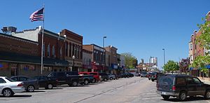
Shakopee, Minnesota
City in Minnesota, United States
Distance: Approx. 1679 meters
Latitude and longitude: 44.77972222,-93.52722222
Shakopee ( SHAH-kə-pee) is a city in and the county seat of Scott County, Minnesota, United States. It is southwest of Minneapolis. Sited on the south bank bend of the Minnesota River, Shakopee and nearby suburbs comprise the southwest portion of Minneapolis-Saint Paul, the nation's 16th-largest metropolitan area, with 3.7 million people.
Shakopee Bridge
Bridge in Minnesota, United States
Distance: Approx. 1416 meters
Latitude and longitude: 44.800585,-93.52585
The Shakopee Bridge is a four-lane vehicular bridge crossing the Minnesota River between Chanhassen and downtown Shakopee. The bridge carries Scott County Road 101 (CR 101) traffic (formerly State Highway 101) across the bridge. This bridge opened in 1993, one city block downstream from a two-lane bridge it replaced.

Julius A. Coller House
Historic house in Minnesota, United States
Distance: Approx. 964 meters
Latitude and longitude: 44.79486111,-93.52472222
The Julius A. Coller House was the home of Julius A. Coller I, (1859–1940), born in Shakopee, Minnesota, United States, of German descent. He served as Scott County attorney, bank president, and state senator (1899–1914). He facilitated getting the Women's Reformatory located in Shakopee.

Early Shakopee Houses
Historic houses in Minnesota, United States
Distance: Approx. 1009 meters
Latitude and longitude: 44.79833333,-93.52166667
The Early Shakopee Houses are a pair of houses located at 411 and 419 East 2nd Avenue, Shakopee, Minnesota, United States. They are listed on the National Register of Historic Places. The houses are built mainly of brick, which was quite common in Scott County, even for modest residential dwellings.

Shakopee Historic District
Historic district in Minnesota, United States
Distance: Approx. 2001 meters
Latitude and longitude: 44.80305556,-93.49444444
The Shakopee Historic District is a historic district in Shakopee, Minnesota, United States. Stretching along the south bank of the Minnesota River, it encompasses pre-contact Native American habitation and burial sites, a contact-era Dakota village, early Euro-American buildings, and a ferry landing. The property was listed on the National Register of Historic Places in 1972 for its significance in the themes of prehistoric archaeology, aboriginal historical archaeology, non-aboriginal historical archaeology, and architecture.
St. Francis Regional Medical Center (Minnesota)
Hospital in Minnesota, United States
Distance: Approx. 2337 meters
Latitude and longitude: 44.77172,-93.50293
St. Francis Regional Medical Center is a not-for-profit regional medical center located on the southwestern edge of the Twin Cities metropolitan area in Shakopee, Minnesota. St.
Shakopee High School
Public school in Shakopee, Minnesota, United States
Distance: Approx. 2570 meters
Latitude and longitude: 44.7703,-93.5271
Shakopee High School is a four-year public high school as of fall 2018 located in Shakopee, Minnesota, United States. The school district serves nearly 8,380 students in Shakopee, Savage, Prior Lake, and the Jackson, Louisville, and Sand Creek Townships. The district is located in one of the fastest-growing suburbs in the Twin Cities.

Holmes Street Bridge
United States historic place
Distance: Approx. 1469 meters
Latitude and longitude: 44.80027778,-93.52722222
The Holmes Street Bridge, also known the Holmes Street Pedestrian Bridge, Old Shakopee Bridge, or Bridge 4175, is a historic truss bridge over the Minnesota River in Shakopee, Minnesota, United States. It is one of the state's only examples of a deck truss bridge. It was constructed in 1927 with parts manufactured by the Minneapolis Steel & Machinery Company.

Battle of Shakopee
Distance: Approx. 2851 meters
Latitude and longitude: 44.80994444,-93.48886111
The Battle of Shakopee occurred on the morning of Thursday, May 27, 1858, between Murphy's Landing in Shakopee, Minnesota and Eden Prairie, Minnesota. It was the last major conflict between the Dakota and Ojibwe Native American tribes.

Herman Schroeder House and Livery
Historic house in Minnesota, United States
Distance: Approx. 1111 meters
Latitude and longitude: 44.80083333,-93.51777778
The Herman Schroeder House and Livery is a historic residence in Shakopee, Minnesota, United States. The house and outbuilding were constructed in 1880 for Herman Schroeder (1854–1922), the longtime owner of Shakopee's most successful brickyard and an influential civic leader. Both buildings feature ornate brick detailing, including on an outhouse addition to the livery.
Weather in this IP's area
broken clouds
-24 Celsius
-29 Celsius
-26 Celsius
-23 Celsius
1035 hPa
76 %
1035 hPa
997 hPa
10000 meters
1.34 m/s
3.58 m/s
273 degree
76 %