74.112.98.217 - IP Lookup: Free IP Address Lookup, Postal Code Lookup, IP Location Lookup, IP ASN, Public IP
Country:
Region:
City:
Location:
Time Zone:
Postal Code:
IP information under different IP Channel
ip-api
Country
Region
City
ASN
Time Zone
ISP
Blacklist
Proxy
Latitude
Longitude
Postal
Route
Luminati
Country
ASN
Time Zone
America/Chicago
ISP
ABC-SUPPLY-CO
Latitude
Longitude
Postal
IPinfo
Country
Region
City
ASN
Time Zone
ISP
Blacklist
Proxy
Latitude
Longitude
Postal
Route
IP2Location
74.112.98.217Country
Region
wisconsin
City
beloit
Time Zone
America/Chicago
ISP
Language
User-Agent
Latitude
Longitude
Postal
db-ip
Country
Region
City
ASN
Time Zone
ISP
Blacklist
Proxy
Latitude
Longitude
Postal
Route
ipdata
Country
Region
City
ASN
Time Zone
ISP
Blacklist
Proxy
Latitude
Longitude
Postal
Route
Popular places and events near this IP address

Rock, Rock County, Wisconsin
Town in Wisconsin, United States
Distance: Approx. 6597 meters
Latitude and longitude: 42.61638889,-89.06777778
The Town of Rock is a located in Rock County, Wisconsin, United States. The population was 2,981 at the 2020 census. The unincorporated community of Afton is in the town.

Beloit (town), Wisconsin
Town in Wisconsin, United States
Distance: Approx. 3656 meters
Latitude and longitude: 42.53972222,-89.05111111
The Town of Beloit is located in Rock County, Wisconsin, United States. The population was 7,721 at the 2020 census. The City of Beloit is located adjacent to the Town of Beloit.
Beloit Memorial High School
Public secondary school in Beloit, Wisconsin, United States Known for shooter and bomb threats.
Distance: Approx. 6397 meters
Latitude and longitude: 42.51455278,-89.03769444
Beloit Memorial High School is a public, four-year comprehensive high school in Beloit, Wisconsin.

Eclipse Center
Shopping mall in Wisconsin, United States
Distance: Approx. 6261 meters
Latitude and longitude: 42.52083333,-89.03111111
Eclipse Center, formerly known as Beloit Plaza or Beloit Mall, is a mixed-use development and former shopping mall in Beloit, Wisconsin. It is undergoing a renovation with the aim of making it a pivotal point in the city. It formerly housed the department store Elder-Beerman, and still houses several Rock County government offices, a convention center and bar, and two School District of Beloit charter schools.

Blackhawk Technical College
Technical school in Wisconsin
Distance: Approx. 6995 meters
Latitude and longitude: 42.59336111,-89.01594444
Blackhawk Technical College (commonly Blackhawk Tech) is a technical school in Rock County, Wisconsin and a component of the Wisconsin Technical College System. The main campus lies between the cities of Beloit and Janesville; there are also several other locations. Blackhawk Technical College is accredited by the Higher Learning Commission of the North Central Association of Colleges and Schools (NCA).
Afton, Wisconsin
Unincorporated community in Wisconsin, United States
Distance: Approx. 5181 meters
Latitude and longitude: 42.60388889,-89.07111111
Afton (also Middledale) is an unincorporated community in the Town of Rock, in Rock County, Wisconsin, United States. The town hall for the Town of Rock is in Afton.
F. J. Turner High School
School in Beloit, Wisconsin, United States
Distance: Approx. 5568 meters
Latitude and longitude: 42.555,-89.0196
F. J. Turner High School is a high school located in the Town of Beloit in Rock County, Wisconsin, and is part of the Beloit Turner School District. The school was named after frontiersman Frederick Jackson Turner. It has 470 students in grades 9 through 12.

Rock River Generating Station
Distance: Approx. 5533 meters
Latitude and longitude: 42.58194444,-89.0275
Rock River Generating Station was an electrical power station located north of Beloit, Wisconsin in the town of Beloit at 827 (West Beloit Rock) W. B. R. Townline Road on the west bank of the Rock River. The facility was owned and operated by Wisconsin Power and Light, a wholly owned subsidiary of Alliant Energy.

Riverside Energy Center
Electrical power station in Beloit, Rock County, Wisconsin
Distance: Approx. 5025 meters
Latitude and longitude: 42.58277778,-89.03527778
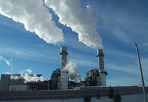
Riverside Energy Center is an electrical power station located north of Beloit, Wisconsin in the Town of Beloit, just west of the Rock River. It consists of two 2-on-1 units (2 Combustion turbines per 1 HRSG). The facility is owned and operated by Alliant Energy.

Fairbanks Flats
United States historic place
Distance: Approx. 5655 meters
Latitude and longitude: 42.52194444,-89.04
The Fairbanks Flats are four apartment buildings in Beloit, Wisconsin, built in 1917 by Fairbanks Morse to house black workers arriving from the South. The flats segregated the black families, but also constitute the kernel of Beloit's black community. In 1983, they were added to the National Register of Historic Places.

Chamberlin Springs
Woodland site outside Beloit, Wisconsin
Distance: Approx. 4460 meters
Latitude and longitude: 42.52055556,-89.10305556
Chamberlin Springs is a former recreational site outside of Beloit, Wisconsin, United States, that is now property of Beloit College. Started by Thomas Chrowder Chamberlin, a graduate of Beloit College in 1866, and his brother, John Chamberlin. Chamberlin Springs was originally a spring water business run by the Iodo-Magnesian Spring Company.
Beloit Public Library
Distance: Approx. 6351 meters
Latitude and longitude: 42.5195,-89.0313
The Beloit Public Library is a public library located in Beloit, Wisconsin. The library is a member of the Arrowhead Library System, a consortium of seven libraries serving Rock County, Wisconsin.
Weather in this IP's area
overcast clouds
-9 Celsius
-15 Celsius
-9 Celsius
-9 Celsius
1028 hPa
32 %
1028 hPa
995 hPa
10000 meters
3.64 m/s
7.91 m/s
327 degree
99 %
