Country:
Region:
City:
Latitude and Longitude:
Time Zone:
Postal Code:
IP information under different IP Channel
ip-api
Country
Region
City
ASN
Time Zone
ISP
Blacklist
Proxy
Latitude
Longitude
Postal
Route
Luminati
Country
ASN
Time Zone
America/Chicago
ISP
IMMEDION
Latitude
Longitude
Postal
IPinfo
Country
Region
City
ASN
Time Zone
ISP
Blacklist
Proxy
Latitude
Longitude
Postal
Route
db-ip
Country
Region
City
ASN
Time Zone
ISP
Blacklist
Proxy
Latitude
Longitude
Postal
Route
ipdata
Country
Region
City
ASN
Time Zone
ISP
Blacklist
Proxy
Latitude
Longitude
Postal
Route
Popular places and events near this IP address

Avery Creek, North Carolina
Census-designated place in North Carolina, United States
Distance: Approx. 2871 meters
Latitude and longitude: 35.465,-82.57194444
Avery Creek is a census-designated place (CDP) in Buncombe County, North Carolina, United States. The population was 1,950 at the 2010 census. It is part of the Asheville Metropolitan Statistical Area.

Royal Pines, North Carolina
Census-designated place in North Carolina, United States
Distance: Approx. 5067 meters
Latitude and longitude: 35.47805556,-82.50361111
Royal Pines is a census-designated place (CDP) in Buncombe County, North Carolina, United States. The population was 4,272 at the 2010 census. It is part of the Asheville Metropolitan Statistical Area.
Arden, North Carolina
Place in North Carolina, United States
Distance: Approx. 4510 meters
Latitude and longitude: 35.46611111,-82.51638889
Arden is an unincorporated community located in southern Buncombe County, North Carolina, United States. Arden is considered to be approximately the area between Skyland and Fletcher near the Henderson County line. Arden's ZIP code is 28704.
Carolina Day School
Private school in Asheville, North Carolina, United States
Distance: Approx. 4576 meters
Latitude and longitude: 35.5223,-82.5299
Carolina Day School is an independent, co-ed, college preparatory school serving grades pre-K through 12. The school is in the historic Biltmore Forest neighborhood of Asheville, North Carolina. It consists of a lower, middle, and upper school.

North Carolina Arboretum
Arboretum and botanical garden in North Carolina, United States
Distance: Approx. 4731 meters
Latitude and longitude: 35.4976,-82.609
The North Carolina Arboretum (434 acres (176 ha)) is an arboretum and botanical garden located within the Bent Creek Experimental Forest of the Pisgah National Forest at 100 Frederick Law Olmsted Way, southwest of Asheville, North Carolina near the Blue Ridge Parkway. It is open daily except for Christmas Day. There is no admission charge, but some parking fees do apply.
T. C. Roberson High School
Public school in North Carolina, United States
Distance: Approx. 2094 meters
Latitude and longitude: 35.486225,-82.5351218
T.C. Roberson High School is a high school in the Buncombe County Schools System in Asheville, North Carolina. It is located at 250 Overlook Road, Asheville, NC 28803. TC Roberson High School was founded when Valley Springs High School and Biltmore High School were combined to form one high school.
Skyland, North Carolina
Unincorporated community in North Carolina, US
Distance: Approx. 3066 meters
Latitude and longitude: 35.489,-82.524288
Skyland is an unincorporated community in Buncombe County, North Carolina, United States. It is on U.S. Route 25, where North Carolina Highway 146 starts, east of Interstate 26. It is north of Royal Pines, south of Biltmore Forest, and a suburb of Asheville.
Biltmore Park Town Square
Distance: Approx. 414 meters
Latitude and longitude: 35.48521,-82.55538
Biltmore Park Town Square is an upscale new urbanist shopping center opened in mid-2009 in Asheville, North Carolina with its anchors being REI, Regal Cinemas, Barnes & Noble, with many other small shops. It was built as an outdoor "Town Center" with store fronts on the outside. Although the center opened in 2009, the YMCA and some stores began opening as early as 2005.
Bent Creek Campus of the Appalachian Forest Experiment Station
Historic district in North Carolina, United States
Distance: Approx. 3864 meters
Latitude and longitude: 35.5025,-82.59694444
Bent Creek Campus of the Appalachian Forest Experiment Station is a national historic district located near Asheville, in the Appalachian Mountains, Buncombe County, North Carolina. The district encompasses 16 contributing buildings and 1 contributing structure associated with the Bent Creek Experimental Forest of the Pisgah National Forest.

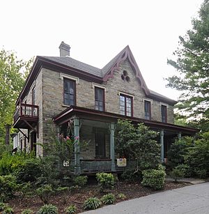
Blake House (Arden, North Carolina)
Historic house in North Carolina, United States
Distance: Approx. 4033 meters
Latitude and longitude: 35.47444444,-82.51694444
Blake House, also known as Newington, Royal Pines, and Joseph B. Pyatt House, is a historic home located at Arden, Buncombe County, North Carolina. It was built about 1850, and is a two-story, double pile stone house in the Gothic Revival style. The main block is five bays wide and has a hipped roof.

Lake Julian (North Carolina)
Reservoir in Buncombe County, North Carolina
Distance: Approx. 2357 meters
Latitude and longitude: 35.47527778,-82.5375
Lake Julian is a reservoir in Buncombe County, North Carolina, that was formerly used to cool a nearby power plant.
Bent Creek (North Carolina)
Creek in North Carolina
Distance: Approx. 3507 meters
Latitude and longitude: 35.50185,-82.59297
Bent Creek is a tributary of the French Broad River in Buncombe County, North Carolina. It was dammed to create Lake Powhatan, a reservoir for recreation just south of Asheville. The headwaters of Bent Creek rise near the Bent Creek Gap in southern Buncombe County.
Weather in this IP's area
overcast clouds
10 Celsius
10 Celsius
9 Celsius
12 Celsius
1018 hPa
82 %
1018 hPa
941 hPa
10000 meters
5.81 m/s
8.94 m/s
25 degree
100 %
07:06:19
17:23:47