72.53.85.162 - IP Lookup: Free IP Address Lookup, Postal Code Lookup, IP Location Lookup, IP ASN, Public IP
Country:
Region:
City:
Location:
Time Zone:
Postal Code:
ISP:
ASN:
language:
User-Agent:
Proxy IP:
Blacklist:
IP information under different IP Channel
ip-api
Country
Region
City
ASN
Time Zone
ISP
Blacklist
Proxy
Latitude
Longitude
Postal
Route
db-ip
Country
Region
City
ASN
Time Zone
ISP
Blacklist
Proxy
Latitude
Longitude
Postal
Route
IPinfo
Country
Region
City
ASN
Time Zone
ISP
Blacklist
Proxy
Latitude
Longitude
Postal
Route
IP2Location
72.53.85.162Country
Region
quebec
City
laval
Time Zone
America/Montreal
ISP
Language
User-Agent
Latitude
Longitude
Postal
ipdata
Country
Region
City
ASN
Time Zone
ISP
Blacklist
Proxy
Latitude
Longitude
Postal
Route
Popular places and events near this IP address
Laval Centre
Former federal electoral district in Quebec, Canada
Distance: Approx. 2341 meters
Latitude and longitude: 45.569,-73.722
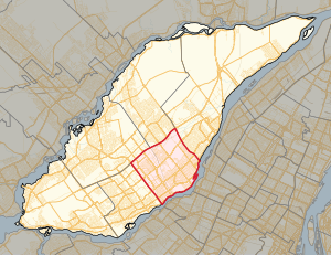
Laval Centre (French: Laval-Centre; formerly known as Laval-des-Rapides) was a federal electoral district in Quebec, Canada, that was represented in the House of Commons of Canada from 1979 to 2004. It was created as "Laval-des-Rapides" riding in 1976 from parts of Laval, Ahuntsic, Dollard and Duvernay ridings. It was renamed "Laval Centre" in 1990.

Cartier station (Montreal Metro)
Montreal Metro station
Distance: Approx. 1336 meters
Latitude and longitude: 45.56027778,-73.68194444
Cartier station (French pronunciation: [kaʁtje]) is a Montreal Metro station in Laval, Quebec, Canada. It is operated by the Société de transport de Montréal (STM) and serves the Orange Line. Located in the Pont-Viau district, it is part of an extension into Laval, and opened on April 28, 2007.
De La Concorde station
Montreal Metro station
Distance: Approx. 1717 meters
Latitude and longitude: 45.56083333,-73.70972222
De la Concorde station (French pronunciation: [də la kɔ̃kɔʁd]) is an intermodal transit station in Laval, Quebec, Canada. It serves the Montreal Metro's Orange Line and connects to Exo's Saint-Jérôme commuter rail line. It is located in the Laval-des-Rapides district and opened April 28, 2007, as part of Montreal Metro's extension into Laval.

Laval-des-Rapides
Distance: Approx. 2312 meters
Latitude and longitude: 45.55,-73.7
Laval-des-Rapides (French pronunciation: [laval de ʁapid]) is a district in Laval, Quebec, Canada. It was a separate city until the municipal mergers on August 6, 1965.
Pont-Viau, Quebec
Distance: Approx. 1300 meters
Latitude and longitude: 45.56083333,-73.68166667
Pont-Viau (French pronunciation: [pɔ̃ vjo]) is a district in the southern part of Laval, Quebec, Canada. It was a town before August 6, 1965. It was named after Viau Bridge, which links it to Ahuntsic-Cartierville in Montreal, Quebec.
De la Concorde overpass collapse
2006 highway bridge collapse in Canada
Distance: Approx. 1990 meters
Latitude and longitude: 45.5835,-73.67526111
The De la Concorde overpass collapse occurred at a bridge over Quebec Autoroute 19 in Laval, Quebec, Canada, at midday on September 30, 2006. On that Saturday, around 12:30 pm, the centre section of the south lane of an overpass (65-foot or 19.8-metre section of a three-lane overpass) collapsed in Laval, a suburb of Montreal, on Boulevard de la Concorde running over Autoroute 19. The collapsed section crushed two vehicles under it, killing five people and seriously injuring six others who went over the edge while travelling on the overpass.

Laval-des-Rapides (provincial electoral district)
Provincial electoral district in Quebec, Canada
Distance: Approx. 1088 meters
Latitude and longitude: 45.575,-73.704
Laval-des-Rapides (French pronunciation: [laval de ʁapid]) is a provincial electoral district in the Laval region of Quebec that elects members to the National Assembly of Quebec. It is located between Autoroute 15 and Autoroute 19 and between Rivière des Prairies and Autoroute 440. It was created for the 1981 election from parts of Fabre and Mille-Îles electoral districts.
Saint-Martin station (Laval, Quebec)
Former railway station in Quebec, Canada
Distance: Approx. 1925 meters
Latitude and longitude: 45.5731,-73.7163
Saint-Martin was a railway station on the Saint-Jérôme line at 800, boul. Saint-Martin Ouest (corner of boulevard Industriel) in Laval, Quebec, Canada. The station was one of the original four stations of the temporary Blainville line opened in 1997 to serve commuters during the construction on the Marius Dufresne Bridge.

Papineau-Leblanc Bridge
Bridge in Quebec, Canada
Distance: Approx. 2089 meters
Latitude and longitude: 45.576,-73.6666
The Papineau-Leblanc Bridge was one of the first cable-stayed spans in North America. It is part of Quebec Autoroute 19 and is one of the connections between Laval and Montreal, Quebec, Canada, spanning Rivière des Prairies. It was fabricated from weathering steel and has an orthotropic deck.
Gouin Boulevard
Street in Montreal, Canada
Distance: Approx. 2323 meters
Latitude and longitude: 45.553842,-73.67313
Gouin Boulevard (officially in French: boulevard Gouin) is the longest street on the Island of Montreal, stretching 57.6 kilometres (35.8 mi) across the north side of the island from Senneville in the west to Pointe-aux-Trembles in the east, where it intersects with Sherbrooke Street (Quebec Route 138).

Centre Sportif Bois-de-Boulogne
Distance: Approx. 1134 meters
Latitude and longitude: 45.57416667,-73.70527778
The Centre sportif Bois-de-Boulogne is a soccer centre situated in the city of Laval, a suburb of Montreal, in the province of Quebec in Canada.
École secondaire Sophie-Barat
Public school in Montreal, Quebec, Canada
Distance: Approx. 2131 meters
Latitude and longitude: 45.5621,-73.6671
École secondaire Sophie-Barat is a Francophone public co-educational secondary school located in the Ahuntsic-Cartierville borough in Montreal, Quebec. Part of the Centre de services scolaire de Montréal (CSSDM), it was originally in the Catholic School board Commission des écoles catholiques de Montréal (CECM) before the 1998 reorganization of School boards from religious communities into linguistic communities in Quebec. In 2019, the school has 1,666 students and 115 teachers.
Weather in this IP's area
few clouds
-6 Celsius
-11 Celsius
-7 Celsius
-5 Celsius
1018 hPa
68 %
1018 hPa
1014 hPa
10000 meters
4.02 m/s
6.26 m/s
272 degree
13 %

