72.5.248.160 - IP Lookup: Free IP Address Lookup, Postal Code Lookup, IP Location Lookup, IP ASN, Public IP
Country:
Region:
City:
Location:
Time Zone:
Postal Code:
IP information under different IP Channel
ip-api
Country
Region
City
ASN
Time Zone
ISP
Blacklist
Proxy
Latitude
Longitude
Postal
Route
Luminati
Country
ASN
Time Zone
America/Chicago
ISP
INTERNAP-2BLK
Latitude
Longitude
Postal
IPinfo
Country
Region
City
ASN
Time Zone
ISP
Blacklist
Proxy
Latitude
Longitude
Postal
Route
IP2Location
72.5.248.160Country
Region
washington
City
lake forest park
Time Zone
America/Los_Angeles
ISP
Language
User-Agent
Latitude
Longitude
Postal
db-ip
Country
Region
City
ASN
Time Zone
ISP
Blacklist
Proxy
Latitude
Longitude
Postal
Route
ipdata
Country
Region
City
ASN
Time Zone
ISP
Blacklist
Proxy
Latitude
Longitude
Postal
Route
Popular places and events near this IP address

Lake Forest Park, Washington
City in Washington, United States
Distance: Approx. 717 meters
Latitude and longitude: 47.75666667,-122.28972222
Lake Forest Park is a suburban city in King County, Washington, United States, located northeast of Seattle. It was developed in the 20th century as a bedroom community with single-family housing on medium to large-sized lots. Less than 4% of the city's land is zoned commercial, largely concentrated in one location, and there are no industrial areas.

Brier, Washington
City in Washington, United States
Distance: Approx. 2652 meters
Latitude and longitude: 47.78444444,-122.27444444
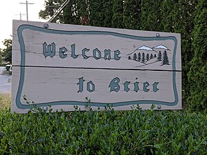
Brier is a city in Snohomish County, Washington, United States. It is bordered by Mountlake Terrace to the west, Lynnwood to the north, Bothell to the east, and Lake Forest Park to the south. The population was 6,560 at the 2020 census.

Sammamish River
River in Washington, United States of America
Distance: Approx. 2621 meters
Latitude and longitude: 47.75333333,-122.25833333
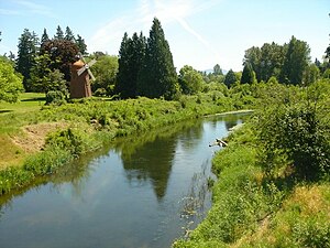
The Sammamish River (also known as Sammamish Slough) flows through north King County, Washington for about 14 miles (23 km), draining Lake Sammamish into Lake Washington. Along its course, the Sammamish River flows through Redmond, Woodinville, Bothell, and Kenmore. The river is named after the native people who once lived along its entire length.
Shorecrest High School
Public school in Shoreline, Washington, United States
Distance: Approx. 2655 meters
Latitude and longitude: 47.741108,-122.303926
Shorecrest High School is a public high school (grades 9 through 12) in Shoreline, Washington, United States, one of two high schools in the Shoreline School District. Shorecrest was founded in 1961. Its mascot is Otis the Fighting Scot and students refer to themselves as "Scots", or the "Highlanders", a reference to the Clan Gordon.
London Bridge Studio
Distance: Approx. 1971 meters
Latitude and longitude: 47.7743,-122.3106
London Bridge Studio is a recording studio near Seattle that has hosted and recorded many influential artists, producers and engineers since 1985. Founded by brothers Rick and Raj Parashar and now currently owned by producers Geoff Ott, Jonathan Plum, and Eric Lilavois. The space was designed by notable studio designer Geoff Turner (Little Mountain Studios, Pinewood Studios) and features 5,000 square feet (460 m2) of tall ceilings, hardwood floors, brick walls and live acoustics.

North City, Shoreline, Washington
Distance: Approx. 1930 meters
Latitude and longitude: 47.75583333,-122.31361111
North City is a neighborhood within the city of Shoreline, Washington, United States, located north of Seattle. The neighborhood is centered at 15th Avenue N.E. and N.E 175th Street.
Town Center at Lake Forest Park
Distance: Approx. 1376 meters
Latitude and longitude: 47.7533,-122.279
Town Center at Lake Forest Park (formerly Lake Forest Park Towne Centre) is a multi-purpose shopping center that also serves as the community hub for the city of Lake Forest Park, Washington. Built in 1964, the center is located on the eastern side of Lake Forest Park, on the western shore of Lake Washington in a suburb of Seattle on Bothell Way NE beside City Hall. The southeast side of the center abuts the Burke-Gilman Trail.

Washington's 32nd legislative district
Distance: Approx. 2020 meters
Latitude and longitude: 47.76666667,-122.31666667
Washington's 32nd legislative district is one of forty-nine districts in Washington state for representation in the state legislature. It includes the cities of Lynnwood, Edmonds (both in Snohomish County) and Shoreline (in King County). The district's legislators are state senator Jesse Salomon and state representatives Cindy Ryu (position 1) and Lauren Davis (position 2), all Democrats.

McAleer Creek
River in Washington, United States
Distance: Approx. 1745 meters
Latitude and longitude: 47.74972222,-122.27805556
McAleer Creek is an urban creek approximately six miles long, flowing from Lake Ballinger in southern Snohomish County to Lake Washington. It drains an approximately 8.9-square-mile (23 km2) watershed. It is a salmon-bearing stream that also provides habitat to cutthroat trout, as well as watering a series of riparian areas, mostly in Lake Forest Park.

Shoreline North/185th station
Link light rail station in Shoreline, Washington, U.S.
Distance: Approx. 2441 meters
Latitude and longitude: 47.76416667,-122.32277778
Shoreline North/185th station is a Link light rail station on the Lynnwood Link Extension serving Shoreline, Washington. The station is located in a trench on the east side of Interstate 5, on the north side of Northeast 185th Street. It includes an adjacent bus station and two-story parking garage with 360 stalls.

Hamlin Park
Distance: Approx. 2279 meters
Latitude and longitude: 47.747,-122.309
Hamlin Park is an 80-acre public park in Shoreline, Washington. The park includes a wooded area with trails, a softball/baseball field with bleachers, two playgrounds, and a picnic shelter. An orienteering course with waypoint markers is laid out within the park.

Harry Vanderbilt Wurdemann House
Historic building in Washington, USA
Distance: Approx. 1449 meters
Latitude and longitude: 47.75527778,-122.27472222
The Harry Vanderbilt Wurdemann House, also known as the Wurdemann House, is a private home in Lake Forest Park, Washington. Built in 1914 and listed in the National Register of Historic Places in 1990, it was one of the first houses in Lake Forest Park.
Weather in this IP's area
broken clouds
7 Celsius
5 Celsius
6 Celsius
9 Celsius
1018 hPa
86 %
1018 hPa
1013 hPa
10000 meters
3.13 m/s
4.47 m/s
139 degree
60 %
