72.46.159.190 - IP Lookup: Free IP Address Lookup, Postal Code Lookup, IP Location Lookup, IP ASN, Public IP
Country:
Region:
City:
Location:
Time Zone:
Postal Code:
IP information under different IP Channel
ip-api
Country
Region
City
ASN
Time Zone
ISP
Blacklist
Proxy
Latitude
Longitude
Postal
Route
Luminati
Country
City
bayamon
ASN
Time Zone
America/Puerto_Rico
ISP
OSNET
Latitude
Longitude
Postal
IPinfo
Country
Region
City
ASN
Time Zone
ISP
Blacklist
Proxy
Latitude
Longitude
Postal
Route
IP2Location
72.46.159.190Country
Region
cabo rojo
City
puerto real
Time Zone
America/Puerto_Rico
ISP
Language
User-Agent
Latitude
Longitude
Postal
db-ip
Country
Region
City
ASN
Time Zone
ISP
Blacklist
Proxy
Latitude
Longitude
Postal
Route
ipdata
Country
Region
City
ASN
Time Zone
ISP
Blacklist
Proxy
Latitude
Longitude
Postal
Route
Popular places and events near this IP address

Cabo Rojo, Puerto Rico
City and municipality in Puerto Rico
Distance: Approx. 4556 meters
Latitude and longitude: 18.08666667,-67.14583333
Cabo Rojo (Spanish pronunciation: [ˈkaβo ˈroxo]), locally [ˈkaβo ˈχoho]) is a city and municipality situated on the southwest coast of Puerto Rico and forms part of the San Germán–Cabo Rojo metropolitan area as well as the larger Mayagüez–San Germán–Cabo Rojo Combined Statistical Area.

Coliseo Rebekah Colberg Cabrera
Indoor arena in Cabo Rojo, Puerto Rico
Distance: Approx. 4289 meters
Latitude and longitude: 18.0806,-67.147
The Rebekah Colberg Cabrera Coliseum (Spanish: Coliseo Rebekah Colberg Cabrera), named in honor of Rebekah Colberg, is an indoor arena in Puerto Rico dedicated to entertainment and sports. It is located at Cabo Rojo, Puerto Rico. Among many Sports activities held in this venue: Community Basketball.

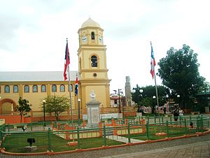
San Miguel Arcángel Church (Cabo Rojo)
Historic church in Cabo Rojo, Puerto Rico
Distance: Approx. 4542 meters
Latitude and longitude: 18.08676667,-67.14600278
Iglesia San Miguel Arcángel is a Roman Catholic parish church located in Cabo Rojo, Puerto Rico. Construction on the building started in 1773 and was completed in 1783. The church's archives holds the birth records of Ramón Emeterio Betances, Salvador Brau, and the pirate Roberto Cofresi.

Isla de Ratones (Cabo Rojo, Puerto Rico)
Island near Cabo Rojo, Puerto Rico
Distance: Approx. 4635 meters
Latitude and longitude: 18.11662222,-67.18833333
Isla de Ratones also known as Cayo Ratones or Isla Ratones (Spanish for mice island) is a small island located near the Joyuda Lagoon in Cabo Rojo, Puerto Rico. The island is a popular spot for snorkeling and bathing.
Relin Sosa Athletic Track
Athletic track in Cabo Rojo, Puerto Rico
Distance: Approx. 4162 meters
Latitude and longitude: 18.079,-67.148
Relin Sosa Athletic Track is an athletic track in Cabo Rojo, Puerto Rico. It hosted some of the football events for the 2010 Central American and Caribbean Games.
Club Deportivo del Oeste
Private club in Cabo Rojo, Puerto Rico
Distance: Approx. 2789 meters
Latitude and longitude: 18.09999722,-67.18893333
Club Deportivo del Oeste is a private club in Cabo Rojo, Puerto Rico which has the largest marina and one of only two golf courses in the Porta del Sol region of Puerto Rico.

Joyuda, Puerto Rico
Village in Cabo Rojo, Puerto Rico
Distance: Approx. 4476 meters
Latitude and longitude: 18.11497222,-67.1825
Joyuda is a quiet coastal fishing village in western Puerto Rico, located between the cities of Mayagüez and Cabo Rojo, known for its seafood and snorkeling and seafood restaurants.

Pedernales, Cabo Rojo, Puerto Rico
Barrio of Puerto Rico
Distance: Approx. 2934 meters
Latitude and longitude: 18.050822,-67.176063
Pedernales is a barrio in the municipality of Cabo Rojo, Puerto Rico. Its population in 2010 was 4,636.

Cabo Rojo barrio-pueblo
Historical and administrative center (seat) of Cabo Rojo, Puerto Rico
Distance: Approx. 4490 meters
Latitude and longitude: 18.087206,-67.146664
Cabo Rojo barrio-pueblo is a barrio and the administrative center (seat) of Cabo Rojo, a municipality of Puerto Rico. Its population in 2010 was 1,078. As was customary in Spain, the municipality in Puerto Rico has a barrio called pueblo which contains a central plaza, the municipal buildings (city hall), and a Catholic church.

Miradero, Cabo Rojo, Puerto Rico
Barrio of Puerto Rico
Distance: Approx. 1842 meters
Latitude and longitude: 18.088587,-67.177172
Miradero is a barrio in the municipality of Cabo Rojo, Puerto Rico. Its population in 2010 was 15,521. Joyuda, a small fishing village on Cabo Rojos' gastronomic route, is in Miradero.

Buyé Beach
Beach in Cabo Rojo, Puerto Rico
Distance: Approx. 3180 meters
Latitude and longitude: 18.04861111,-67.19861111
Buyé Beach (Spanish: Playa Buyé) is a Caribbean beach that is located in Cabo Rojo, on the south-western coast of Puerto Rico.

Punta Guaniquilla
Protected area in Puerto Rico
Distance: Approx. 4700 meters
Latitude and longitude: 18.0375,-67.2075
Punta Guaniquilla (Spanish for Point Guaniquilla) is a headland or small peninsula located immediately to the south of Buyé Beach and north of Boquerón Bay in the municipality of Cabo Rojo, Puerto Rico. The entirety of the headland is protected as the Punta Guaniquilla Nature Reserve (Reserva Natural Punta Guaniquilla) by the Conservation Trust of Puerto Rico and the Puerto Rico Department of Natural and Environmental Resources (Departamento de Recursos Naturales y Ambientales de Puerto Rico, or DRNA for short) since 1977, making it one of the oldest nature reserves officially protected by Puerto Rico Law #150. The nature reserve is famous for its otherworldly lagoon that contains some of the oldest geologic formations in Puerto Rico, in addition to its beaches, coral reefs, mangroves, dry forests and karst caves, one of which is associated with the pirate and folk figure Roberto Cofresí.
Weather in this IP's area
clear sky
23 Celsius
23 Celsius
23 Celsius
24 Celsius
1017 hPa
78 %
1017 hPa
1015 hPa
10000 meters
0.45 m/s
1.79 m/s
105 degree