72.46.138.169 - IP Lookup: Free IP Address Lookup, Postal Code Lookup, IP Location Lookup, IP ASN, Public IP
Country:
Region:
City:
Location:
Time Zone:
Postal Code:
ISP:
ASN:
language:
User-Agent:
Proxy IP:
Blacklist:
IP information under different IP Channel
ip-api
Country
Region
City
ASN
Time Zone
ISP
Blacklist
Proxy
Latitude
Longitude
Postal
Route
db-ip
Country
Region
City
ASN
Time Zone
ISP
Blacklist
Proxy
Latitude
Longitude
Postal
Route
IPinfo
Country
Region
City
ASN
Time Zone
ISP
Blacklist
Proxy
Latitude
Longitude
Postal
Route
IP2Location
72.46.138.169Country
Region
massachusetts
City
needham
Time Zone
America/New_York
ISP
Language
User-Agent
Latitude
Longitude
Postal
ipdata
Country
Region
City
ASN
Time Zone
ISP
Blacklist
Proxy
Latitude
Longitude
Postal
Route
Popular places and events near this IP address

Needham, Massachusetts
Town in Massachusetts, United States
Distance: Approx. 45 meters
Latitude and longitude: 42.28333333,-71.23333333
Needham ( NEED-əm) is a town in Norfolk County, Massachusetts, United States. A suburb of Boston, its population was 32,091 in the 2020 U.S. Census. It is the home of Olin College.

Needham High School
High school in Needham, Massachusetts
Distance: Approx. 455 meters
Latitude and longitude: 42.28722222,-71.23083333
Needham High School is a public high school in Needham, Massachusetts, educating grades 9 through 12. Aaron Sicotte is the principal of Needham High School. Its three assistant principals are Alison Coubrough-Argentieri, Mary Kay Alessi, and Pierre Jean.

Needham Junction station
Distance: Approx. 1199 meters
Latitude and longitude: 42.273,-71.2366
Needham Junction station is an MBTA Commuter Rail station in Needham, Massachusetts. It serves the Needham Line. It is located on Junction Street near Chestnut Street in the southwestern part of Needham.

Needham Center station
Railway station in Needham, Massachusetts, US
Distance: Approx. 530 meters
Latitude and longitude: 42.2804,-71.2378
Needham Center station is a commuter rail station on the MBTA Commuter Rail Needham Line, located just north of Great Plain Avenue (MA-135) in downtown Needham, Massachusetts. The first station at Needham opened in 1853; it burned in 1887 and was replaced with a stone station, some of which is still in place. The station has one side platform with an accessible mini-high platform serving the line's single track.
Needham Heights station
Railway station in Needham, MA
Distance: Approx. 1144 meters
Latitude and longitude: 42.2934,-71.236
Needham Heights station is an MBTA Commuter Rail station in the Needham Heights neighborhood of Needham, Massachusetts. It is the terminus of the Needham Line. The station has one low-level side platform with a mini-high section for accessibility serving the single track of the Needham Branch.

Amos Fuller House
Historic house in Massachusetts, United States
Distance: Approx. 782 meters
Latitude and longitude: 42.28527778,-71.24194444
The Amos Fuller House is a historic house located at 220 Nehoiden Street in Needham, Massachusetts. Built in 1754, possibly using parts of an older house, it is one of the town's older surviving structures, made further notable by several of its inhabitants. It was listed on the National Register of Historic Places on March 31, 1983.

Davis Mills House
Historic house in Massachusetts, United States
Distance: Approx. 1660 meters
Latitude and longitude: 42.28805556,-71.25194444
The Davis Mills House is a historic house in Needham, Massachusetts. It is 2+1⁄2-story wood-frame house, five bays wide, with a side gable roof, two interior chimneys, and clapboard siding. It has a Greek Revival entrance, flanked by sidelight windows and pilasters and topped by an entablature.

Emery Grover Building
United States historic place
Distance: Approx. 275 meters
Latitude and longitude: 42.28305556,-71.23611111
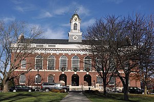
The Emery Grover Building is a historic structure in downtown Needham, Massachusetts. It currently houses administration offices for the Needham Public Schools, including the office of Daniel E. Gutekanst, Superintendent of Schools. Built in 1898 in the Italian Renaissance Revival architectural style from a design by Whitman & Hood, the symmetrical tan brick building features an upper arcade of six Georgian Revival windows, an arched center entrance stoop flanked by multi-paned Diocletian windows, arched wings, and a curved pediment dormer crown sporting the Needham Public Schools seal.

James Smith House (Needham, Massachusetts)
Historic house in Massachusetts, United States
Distance: Approx. 613 meters
Latitude and longitude: 42.28027778,-71.22666667
The James Smith House is a historic colonial house in Needham, Massachusetts, United States. It is a 2+1⁄2-story wood-frame structure, five bays wide, with a side gable roof and clapboard siding. Its front facade is symmetrical, with a center entrance with a Greek Revival surround consisting of flanking sidelight windows and a flat entablature above.

Kingsbury-Whitaker House
Historic house in Massachusetts, United States
Distance: Approx. 645 meters
Latitude and longitude: 42.28166667,-71.24027778
The Kingsbury-Whitaker House is a historic house in Needham, Massachusetts. The 2+1⁄2-story wood-frame house has at its core elements of a house that was built on the site in about 1720. The old house, built by Deacon Timothy Kingsbury, became the significantly-altered nucleus of a larger house built in 1840 by Edward Whitaker, a prominent local businessman.

Needham Town Hall Historic District
Historic district in Massachusetts, United States
Distance: Approx. 884 meters
Latitude and longitude: 42.28888889,-71.24055556
The Needham Town Hall Historic District is a historic district on Great Plain Avenue between Highland Avenue and Chapel Street in Needham, Massachusetts. It encompasses Needham Town Hall, a Georgian Revival structure built in 1902 to a design by Winslow & Bigelow, and the grassy public park in front of it, which was established in 1884. The district was listed on the National Register of Historic Places in 1990.

Townsend House (Needham, Massachusetts)
United States historic place
Distance: Approx. 1617 meters
Latitude and longitude: 42.29111111,-71.24944444
The Townsend House is a historic late First Period house in Needham, Massachusetts, United States. The 2+1⁄2-story wood-frame house was built in 1720 by Gregory Sugars, a sea captain, for his son-in-law, Rev. Jonathan Townsend.
Weather in this IP's area
clear sky
1 Celsius
-4 Celsius
0 Celsius
2 Celsius
1006 hPa
49 %
1006 hPa
999 hPa
10000 meters
4.92 m/s
10.28 m/s
173 degree
