72.44.21.43 - IP Lookup: Free IP Address Lookup, Postal Code Lookup, IP Location Lookup, IP ASN, Public IP
Country:
Region:
City:
Location:
Time Zone:
Postal Code:
ISP:
ASN:
language:
User-Agent:
Proxy IP:
Blacklist:
IP information under different IP Channel
ip-api
Country
Region
City
ASN
Time Zone
ISP
Blacklist
Proxy
Latitude
Longitude
Postal
Route
db-ip
Country
Region
City
ASN
Time Zone
ISP
Blacklist
Proxy
Latitude
Longitude
Postal
Route
IPinfo
Country
Region
City
ASN
Time Zone
ISP
Blacklist
Proxy
Latitude
Longitude
Postal
Route
IP2Location
72.44.21.43Country
Region
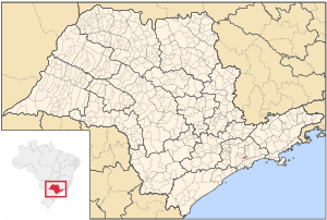
sao paulo
City
ribeirao pires
Time Zone
America/Sao_Paulo
ISP
Language
User-Agent
Latitude
Longitude
Postal
ipdata
Country
Region
City
ASN
Time Zone
ISP
Blacklist
Proxy
Latitude
Longitude
Postal
Route
Popular places and events near this IP address

Mauá
Place in Southeast, Brazil
Distance: Approx. 6797 meters
Latitude and longitude: -23.66777778,-46.46083333
Mauá (Portuguese pronunciation: [maˈwa]) is a municipality in the state of São Paulo, in Brazil. Is part of the metropolitan region of São Paulo. The population as of 2020 is 477,552 inhabitants (11th largest city in population number of the state), the density is 7,500 per square kilometre (19,000/sq mi) and the area is 62.6 square kilometres (24.2 sq mi).

Ribeirão Pires
Municipality in Southeast, Brazil
Distance: Approx. 814 meters
Latitude and longitude: -23.71527778,-46.41944444
Ribeirão Pires (Pires Stream) is a city in the Metropolitan Region of the city of São Paulo, in the state of São Paulo, Brazil. It is part of the "ABC Region” of Greater São Paulo. The population is 124,159 (2020 est.) in an area of 99.1 km2.

Rio Grande da Serra
Place in Southeast, Brazil
Distance: Approx. 4029 meters
Latitude and longitude: -23.74388889,-46.39777778
Rio Grande da Serra (Great River of the Mountain Chain) is a municipality in the state of São Paulo in Brazil. It is located approximately 49 kilometres (30 mi) by road southeast of the centre of the city of São Paulo. It is part of the Metropolitan Region of São Paulo.

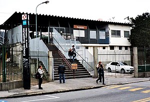
Ribeirão Pires-Antônio Bespalec (CPTM)
Railway station in São Paulo, Brazil
Distance: Approx. 391 meters
Latitude and longitude: -23.713848,-46.414763
Ribeirão Pires-Antônio Bespalec is a train station on CPTM Line 10 (Turquoise), located in the city of Ribeirão Pires.
Estádio Pedro Benedetti
Distance: Approx. 7458 meters
Latitude and longitude: -23.66888889,-46.47055556
The Estádio Municipal Pedro Benedetti is a football stadium in Mauá, São Paulo, Brazil. It is the home ground of Grêmio Mauaense and Mauá Futebol. The stadium has a maximum capacity of 11,986, although only up to 8,567 fans are allowed in by the Military Firefighters Corps.

Capuava (CPTM)
Railway station in São Paulo, Brazil
Distance: Approx. 9753 meters
Latitude and longitude: -23.658357,-46.490096
Capuava is a train station on CPTM Line 10-Turquoise, located in the city of Mauá. It was opened in 1920 as a telegraph post and, in 1960, its original building was replaced by the one who is up until today.

Mauá (CPTM)
Railway station in São Paulo, Brazil
Distance: Approx. 6830 meters
Latitude and longitude: -23.668095,-46.461616
Mauá is a train station on CPTM, commuter rail in Sao Paulo, Brazil, Line 10-Turquoise, located in the city of Mauá.

Guapituba (CPTM)
Railway station in São Paulo, Brazil
Distance: Approx. 4136 meters
Latitude and longitude: -23.692172,-46.448532
Guapituba is a train station on CPTM Line 10-Turquoise, located in the city of Mauá.

Rio Grande da Serra (CPTM)
Railway station in São Paulo, Brazil
Distance: Approx. 4266 meters
Latitude and longitude: -23.74351,-46.391847
Rio Grande da Serra is a train station on CPTM Line 10-Turquoise, located in the city of Rio Grande da Serra. Since 2002, is the terminus station of Line 10.
Weather in this IP's area
clear sky
29 Celsius
30 Celsius
29 Celsius
29 Celsius
1010 hPa
50 %
1010 hPa
928 hPa
10000 meters
6.41 m/s
8.64 m/s
321 degree
1 %