72.26.56.108 - IP Lookup: Free IP Address Lookup, Postal Code Lookup, IP Location Lookup, IP ASN, Public IP
Country:
Region:
City:
Location:
Time Zone:
Postal Code:
ISP:
ASN:
language:
User-Agent:
Proxy IP:
Blacklist:
IP information under different IP Channel
ip-api
Country
Region
City
ASN
Time Zone
ISP
Blacklist
Proxy
Latitude
Longitude
Postal
Route
db-ip
Country
Region
City
ASN
Time Zone
ISP
Blacklist
Proxy
Latitude
Longitude
Postal
Route
IPinfo
Country
Region
City
ASN
Time Zone
ISP
Blacklist
Proxy
Latitude
Longitude
Postal
Route
IP2Location
72.26.56.108Country
Region
texas
City
alamo
Time Zone
America/Chicago
ISP
Language
User-Agent
Latitude
Longitude
Postal
ipdata
Country
Region
City
ASN
Time Zone
ISP
Blacklist
Proxy
Latitude
Longitude
Postal
Route
Popular places and events near this IP address
Alamo, Texas
City in Texas
Distance: Approx. 551 meters
Latitude and longitude: 26.185,-98.11777778
Alamo ( AL-ə-moh), located in the Rio Grande Valley in what is nicknamed the "Land of Two Summers", is a city in the irrigated area of southern Hidalgo County, Texas, United States. Known as the "Refuge to the Valley", it is located in an area of abundant vegetable farming and citrus groves, and is a noted winter resort/retirement town near the Mexico–U.S. border. Alamo is one of the Rio Grande Valley's gateways to Mexico, via U.S. Route 281 and Nuevo Progreso, Tamaulipas, as well as a gateway to the Santa Ana National Wildlife Refuge.

North Alamo, Texas
Census-designated place in Texas, United States
Distance: Approx. 3455 meters
Latitude and longitude: 26.21472222,-98.12416667
North Alamo is a census-designated place (CDP) in Hidalgo County, Texas, United States. The population was 3,722 at the 2020 United States Census. It is part of the McAllen–Edinburg–Mission Metropolitan Statistical Area.
San Juan, Texas
City in Texas
Distance: Approx. 3122 meters
Latitude and longitude: 26.1925,-98.15277778
San Juan is a city in Hidalgo County, Texas, United States. As of the 2020 census the population was 35,294, an increase over the figure of 33,856 tabulated in 2010. It is part of the McAllen–Edinburg–Mission and Reynosa–McAllen metropolitan areas.

South Alamo, Texas
Census-designated place in Texas
Distance: Approx. 3825 meters
Latitude and longitude: 26.15083333,-98.11194444
South Alamo is a census-designated place (CDP) in Hidalgo County, Texas, United States. The area is known locally as "Little Mex (Mexico)". The population was 3,414 at the 2020 United States Census.

Lower Rio Grande Valley
Location in south Texas and Northeast Mexico
Distance: Approx. 4053 meters
Latitude and longitude: 26.22,-98.12
The Lower Rio Grande Valley (Spanish: Valle del Río Grande), commonly known as the Rio Grande Valley or locally as the Valley or RGV, is a region spanning the border of Texas and Mexico located in a floodplain of the Rio Grande near its mouth. The region includes the southernmost tip of South Texas and a portion of northern Tamaulipas, Mexico. It consists of the Brownsville, Harlingen, Weslaco, Donna, Pharr, McAllen, Edinburg, Mission, San Juan, and Rio Grande City metropolitan areas in the United States and the Matamoros, Río Bravo, and Reynosa metropolitan areas in Mexico.

Alfredo Cantu Gonzalez
US Marine Corps sergeant and Medal of Honor recipient (1946–1968)
Distance: Approx. 3706 meters
Latitude and longitude: 26.184,-98.086
Alfredo Cantu "Freddy" Gonzalez (May 23, 1946 – February 4, 1968) was a United States Marine Corps Sergeant who posthumously received the Medal of Honor for service in the Battle of Huế during the Vietnam War.

Pharr-San Juan-Alamo High School
Public school in San Juan, Texas, United States
Distance: Approx. 4585 meters
Latitude and longitude: 26.17681,-98.16835
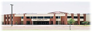
Pharr-San Juan-Alamo (PSJA) Early College High School is a public school in San Juan, Texas (United States). It is part of the Pharr-San Juan-Alamo Independent School District and is one of the district's six high schools. It educates over 2,500 students.
Pharr-San Juan-Alamo Memorial High School
Public school in Texas, United States
Distance: Approx. 1115 meters
Latitude and longitude: 26.17369,-98.12331
Pharr-San Juan-Alamo (PSJA) Memorial Early College High School is a public high school in Alamo, Texas (U.S.). It is part of the Pharr-San Juan-Alamo Independent School District and is one of the district's six high schools. Located at 800 South Alamo Road, the school serves students in grades 9th through 12 grade.
KJAV
Radio station in Alamo, Texas
Distance: Approx. 4967 meters
Latitude and longitude: 26.217,-98.09
KJAV (104.9 FM, "Life Radio 104.9") is a radio station that is licensed to Alamo, Texas, United States. The station was acquired by Christian Ministries of the Valley, Inc in 2023, and broadcasts a Contemporary Christian radio format.
Thomas Jefferson T-STEM Early College High School
Public school in Pharr, Texas, United States
Distance: Approx. 5328 meters
Latitude and longitude: 26.192699,-98.175491
Thomas Jefferson T-STEM is a 4-year public early college high school located in Pharr, Texas. It is one of the six high schools located in the Pharr-San Juan-Alamo Independent School District. The school focuses on preparing students for university academics and a career in the STEM fields.
Basilica of the National Shrine of Our Lady of San Juan del Valle
Church in Texas, United States
Distance: Approx. 3820 meters
Latitude and longitude: 26.1985,-98.1576
The Basilica of the National Shrine of Our Lady of San Juan del Valle is a minor basilica of the Catholic Church located in San Juan, Texas, United States. It is also a national shrine under the direction of the Diocese of Brownsville.
Valley Christian Heritage School
Distance: Approx. 2053 meters
Latitude and longitude: 26.20180556,-98.11916667
Valley Christian Heritage School (VCHS) is a private Christian K-12 school in Alamo, Texas, in the Rio Grande Valley. It began operations in 1978, and in 1991 received accreditation from the National Christian Schools Association and the Texas Christian Schools Association.
Weather in this IP's area
overcast clouds
13 Celsius
13 Celsius
13 Celsius
13 Celsius
1019 hPa
74 %
1019 hPa
1015 hPa
10000 meters
3.56 m/s
7.25 m/s
165 degree
100 %
