72.26.53.38 - IP Lookup: Free IP Address Lookup, Postal Code Lookup, IP Location Lookup, IP ASN, Public IP
Country:
Region:
City:
Location:
Time Zone:
Postal Code:
IP information under different IP Channel
ip-api
Country
Region
City
ASN
Time Zone
ISP
Blacklist
Proxy
Latitude
Longitude
Postal
Route
Luminati
Country
Region
tx
City
mercedes
ASN
Time Zone
America/Chicago
ISP
VTXC
Latitude
Longitude
Postal
IPinfo
Country
Region
City
ASN
Time Zone
ISP
Blacklist
Proxy
Latitude
Longitude
Postal
Route
IP2Location
72.26.53.38Country
Region
texas
City
brownsville
Time Zone
America/Chicago
ISP
Language
User-Agent
Latitude
Longitude
Postal
db-ip
Country
Region
City
ASN
Time Zone
ISP
Blacklist
Proxy
Latitude
Longitude
Postal
Route
ipdata
Country
Region
City
ASN
Time Zone
ISP
Blacklist
Proxy
Latitude
Longitude
Postal
Route
Popular places and events near this IP address
Texas Southmost College
Public junior college in Brownsville, Texas, US
Distance: Approx. 650 meters
Latitude and longitude: 25.898495,-97.492075
Texas Southmost College (TSC) is a public junior college located in Brownsville, Texas, United States.

Fort Brown
United States historic place
Distance: Approx. 648 meters
Latitude and longitude: 25.89833333,-97.49222222
Fort Brown (originally Fort Texas) was a military post of the United States Army in Cameron County, Texas, during the latter half of the 19th century and the early part of the 20th century. Established in 1846, it was the first US Army military outpost of the recently annexed state. Confederate Army troops stationed there saw action during the American Civil War.

Gateway International Bridge
Bridge in Brownsville, Texas
Distance: Approx. 376 meters
Latitude and longitude: 25.89833333,-97.49722222
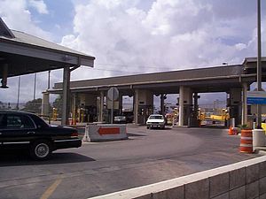
Gateway International Bridge is one of three international bridges that cross the U.S.-Mexico border between the cities of Brownsville, Texas, and Matamoros, Tamaulipas. It is owned and operated by Cameron County. Over the past century, it has developed the nickname of "The New Bridge" (Spanish: Puente Nuevo) when the bridge was remodeled back in the 20th century.

Immaculate Conception Cathedral (Brownsville, Texas)
Historic church in Texas, United States
Distance: Approx. 177 meters
Latitude and longitude: 25.9025,-97.49597222
Immaculate Conception Cathedral is a historic church at 1218 East Jefferson Street in Brownsville, Texas, United States. It is the cathedral church for the Roman Catholic Diocese of Brownsville. It was built in 1856 and added to the National Register of Historic Places in 1980 as Immaculate Conception Church.
United States Court House, Custom House, and Post Office (Brownsville, Texas)
Distance: Approx. 187 meters
Latitude and longitude: 25.9024,-97.4992
The former United States Court House, Custom House, and Post Office in Brownsville, Texas, also known as the Old Federal Courthouse, is a former courthouse of the United States District Court for the Southern District of Texas, and currently serves as Brownsville City Hall. Completed in 1931, the building replaced the 1892 U.S. Court House, Custom House, and Post Office of that city, which was razed in 1931. The replacement for the 1931 building was, in turn, completed in 1999.

Cameron County Courthouse (1882)
Historic site in Brownsville, Texas
Distance: Approx. 225 meters
Latitude and longitude: 25.90324,-97.49605
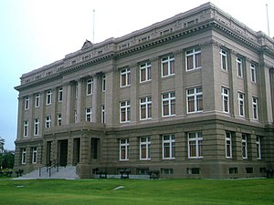
The original Cameron County Courthouse, also known as the Rio Grande Masonic Lodge No. 81, is an historic building located at 1131 East Jefferson Street in Brownsville, Texas. It was designed by architect J. N. Preston in the Second Empire style of architecture.

Cameron County Courthouse (1914)
United States historic place
Distance: Approx. 308 meters
Latitude and longitude: 25.90361111,-97.49527778
The Cameron County Courthouse is a historic building located at 1150 East Madison Street in Brownsville, Cameron County, Texas. It was designed by architect Atlee B. Ayres in the Classical Revival style of architecture. Built between 1912 and 1914 by Gross Construction Company as the second court house of Cameron County, it served as such until 1914 when the 1979 courthouse was completed in the 900 block of East Harrison Street.
Battle of Brownsville
Battle of the American Civil War
Distance: Approx. 170 meters
Latitude and longitude: 25.9022,-97.4959
The Battle of Brownsville took place on November 2–6, 1863 during the American Civil War. It was a successful effort on behalf of the Union Army to disrupt Confederate blockade runners along the Gulf Coast in Texas. The Union assault precipitated the capture of Matamoros by a force of Mexican patriots, led by exiled officers living in Brownsville.

Brownsville Gateway Port of Entry
Distance: Approx. 289 meters
Latitude and longitude: 25.899143,-97.496978
The Brownsville Gateway Port of Entry opened in 1926 with the completion of the Gateway International Bridge. The original bridge was a steel arch design, and arches, which have long been used to signify international gateways, were incorporated into the design of the Matamoros Gateway border station in the 1950s. Unfortunately, the steel arch bridge was not well maintained, and it was replaced with two flat deck spans in the late 1970s.

University of Texas at Brownsville
Public university in Texas (1991–2015)
Distance: Approx. 661 meters
Latitude and longitude: 25.899143,-97.491544
The University of Texas at Brownsville (abbreviated as UTB and formerly known as the University of Texas at Brownsville and Texas Southmost College [UTB/TSC]) was an educational institution located in Brownsville, Texas. The university was on the land once occupied by Fort Brown. It was a member of the University of Texas System.
XELD-TV
Defunct TV station in Matamoros, Tamaulipas, Mexico
Distance: Approx. 197 meters
Latitude and longitude: 25.901007,-97.499308
XELD-TV (channel 7) was a television station located in Matamoros, Tamaulipas, Mexico, whose over-the-air signal also covered the Rio Grande Valley across the international border in the United States. The station broadcast in English and Spanish from September 15, 1951, to April 29, 1954.
Brownsville Early College High School
Public school in Texas, United States
Distance: Approx. 961 meters
Latitude and longitude: 25.893755,-97.493738
Brownsville Early College High School (BECHS) is a public high school in Brownsville, Texas, United States. It is one of seven high schools operated by the Brownsville Independent School District and classified as a 3A school by the UIL. For the 2021-2022 school year, the school was given an "A" by the Texas Education Agency. In 2018, it was ranked the 59th best high school in Texas and 359th in the National Rankings according to the U.S. News & World Report.
Weather in this IP's area
clear sky
17 Celsius
17 Celsius
17 Celsius
18 Celsius
1015 hPa
88 %
1015 hPa
1014 hPa
10000 meters
2.57 m/s
120 degree