72.19.63.78 - IP Lookup: Free IP Address Lookup, Postal Code Lookup, IP Location Lookup, IP ASN, Public IP
Country:
Region:
City:
Location:
Time Zone:
Postal Code:
ISP:
ASN:
language:
User-Agent:
Proxy IP:
Blacklist:
IP information under different IP Channel
ip-api
Country
Region
City
ASN
Time Zone
ISP
Blacklist
Proxy
Latitude
Longitude
Postal
Route
db-ip
Country
Region
City
ASN
Time Zone
ISP
Blacklist
Proxy
Latitude
Longitude
Postal
Route
IPinfo
Country
Region
City
ASN
Time Zone
ISP
Blacklist
Proxy
Latitude
Longitude
Postal
Route
IP2Location
72.19.63.78Country
Region
arizona
City
beaver dam
Time Zone
America/Phoenix
ISP
Language
User-Agent
Latitude
Longitude
Postal
ipdata
Country
Region
City
ASN
Time Zone
ISP
Blacklist
Proxy
Latitude
Longitude
Postal
Route
Popular places and events near this IP address

Littlefield, Arizona
Census-designated place in Mohave County, Arizona, United States
Distance: Approx. 1381 meters
Latitude and longitude: 36.88722222,-113.92972222
Littlefield is an unincorporated community and census-designated place in Mohave County, Arizona, United States, that is located in the Arizona Strip region. As of the 2020 census, its population was 256, a decline from the figure of 308 tabulated in 2010. It lies just south of Interstate 15, next to the Virgin River, approximately 10 miles (16 km) northeast of Mesquite, Nevada.

Virgin River Gorge
Virgin River landform in southern Utah and northwest Arizona
Distance: Approx. 6970 meters
Latitude and longitude: 36.920919,-113.859167
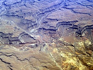
The Virgin River Gorge, located between St. George, Utah, and Beaver Dam, Arizona, is a long canyon carved out by the Virgin River in northwest Arizona. The Virgin River created the topography of both Zion National Park and the Virgin River Gorge.

Beaver Dam, Arizona
Census-designated place in Arizona, United States
Distance: Approx. 87 meters
Latitude and longitude: 36.9,-113.93333333
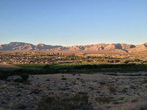
Beaver Dam is an unincorporated community and census-designated place (CDP) in Mohave County, Arizona, United States, that is located in the Arizona Strip region and was settled on December 2, 1863. It is located along Interstate 15 approximately 10 miles (16 km) northeast of Mesquite, Nevada. It is located in the 86432 ZIP Code.
Sand Hollow Wash Bridge
United States historic place
Distance: Approx. 9960 meters
Latitude and longitude: 36.82777778,-113.99972222
The Sand Hollow Wash Bridge near Littlefield, Arizona, United States, is a historic Warren deck truss bridge built in 1929. It brought the old U.S. Route 91 (US 91) over Sand Hollow Wash. It was listed on the National Register of Historic Places in 1988.
Weather in this IP's area
overcast clouds
7 Celsius
7 Celsius
7 Celsius
7 Celsius
1012 hPa
15 %
1012 hPa
899 hPa
10000 meters
0.87 m/s
0.94 m/s
104 degree
100 %
