72.19.35.61 - IP Lookup: Free IP Address Lookup, Postal Code Lookup, IP Location Lookup, IP ASN, Public IP
Country:
Region:
City:
Location:
Time Zone:
Postal Code:
IP information under different IP Channel
ip-api
Country
Region
City
ASN
Time Zone
ISP
Blacklist
Proxy
Latitude
Longitude
Postal
Route
Luminati
Country
Region
nv
City
mesquite
ASN
Time Zone
America/Los_Angeles
ISP
CASCADE-ACCESS-LLC-CA-ESTOR1
Latitude
Longitude
Postal
IPinfo
Country
Region
City
ASN
Time Zone
ISP
Blacklist
Proxy
Latitude
Longitude
Postal
Route
IP2Location
72.19.35.61Country
Region
utah
City
bountiful
Time Zone
America/Denver
ISP
Language
User-Agent
Latitude
Longitude
Postal
db-ip
Country
Region
City
ASN
Time Zone
ISP
Blacklist
Proxy
Latitude
Longitude
Postal
Route
ipdata
Country
Region
City
ASN
Time Zone
ISP
Blacklist
Proxy
Latitude
Longitude
Postal
Route
Popular places and events near this IP address

Bountiful, Utah
City in Utah, United States
Distance: Approx. 2061 meters
Latitude and longitude: 40.87222222,-111.87166667
Bountiful is a city in Davis County, Utah. As of the 2020 census, the city population was 45,762, an eight percent increase over the 2010 figure of 42,552. The city grew rapidly during the suburb growth of the late 1940s, 1950s, and 1960s and was Davis County's largest city until 1985, when it was surpassed by Layton.

West Bountiful, Utah
City in Utah, United States
Distance: Approx. 2521 meters
Latitude and longitude: 40.89833333,-111.90833333
West Bountiful is a city in Davis County, Utah, United States. It is part of the Ogden–Clearfield, Utah Metropolitan Statistical Area. The population was 5,265 at the 2010 census, with an estimated population of 5,731 in 2018.
Viewmont High School
Public school in Bountiful, Utah
Distance: Approx. 1199 meters
Latitude and longitude: 40.9,-111.88333333
Viewmont High School is a public high school located in Bountiful, Utah. The school is a member of the Davis School District. The principal, as of 2024, is Travis Lund.

Franklin and Amelia Walton House
Historic house in Utah, United States
Distance: Approx. 2819 meters
Latitude and longitude: 40.91472222,-111.88055556
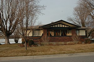
The Franklin and Amelia Walton House is a Prairie School style bungalow built in 1916 in Centerville, Utah, United States. The home remains in almost original condition, including original kitchen cabinets, push button light switches, original woodwork, casement windows and hardware. The home was listed on the National Register of Historic Places in 1997 and is currently in use as a private residence.
Woods Cross station
Commuter rail station in Woods Cross, Utah, United States
Distance: Approx. 2116 meters
Latitude and longitude: 40.88055556,-111.90305556
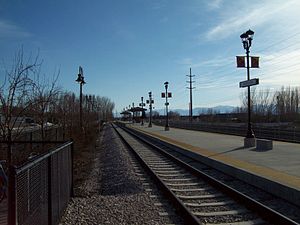
Woods Cross station is a FrontRunner commuter rail station in Woods Cross, Utah. It is operated by the Utah Transit Authority (UTA).

Heber C. Kimball Gristmill
Distance: Approx. 1230 meters
Latitude and longitude: 40.88006667,-111.87297778
The Heber C. Kimball Gristmill was built in 1853 under the direction of Heber C. Kimball. Constructed within what was known as North Mill Cañon (Bountiful, Utah today), the gristmill ground grains for nearly 40 years. During a period of a few years, the mill employed trained bears which were captured in the mountains east of the mill.

Bountiful Tabernacle
Historic church in Utah, United States
Distance: Approx. 186 meters
Latitude and longitude: 40.88916667,-111.87861111
Bountiful Tabernacle is a historic Mormon tabernacle building at Main and Center Streets in Bountiful, Utah, United States.

Bountiful Historic District
Historic district in Utah, United States
Distance: Approx. 196 meters
Latitude and longitude: 40.8894,-111.87847
The Bountiful Historic District in Bountiful, Utah has significance dating to 1850. It is a 310-acre (130 ha) historic district that was listed on the National Register of Historic Places in 2005. It includes Mid 19th Century Revival, Late Victorian, and other architecture, among its 522 contributing buildings and one contributing site.
Woods Cross High School
Public high school in Woods Cross, Utah, United States
Distance: Approx. 2639 meters
Latitude and longitude: 40.8683,-111.8951
Woods Cross High School is a public high school (serving grades 10–12) in Woods Cross, Utah, in the Davis School District. It is sometimes abbreviated as WXHS. As of the 2024–25 school year, the principal is Deanne Kapetanov. The assistant principals are Sam Demonja, Elliott Tupea 1,485 students were enrolled at that time.

James and Jane Eldredge House
United States historic place
Distance: Approx. 1174 meters
Latitude and longitude: 40.89444444,-111.89305556
The James and Jane Eldredge House, at 564 West 400 North in West Bountiful, Utah, was built in 1896. It was listed on the National Register of Historic Places in 2005. It is a two-and-a-half-story brick house with Victorian Eclectic and Italianate architecture.

Rich-Steeper House
United States historic place
Distance: Approx. 2611 meters
Latitude and longitude: 40.91277778,-111.87833333
The Rich-Steeper House, at 415 S. Main St. in Centerville, Utah, was built in 1908. It was listed on the National Register of Historic Places in 1997.

Anson Call House
Distance: Approx. 1400 meters
Latitude and longitude: 40.90136,-111.88593
The Anson Call House was built by Mormon pioneer Anson Call in the early years of Bountiful City in what was then referred to as Session's Settlement, or North Canyon. The Call family set up their homestead in September 1848, one year after Bountiful City founder Perrigrine Sessions had arrived in September 1847. Anson Call began construction on the original one-room stone cabin in 1855.
Weather in this IP's area
overcast clouds
-4 Celsius
-6 Celsius
-4 Celsius
-2 Celsius
1030 hPa
93 %
1030 hPa
842 hPa
10000 meters
1.54 m/s
10 degree
100 %
