72.142.149.103 - IP Lookup: Free IP Address Lookup, Postal Code Lookup, IP Location Lookup, IP ASN, Public IP
Country:
Region:
City:
Location:
Time Zone:
Postal Code:
IP information under different IP Channel
ip-api
Country
Region
City
ASN
Time Zone
ISP
Blacklist
Proxy
Latitude
Longitude
Postal
Route
Luminati
Country
Region
ab
City
ftsaskatchewan
ASN
Time Zone
America/Edmonton
ISP
CFCS
Latitude
Longitude
Postal
IPinfo
Country
Region
City
ASN
Time Zone
ISP
Blacklist
Proxy
Latitude
Longitude
Postal
Route
IP2Location
72.142.149.103Country
Region
alberta
City
edmonton
Time Zone
America/Edmonton
ISP
Language
User-Agent
Latitude
Longitude
Postal
db-ip
Country
Region
City
ASN
Time Zone
ISP
Blacklist
Proxy
Latitude
Longitude
Postal
Route
ipdata
Country
Region
City
ASN
Time Zone
ISP
Blacklist
Proxy
Latitude
Longitude
Postal
Route
Popular places and events near this IP address
CFRN-DT
TV station in Edmonton, Alberta, Canada
Distance: Approx. 2786 meters
Latitude and longitude: 53.54180556,-113.64138889
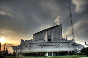
CFRN-DT (channel 3) is a television station in Edmonton, Alberta, Canada, part of the CTV Television Network. It is owned and operated by network parent Bell Media alongside cable-exclusive CTV 2 Alberta. The two outlets share studios with sister radio station CFRN (1260 AM) on Stony Plain Road in Edmonton; CFRN-DT's transmitter is located near Highway 21, southeast of Sherwood Park.

Telus World of Science Edmonton
Science centre in Alberta, Canada
Distance: Approx. 2886 meters
Latitude and longitude: 53.5611,-113.5639
Telus World of Science Edmonton (TWOSE) is a broad-based science centre in Edmonton, Alberta, Canada, operated by the (non-profit) Edmonton Space & Science Foundation. The centre is located on the southwest corner of Coronation Park in the neighborhood of Woodcroft. The science centre houses 144,430 sq.

Edmonton Christian High School
10-12 school in Edmonton, Alberta (est. 1965)
Distance: Approx. 2569 meters
Latitude and longitude: 53.554,-113.568
Edmonton Christian High School is a Christian high school (grades 10–12) in Edmonton, Alberta, operated by the Edmonton Society for Christian Education, and established in 1965. ECHS provides Christ-centred education from students grade 10–12. Edmonton Christian High School is a sister school to Edmonton Christian Northeast School and Edmonton Christian West School.
Crestwood, Edmonton
Neighbourhood in Alberta, Canada
Distance: Approx. 2769 meters
Latitude and longitude: 53.538189,-113.5774857
Crestwood is a residential neighbourhood in west Edmonton, Alberta, Canada, overlooking the North Saskatchewan River valley and nestled between two ravines.
Terra Losa, Edmonton
Neighbourhood in Edmonton, Alberta, Canada
Distance: Approx. 2547 meters
Latitude and longitude: 53.535,-113.622
Terra Losa is a mixed residential and commercial neighbourhood located in west Edmonton, Alberta, Canada. It is bounded on the east by 170 Street, on the south by 95 Avenue, on the west by 178 Street, and on the north by 100 Avenue (west of 176 Street) and 99A Avenue (east of 176 Street).

Archbishop MacDonald High School
10-12 school in Edmonton, Alberta (est. 1967)
Distance: Approx. 2653 meters
Latitude and longitude: 53.55277778,-113.56694444
Archbishop MacDonald High School is an academic high school in Edmonton, Alberta, Canada.
Yellowhead Tribal College
Educational institution in Edmonton
Distance: Approx. 1158 meters
Latitude and longitude: 53.5491,-113.6198
Yellowhead Tribal College is an educational institution located in Edmonton, Alberta, Canada, which is run by four member nations of Treaty 6 with the four members being Alexander First Nation, O'Chiese First Nation, Sunchild First Nation and Alexis Nakota Sioux Nation. Yellowhead Tribal College is an inclusive and open learning institution that welcomes all adult learners.
Edmonton-Mayfield
Defunct provincial electoral district in Alberta, Canada
Distance: Approx. 651 meters
Latitude and longitude: 53.555,-113.597
Edmonton-Mayfield was a provincial electoral district in Alberta, Canada, mandated to return a single member to the Legislative Assembly of Alberta using the first past the post method of voting from 1993 to 1997.

Edmonton Association of the Deaf
Nonprofit organization
Distance: Approx. 2783 meters
Latitude and longitude: 53.56309983,-113.566342
The Edmonton Association of the Deaf (E.A.D.) is an Albertan non-governmental organization that works to promote the interests of the Deaf community in Edmonton, Alberta, Canada.

Edmonton Police Association
Building in Edmonton, AB
Distance: Approx. 2719 meters
Latitude and longitude: 53.560717,-113.566349
The Edmonton Police Association (E.P.A.) is a labour union in Edmonton, Alberta, Canada that represents members of the Edmonton Police Service.

Ford Parts & Accessories Depot
Historic site in Edmonton, Alberta, Canada
Distance: Approx. 2095 meters
Latitude and longitude: 53.55944444,-113.57555556
The Ford Parts and Accessories Depot of Edmonton, Alberta, Canada is a historic building in the neighborhood of Huff Bremner Estate. In 2006, the building was added to the Edmonton Inventory of Historic Sites on the basis of its "Early Modern architecture in the International Style".

Centre for Family Literacy
Distance: Approx. 2932 meters
Latitude and longitude: 53.569283,-113.568413
The Centre for Family Literacy is a non-profit organization in Edmonton, Alberta, Canada.
Weather in this IP's area
clear sky
-2 Celsius
-5 Celsius
-6 Celsius
-2 Celsius
1005 hPa
64 %
1005 hPa
923 hPa
10000 meters
2.06 m/s
260 degree
6 %