72.142.148.51 - IP Lookup: Free IP Address Lookup, Postal Code Lookup, IP Location Lookup, IP ASN, Public IP
Country:
Region:
City:
Location:
Time Zone:
Postal Code:
IP information under different IP Channel
ip-api
Country
Region
City
ASN
Time Zone
ISP
Blacklist
Proxy
Latitude
Longitude
Postal
Route
Luminati
Country
Region
ab
City
ftsaskatchewan
ASN
Time Zone
America/Edmonton
ISP
CFCS
Latitude
Longitude
Postal
IPinfo
Country
Region
City
ASN
Time Zone
ISP
Blacklist
Proxy
Latitude
Longitude
Postal
Route
IP2Location
72.142.148.51Country
Region
alberta
City
edmonton
Time Zone
America/Edmonton
ISP
Language
User-Agent
Latitude
Longitude
Postal
db-ip
Country
Region
City
ASN
Time Zone
ISP
Blacklist
Proxy
Latitude
Longitude
Postal
Route
ipdata
Country
Region
City
ASN
Time Zone
ISP
Blacklist
Proxy
Latitude
Longitude
Postal
Route
Popular places and events near this IP address

Edmonton—Mill Woods—Beaumont
Federal electoral district in Alberta, Canada
Distance: Approx. 1732 meters
Latitude and longitude: 53.48,-113.433
Edmonton—Mill Woods—Beaumont (originally known as Edmonton—Beaumont) was a federal electoral district in Alberta, Canada, that was represented in the House of Commons of Canada from 2004 to 2015.
CHED (AM)
Radio station in Edmonton, Alberta
Distance: Approx. 770 meters
Latitude and longitude: 53.49055556,-113.44861111
CHED (880 kHz) is a radio station licensed to Edmonton, Alberta. Owned by Corus Entertainment, it broadcasts a news/talk format, and first signed on in 1954. Its studios are located on 84th Street and Roper Road in Edmonton, while its transmitters are located southeast of Edmonton.
CJCA
Radio station in Edmonton
Distance: Approx. 2629 meters
Latitude and longitude: 53.49055556,-113.49611111
CJCA is a Canadian radio station. It operates at 930 AM branded as AM930 The Light in Edmonton, Alberta. It is Alberta’s first radio station, established by the Edmonton Journal in May 1922.

W.P. Wagner High School
10-12 school in Edmonton, Alberta (est. 1969)
Distance: Approx. 1591 meters
Latitude and longitude: 53.49972222,-113.45111111
W.P. Wagner is an Edmonton Public high school located in Southeast Edmonton with a student population of about 1500. Its primary focus is science and technology. The school is named after William Phillip Wagner, a former Superintendent of Edmonton Public Schools.
Greenview, Edmonton
Neighbourhood in Edmonton, Alberta, Canada
Distance: Approx. 2342 meters
Latitude and longitude: 53.476,-113.426
Greenview is a residential neighbourhood in the Mill Woods area of southeast Edmonton, Alberta, Canada. It is located to the south of the Mill Woods Golf Course. Most of the residential development in Greenview occurred during the 1970s and 1980s, with 97.9% of the residences constructed during this time.
Millwoods Christian School
K-12 school in Edmonton, Alberta (est. 1978)
Distance: Approx. 1199 meters
Latitude and longitude: 53.47555556,-113.46222222
Millwoods Christian School, located in southeast Edmonton, Alberta, Canada, is an alternative school in the Edmonton Public School System. With its campus situated in the neighbourhood of Tweddle Place in Mill Woods, it has been serving the community since 1978. The school opened as an independent school under the direction of Calvary Community Church, a non-denominational church in south Edmonton.

Provincial Archives of Alberta
Official archives of Alberta, Canada
Distance: Approx. 387 meters
Latitude and longitude: 53.487409,-113.451929
The Provincial Archives of Alberta is the official archives of the Canadian province of Alberta. It preserves and makes available for research both private and government records of all media related to Alberta. The Provincial Archives of Alberta also serves as the permanent archival repository of the Government of Alberta.

Argyll Velodrome
Distance: Approx. 2413 meters
Latitude and longitude: 53.50732,-113.462749
The Argyll Velodrome is an outdoor velodrome in Edmonton, Alberta, Canada. The velodrome is 333.333 m (1,093.61 ft) x 7 m (23 ft) wide with a 37 degree banked concrete surface.

Millbourne/Woodvale stop
Light rail station in Edmonton, Alberta, Canada
Distance: Approx. 1716 meters
Latitude and longitude: 53.475,-113.43888889
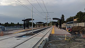
Millbourne/Woodvale stop is a tram stop in the Edmonton LRT network in Edmonton, Alberta, Canada. It serves the Valley Line, and is located on the east side of 66 Street, north of 38 Avenue NW, at the corners of Michaels Park, Greenview, Hillview, and Lee Ridge. The stop was scheduled to open in 2020.

Davies station
Light rail station in Edmonton, Alberta, Canada
Distance: Approx. 1791 meters
Latitude and longitude: 53.5,-113.44416667
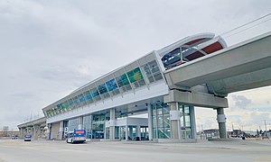
Davies station is an elevated light rail transit station in Edmonton, Alberta, as part of its Valley Line extension. It is located south-west of the intersection of 75 Street and Wagner Road, in Davies Industrial. The station is the first elevated rail station utilized by the Edmonton Transit Service, and includes a 1,300 stall park and ride and a new transit centre.

Avonmore stop
Light rail station in Edmonton, Alberta, Canada
Distance: Approx. 2625 meters
Latitude and longitude: 53.50944444,-113.455
Avonmore stop is a tram stop in the Edmonton LRT network in Edmonton, Alberta, Canada. It serves the Valley Line, and is located on 83 Street, staggered on either side of 73 Avenue, in Avonmore. Northbound passengers board the train north of 73 Avenue, while southbound passengers board south of 73 Avenue.

Gerry Wright Operations and Maintenance Facility
Maintenance facility in Edmonton, Alberta, Canada
Distance: Approx. 1216 meters
Latitude and longitude: 53.48666667,-113.43888889
The Gerry Wright Operations and Maintenance Facility (OMF) is the maintenance facility, garage, and operations centre for the light rail transit Valley Line, in the city of Edmonton, Alberta. Located in the Roper industrial area, on the north side of Whitemud Drive, it has housed the light rail vehicles for the Valley Line since 2018.
Weather in this IP's area
clear sky
-6 Celsius
-9 Celsius
-6 Celsius
-5 Celsius
1005 hPa
92 %
1005 hPa
921 hPa
10000 meters
1.98 m/s
3.62 m/s
261 degree
6 %